01/07/2025
23rd– 26th Aug 2024
With another four days off, we set our sights on Yoho and Kootenay National Parks—two gems tucked away in the Canadian Rockies. Once again, we rented a car from Budget and planned to sleep in it along the way. Would the car be cozy enough? Would the weather behave? As always, we were ready to improvise. And so, the adventure began.
Day 1: Peaks, Lakes, and Rainy Night Escapes
August 23rd, 2024
Our itinerary was set: four full days and a rough idea of where we’d crash each night. We picked up our car at 8 AM—the earliest slot available—but had to wait in a frustratingly slow queue. When we finally got the vehicle, we realized the trunk space was far from sleep-friendly. Swapping it would’ve cost an extra $30 per day, so we decided to tough it out and embrace the discomfort.
We hit the road around 9 AM, heading for Wapta Lake, followed by a hike to Paget Peak. It was the perfect start—crisp mountain air, sweeping alpine views, and a surprise panorama of Sherbrooke Lake from above. It looked too beautiful to pass up, so we hiked down to check it out. There, we found a group of older ladies casually swimming in the icy water—definitely putting our hiking toughness into perspective.
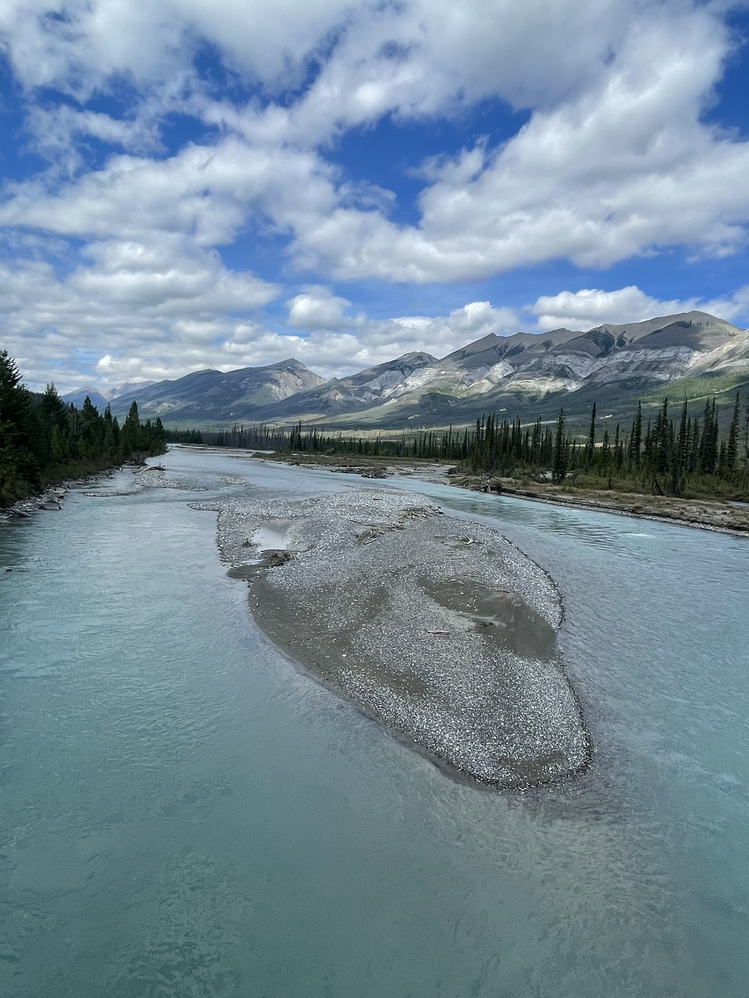
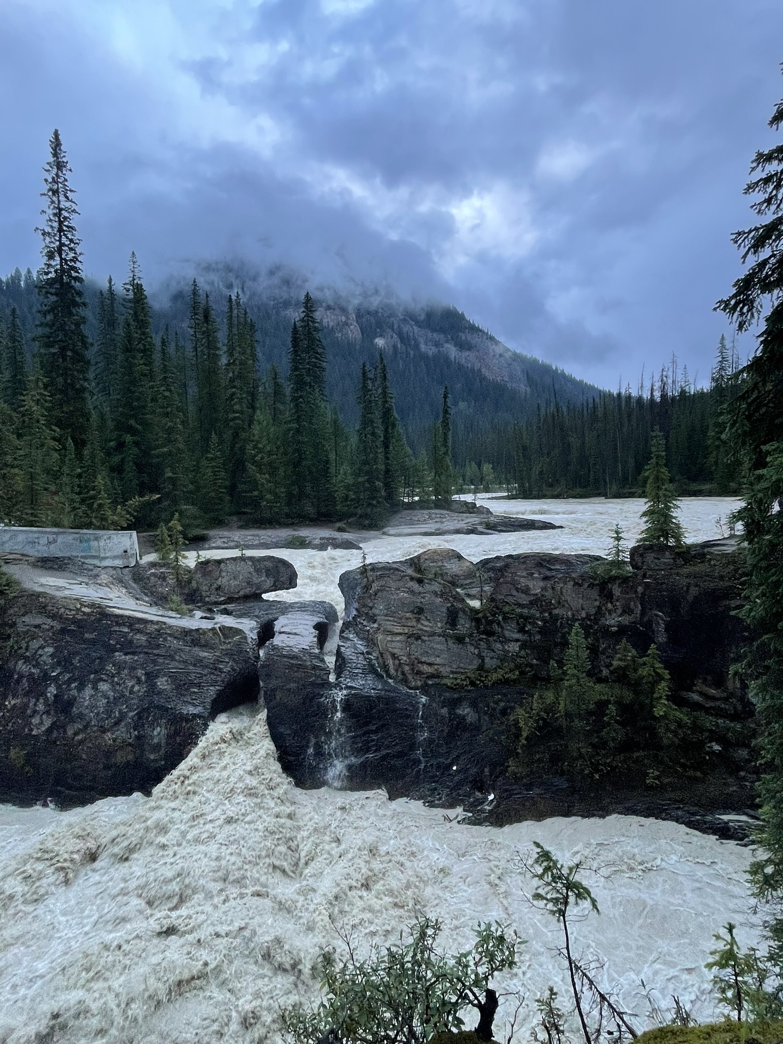
Next up: the Meeting of the Waters, where the Yoho and Kicking Horse Rivers converge. Each river is a distinct shade of blue, thanks to the types of rock the glaciers grind over and the timing of the seasonal melt. It’s like nature’s own watercolor experiment.
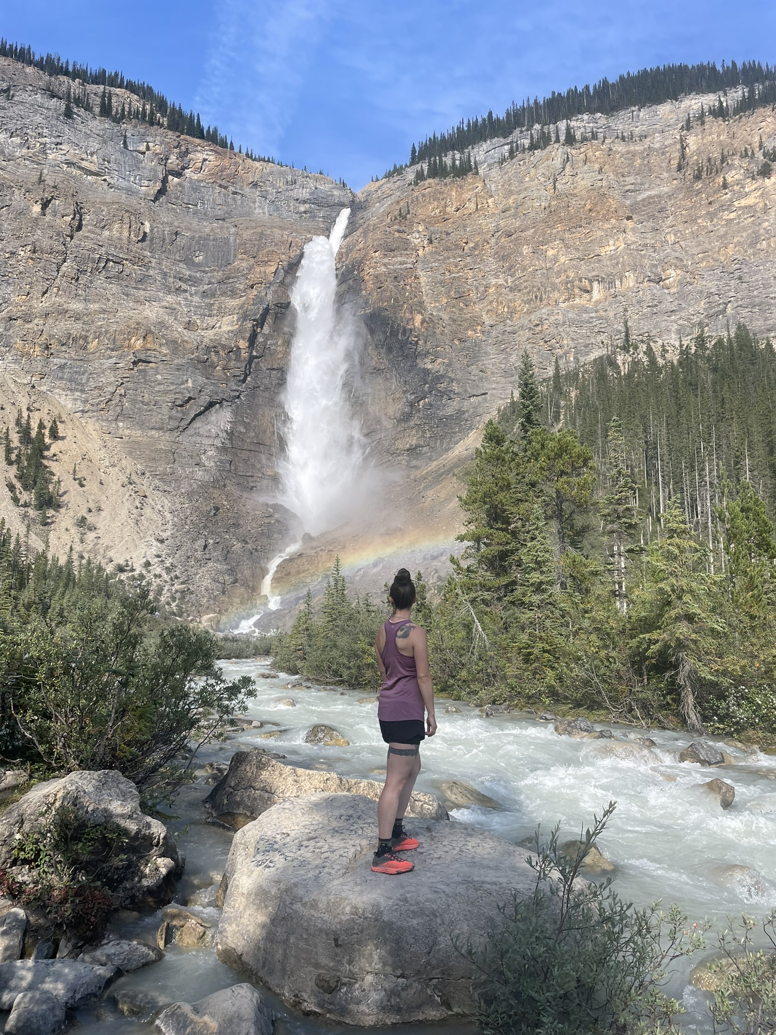
Then came Takakkaw Falls—one of the tallest waterfalls in Canada. We stood in awe before the thunderous cascade fed by Daly Glacier. The nearby info boards told a sobering story: the glacier has shrunk dramatically over the years. One day, both the glacier and the falls could disappear.
We continued toward Faeder Lake, hoping for a peaceful dinner spot by the water. Plot twist—it no longer exists. Completely dried up. So we pressed on.
Our final stop for the day was Wapta Falls. There are two trailheads—one inside the park and one outside. We opted for the 4 km round-trip from the park side. With headlamps in our packs (just in case), we jogged to the falls, soaked up the view, and sprinted back as a storm rolled in. Lightning cracked across the sky as we jumped into the car and drove to the second trailhead just outside the park boundary—where sleeping is allowed. Turns out, we weren’t the only ones with that idea.
Day 2: Emerald Silence and Unfinished Summits
August 24th, 2024
The day started with rain. Still, we pushed on and stopped at the Natural Bridge—a rock formation carved by the relentless power of the Kicking Horse River. Standing beside it, you really gain a new respect for what water can do. We wisely kept off the slick rocks and stayed dry.
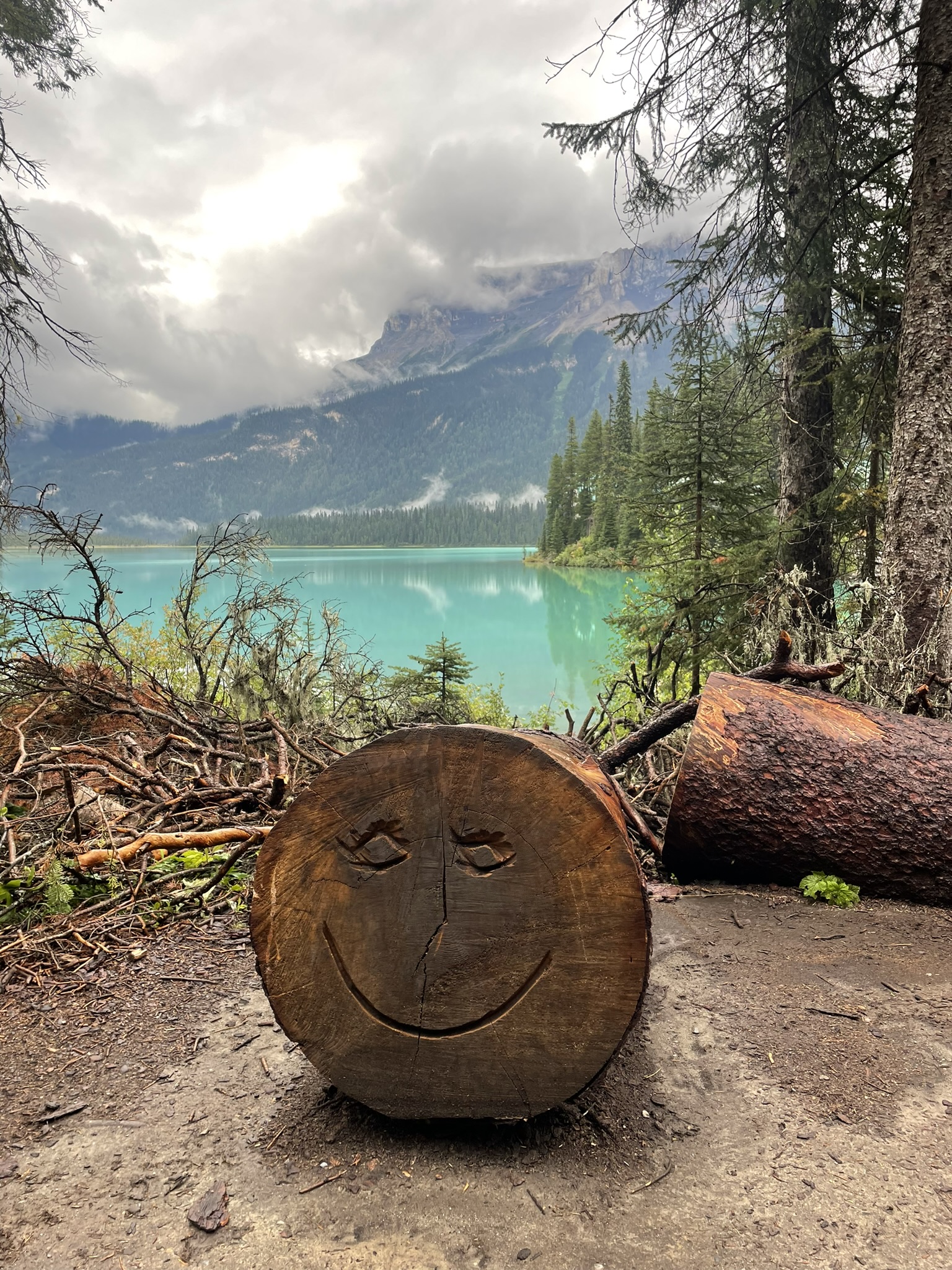
Next up was Emerald Lake. We were hoping to tackle Mount Carnarvon later, assuming the rain would clear. So we began with a peaceful loop around the lake. At 8 AM, the trail was almost empty—serene and quiet. By the time we wrapped up around 10, the crowds were rolling in. Perfect timing.
Fun fact: Emerald Lake changes color throughout the year. The most intense emerald glow appears in the summer, when the glaciers from the surrounding mountains melt and bring “rock flour” into the lake – a fine silt created by glacial erosion. It’s like Mother Nature discovered Instagram filters before we did.
Emerald Lake isn’t just a pretty face. You can rent a canoe, walk its shoreline, or grab a coffee at the historic Emerald Lake Lodge, located right on the shore. Originally built for the Canadian Pacific Railway (CPR), the lodge still retains its rustic yet elegant mountain charm – no TV, no cell service. A perfect digital detox!
Bonus for silence seekers: Stand by the lake early in the morning and you might hear your own breath. The silence isn’t empty—it’s full of forest rustles, distant creek whispers, and the occasional birdcall. That kind of peace is hard to come by these days.
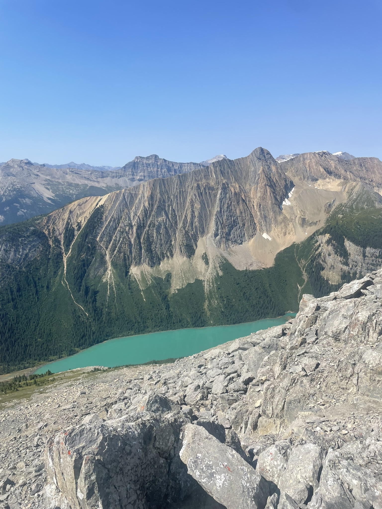
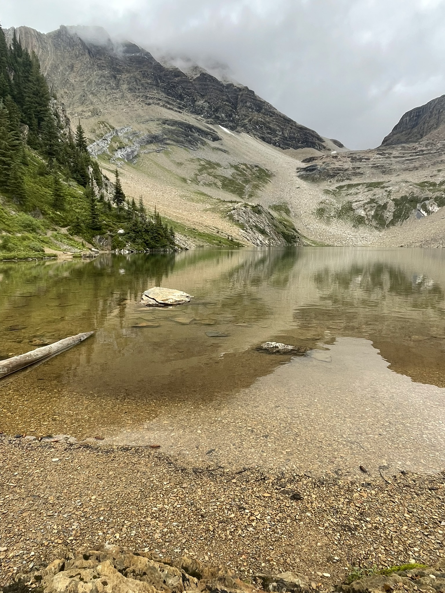
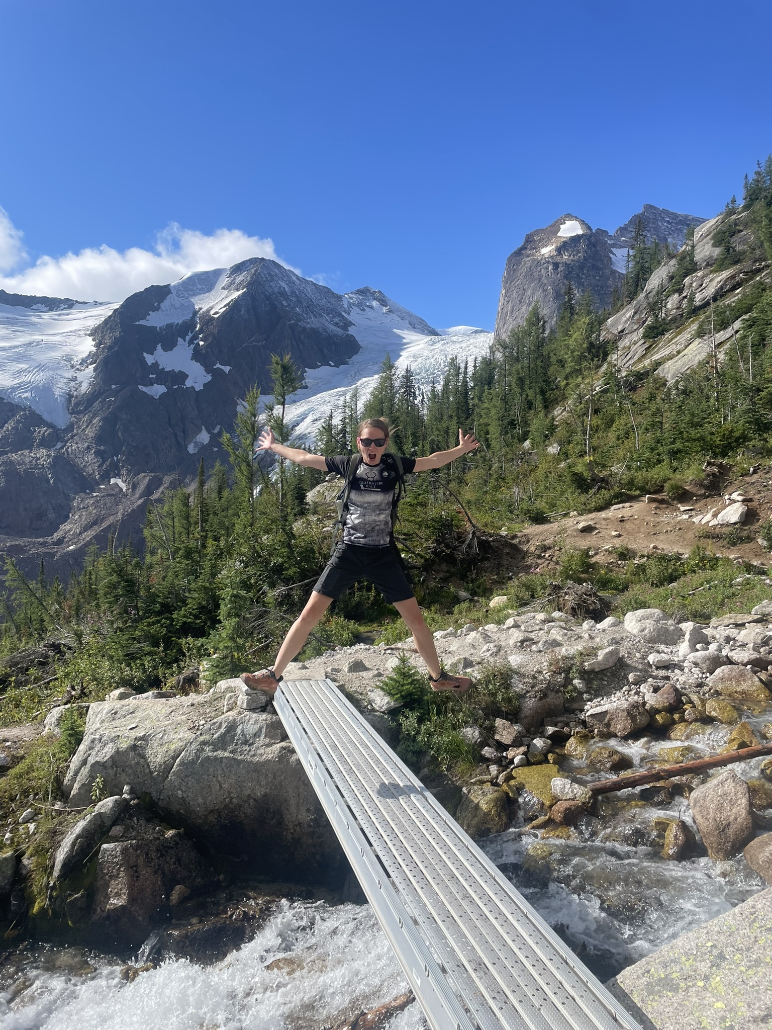
Our plan: summit Mount Carnarvon via Hamilton Falls and Hamilton Lake and then loop over Emerald Peak. The trail to Hamilton Lake alone climbs 800 meters—but the reward is a hidden glacial lake so quiet and blue it feels like another planet. Mount Carnarvon is a 3,000-meter peak that very few people climb these days, and we were excited about that: the highest summit in the area, complete solitude, and unforgettable views.
Our route was supposed to continue to Mount Carnarvon and then to Emerald Peak, with a possible second trail descending from there to create a beautiful loop. But as always, plans change with the weather. When we arrived at the lake, it was cloudy but not raining. We decided to take a snack break and hope for improvement. But quite the opposite happened: within minutes it started snowing, the peaks disappeared into the fog, and we decided to be wise for once and cut the hike short. We turned back to the car. So now we have unfinished business at Emerald Lake and hope to return if time allows.
With our main plan cut short, we filled the afternoon with the Hoodoo Creek Trail—short and totally doable, even in the rain. The trail winds past towering hoodoos: tall, skinny spires shaped like chimneys. They were formed by erosion over thousands of years, with hard rock caps keeping them from collapsing. The tallest one here stands over 10 meters and looks like something from a fantasy movie.
We ended the day heading toward Bugaboo Provincial Park. We made a quick stop in Golden, walked around town, and realized there wasn’t much to see. We treated ourselves with ice cream and continued our journey. We didn’t make it all the way to the Bugaboo trailhead that night, since the parking lot for Bugaboo Spires or Conrad Kain Hut is already inside the provincial park where overnight camping isn’t allowed. We found a fairly flat and secluded spot nearby, cooked a quick dinner, and called it a night.
Day 3: Bugaboos and a Bear Warning
August 25th, 2024
We hit the road early in the morning and after a quick stop at Bugaboo Falls, we arrived at the parking lot at 8AM. We did not need to be worried about sleeping on that spot, because people from car parked next to us were obviously sleeping right there, haha.
There was a sign at the parking lot advising everyone to bring their own fencing, as there is no storage for it on-site. Fencing? This was news to us – something we missed in our road trip planning. Luckily, we did find some fencing at the trailhead. It’s used to protect cars from porcupines. Yes, porcupines in the Bugaboos are notorious for chewing on rubber and plastic parts of cars: brake lines, cables, insulation, wheel wells. Why? Salt. Rubber parts often absorb road salt, and porcupines are obsessed with it. They will literally gnaw into your car to get it. So, it’s recommended to fully fence the underside of your car, even for just one night. The damage can be severe, and getting towed from the Bugaboos is complicated and expensive. We fenced off our car even though we were only hiking for a few hours. In fact, every single car in the lot was fenced.
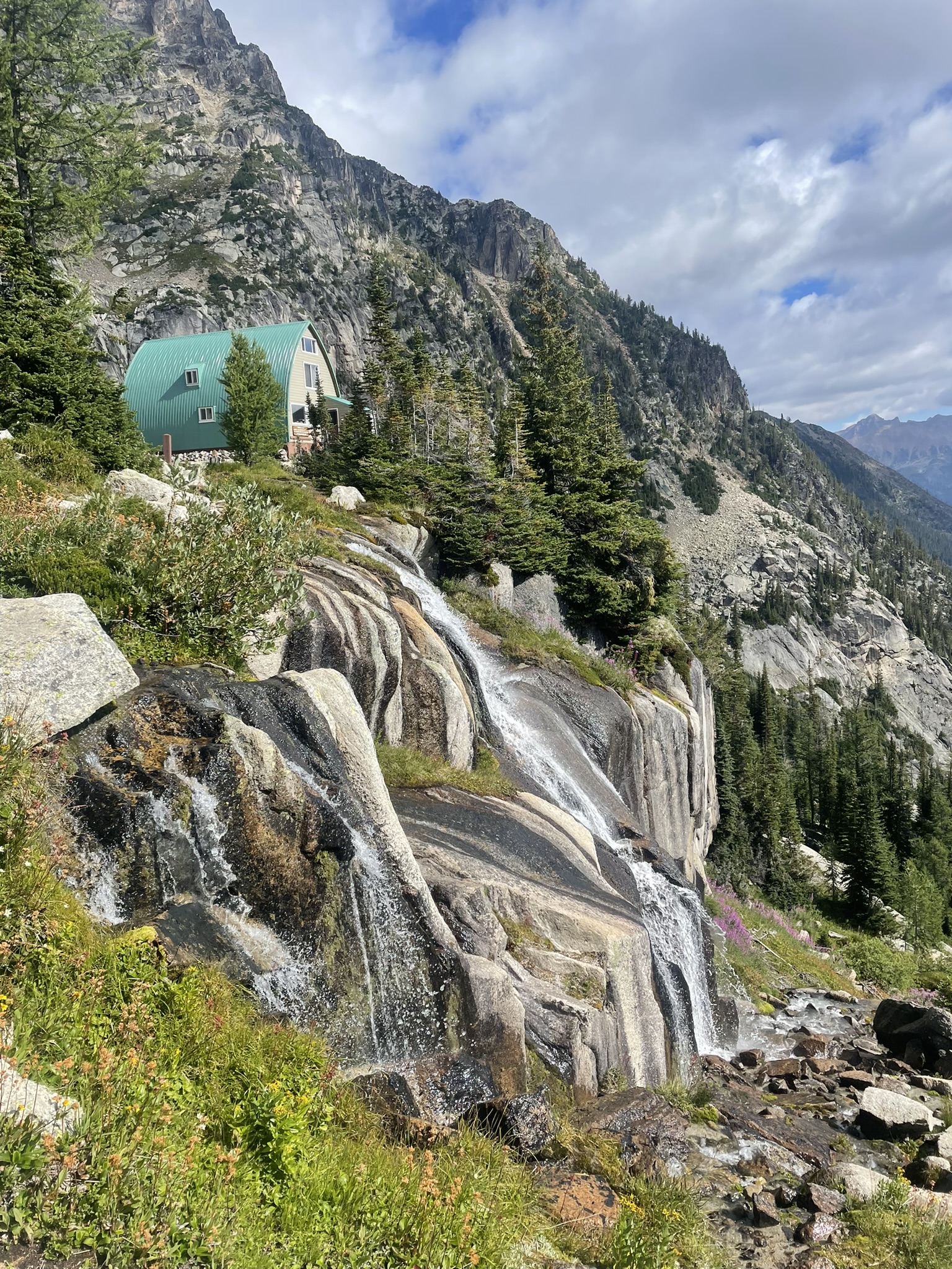
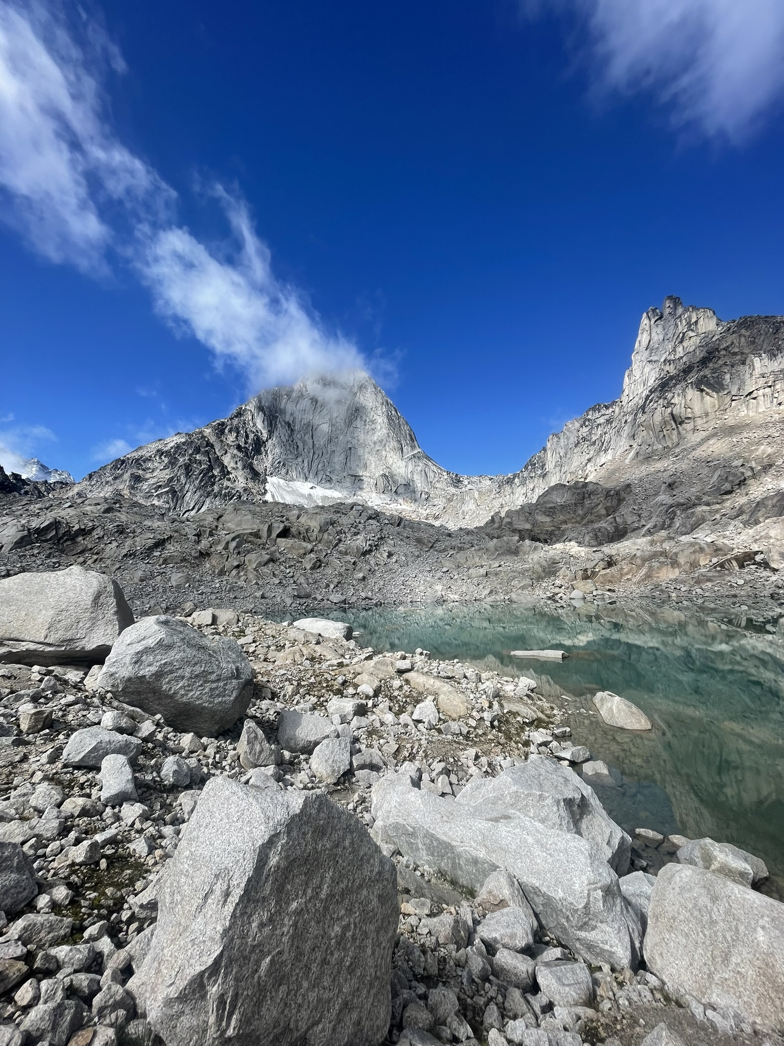
The hike itself was spectacular. For most of the trail, we admired the active Bugaboo Glacier – which we later learned is the access point for many major climbs. This is one of the rare places in Canada where you can combine ridge climbing, glacier travel, and alpine hiking all in one day. On the way to the Conrad Kain Hut, we encountered chains and one ladder section. Honestly, we admire the climbers who do this route with all their gear. Even though we didn’t climb any peaks, we were completely captivated by the area. The approach to the hut and the two nearby campgrounds give you a taste of the heart of the Bugaboos: postcard-worthy towers, glacier views, and short hikes around the hut.
The Bugaboos are often called the “Canadian Patagonia” – and it’s not far from the truth. Towering granite spires, glacier tongues, and sharp ridges rise directly from the forest, offering breathtaking panoramas with far fewer crowds than South America. A dream destination for climbers and mountain lovers.
Fun fact: Where does the name “Bugaboos” come from? In the 19th century, “bugaboo” meant a ghost, obsession, or wild goose chase. Early gold prospectors thought they’d strike it rich here. Instead, they found only rock. They called it a bugaboo—something scary or fruitless. Today’s treasure hunters are climbers instead of miners.
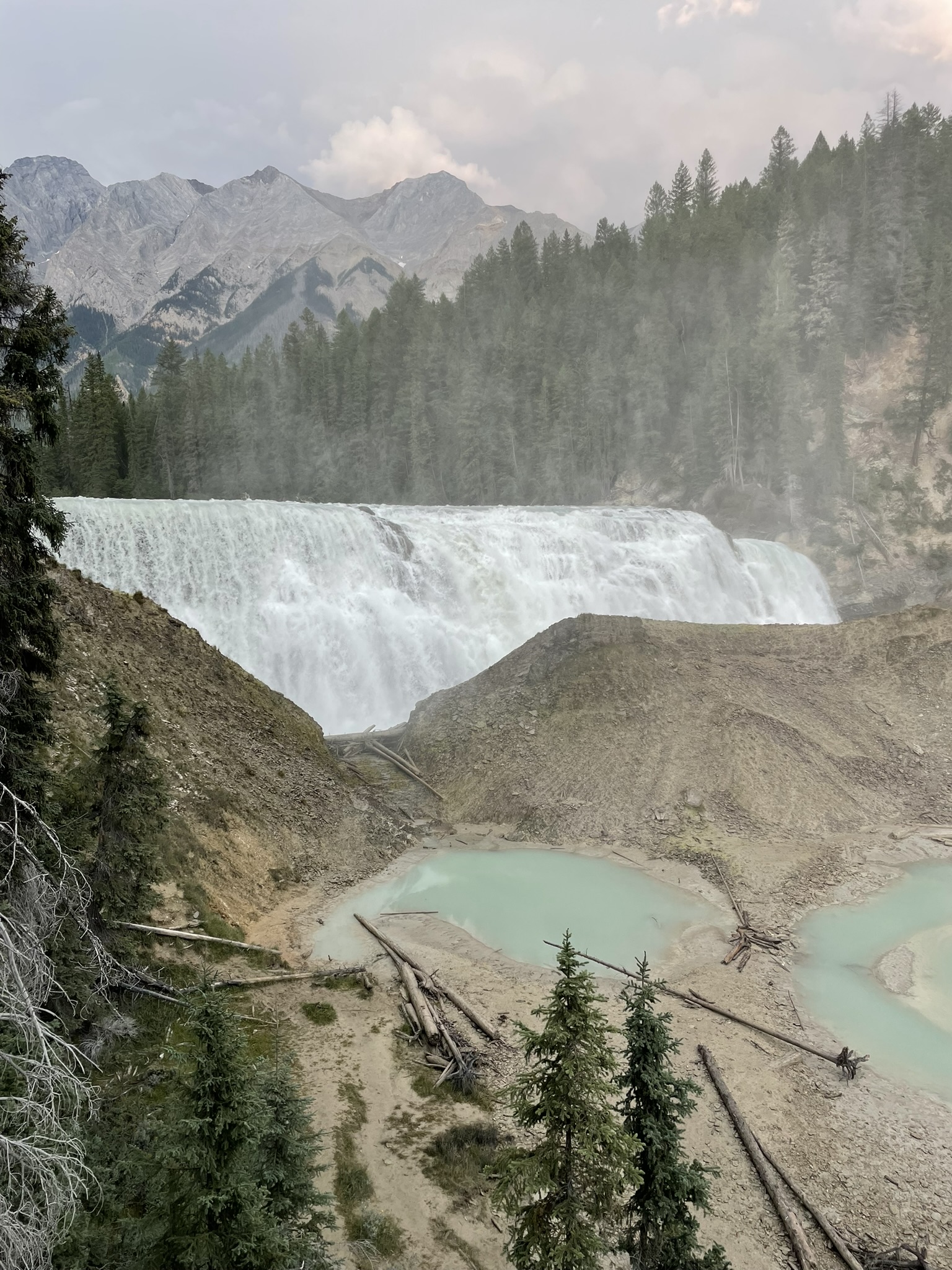
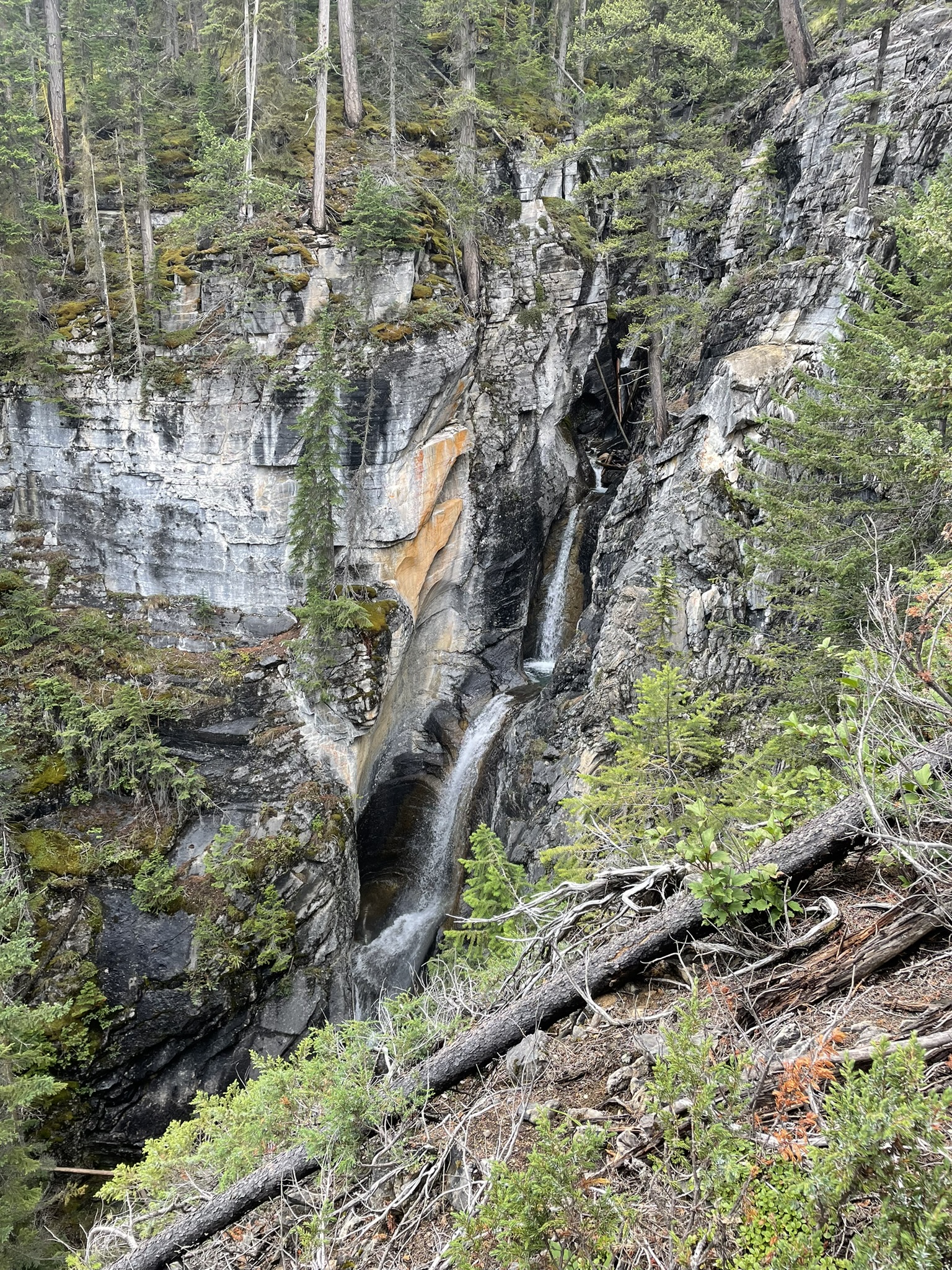
The weather held, and we were ahead of schedule. On the way out, we stopped at Lower Bugaboo Falls—a hidden gem. After just 20 minutes of hiking, you reach a canyon with dramatic rock walls and a waterfall dropping 25 meters into a natural pool. Often missed by travelers, but absolutely worth the detour.
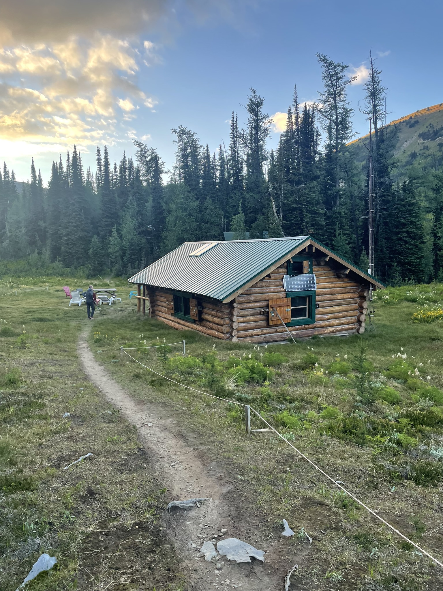
Then we drove to Diana Lake. It’s about 50 km on service roads. We arrived around 6 or 6:30 PM. According to our maps, we weren’t supposed to reach the lake until 10 PM, but we made it by 8. After a short rest, we walked to Diana Lake Lodge & Tea House. A woman came out and immediately asked if we were lost, if we were okay, and offered us a beer. We were in a hurry but couldn’t say no—and ended up chatting with her for nearly an hour.
She offered us a bed, but our stuff was in the car. She also mentioned a grizzly had been spotted earlier that day, chasing a group of women toward The Judge summit—luckily the opposite direction. We left quickly, hoping to get back before nightfall. Within minutes we were using headlamps and making noise to avoid bears. We reached the car safely an hour and fifteen minutes later. Quick dinner, then sleep.
Note on Diana Lake Lodge & Tea House: It operates only a few months a year with no road access. Heavy supplies come in by helicopter; lighter stuff is carried by staff up an 8 km trail with 600 meters elevation gain. The lodge uses solar power, has filtered summer water, propane-heated showers, and sells drinks, snacks, and even pizza.
Day 4: Hot Springs and Hidden Fossils
August 26th, 2024
Today was more about driving than hiking. First stop: Radium Hot Springs for a short walk. We looked for souvenirs—no thimble or magnets. Since Radium is small, we stayed for breakfast—where we later realized someone tried to scam us.
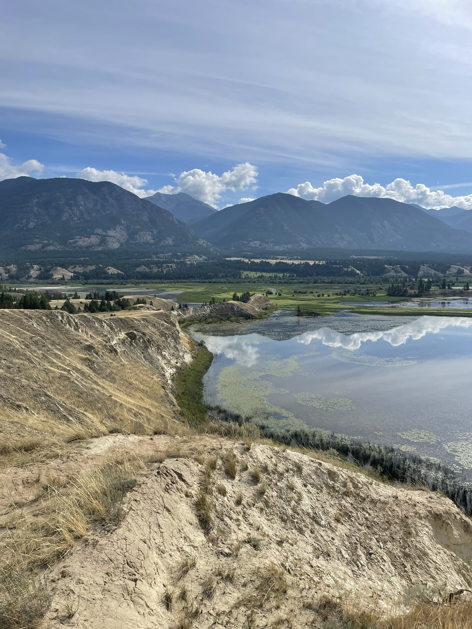
We continued to Panorama to ask about jobs, but most places wanted staff for the full season, and our visas expire in January. We explored a bit, failed to find souvenirs again, and moved on to Wilmer for a walk on the Wetlands Trail. This easy but scenic path offers views of the Columbia River Wetlands—one of the largest intact wetland systems in North America.
Then we started heading back to Banff. Along the way, we picked up a hitchhiker heading to Banff. We offered him a lift, warning him about a few planned stops. He didn’t mind at all He’d lived in Canada for six years but hadn’t seen much. Originally from Ukraine, he’d moved from Toronto to Edmonton. His car broke down in Radium, but he’s a mechanic and plans to return and fix it. He said he was glad the breakdown happened—it let him meet us and see places he didn’t know existed.
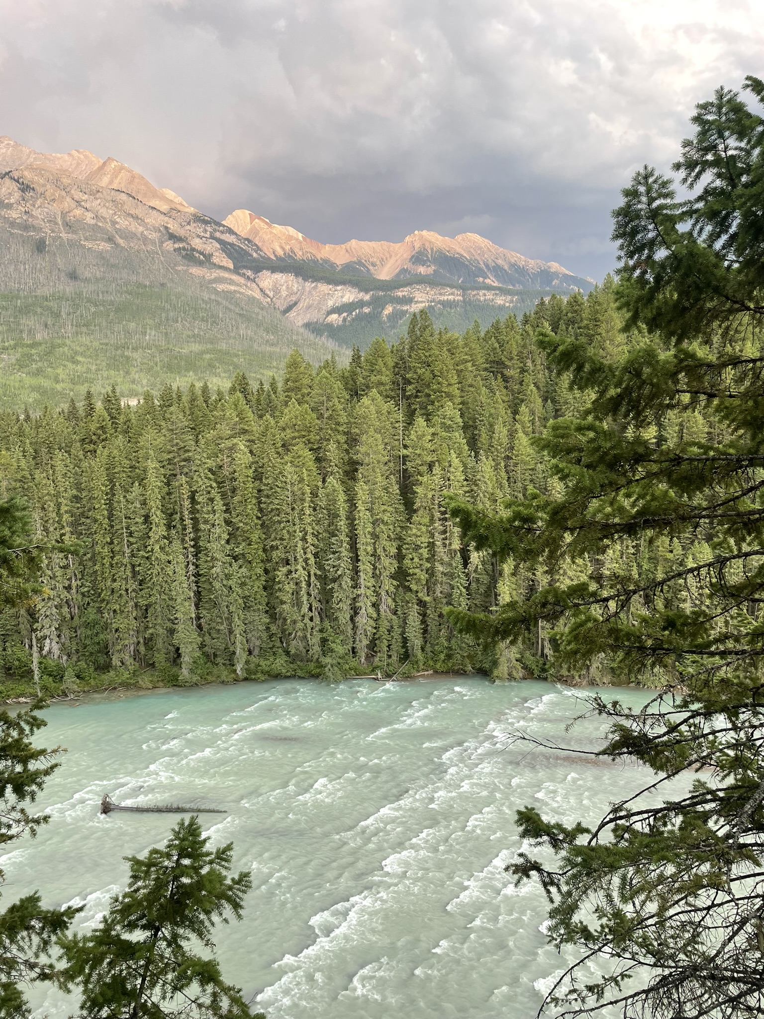
First stop: Dog Lake. Officially named in 1966, but no one knows why. Despite its ordinary-sounding name, the lake is scenic and surrounded by mountains, making it a peaceful destination for nature lovers. The trail features two suspension bridges over the Kootenay River and passes through old forest that offers pleasant shade and a chance to spot local flora and fauna. While the walk was lovely, the lake itself didn’t wow us – perhaps because we’ve already seen so many spectacular Canadian lakes that few can compare.
Next: Vermillion River, where we just stopped for snacks and red chairs.
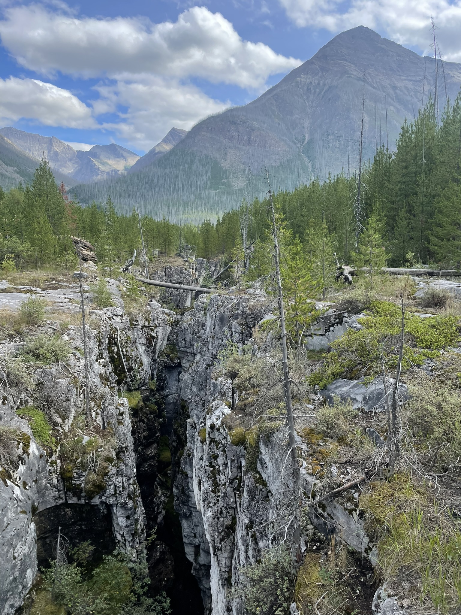
Finally, our last planned stop was Marble Canyon in Kootenay National Park – a fascinating natural feature with breathtaking scenery. The 1.4 km trail is well maintained and crosses seven bridges that give views deep into the canyon. Over 500 million years ago, this area was a shallow tropical sea. The sediments, known as the Cathedral Formation, gradually became the limestone that now forms the canyon walls. Despite the name “Marble,” the rock is actually limestone, not metamorphosed marble. The canyon was carved by glaciers and further sculpted by Tokumm Creek, creating its dramatic depth and narrow shape.
In 2012, paleontologists discovered a Burgess Shale fossil site near Marble Canyon, rivaling the original site in Yoho National Park. During a two-week expedition, they found 57 species, 17 of them previously unknown. The discovery offers valuable insight into the early evolution of complex life on Earth.
To us, Marble Canyon was even more beautiful than Johnston Canyon in Banff, which is packed with crowds all summer long. At Johnston Canyon, people wait in line just to reach the viewpoint.
From Marble Canyon, we had only about 40 minutes left to drive, which was ideal. Just before 6 p.m., we said goodbye to Alexander, wished him luck with his car, and headed off. All we had left to do was clean out the car, return it to the rental agency, do laundry, and get ready for work the next day.
Yoho & Kootenay delivered exactly what we needed: peaks, waterfalls, mud, snow, silence, strangers, and stories. We’ll be back—Floe Lake, Lake O’Hara and Carnarvon are still waiting.