
01/01/2026
8th– 18th September 2025
Day 1 (September 8, 2025)
Hike to Sahale Glacier (9.84 km; 1,245 m ↑ 49 m ↓)
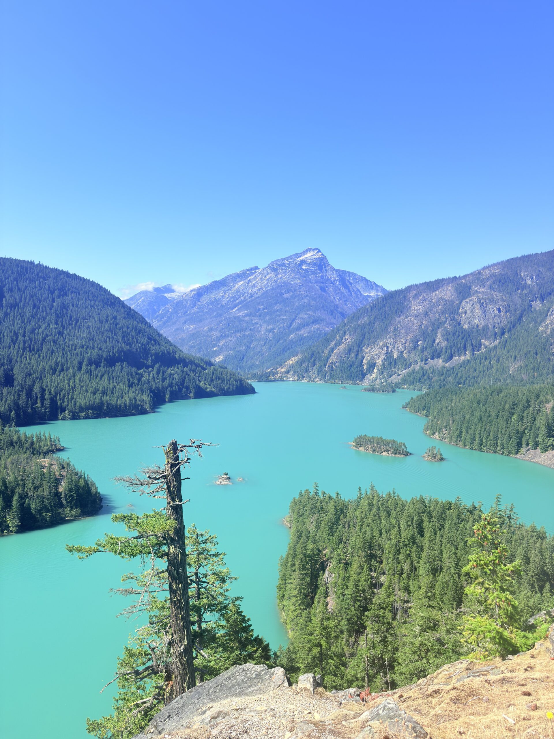
The first day we are mainly driving like the day before. After that, we once again had to rethink what made the most sense for us, especially since we wanted to sleep on two peaks. Originally, we planned to hike to Diablo Lake first, but in the end we only stopped at the viewpoint. Once we realized that the trail itself wouldn’t offer much more than what we had already seen, we decided to skip it and hurry instead – our main goal was to make it up to Sahale Glacier.
Camping at Sahale Glacier requires a permit, which must be arranged in advance or at the Wilderness and Wildlife Information Center. We were incredibly lucky: there was availability for that very day. The ranger was a bit surprised, though, because we were only supposed to arrive at the parking lot at 3 p.m., which meant we’d have roughly four hours of daylight left to hike up to the glacier.
We borrowed a bear canister, finalized the reservation, and hit the road. True to plan, we arrived at the parking lot at 3 p.m. We cooked there so we wouldn’t have to carry a stove with us, ate a proper meal before starting, and at the same time prepared dinner and breakfast for the next morning.
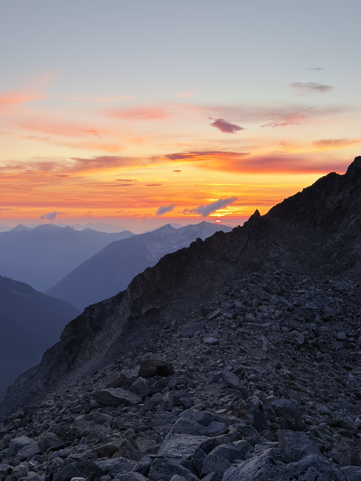
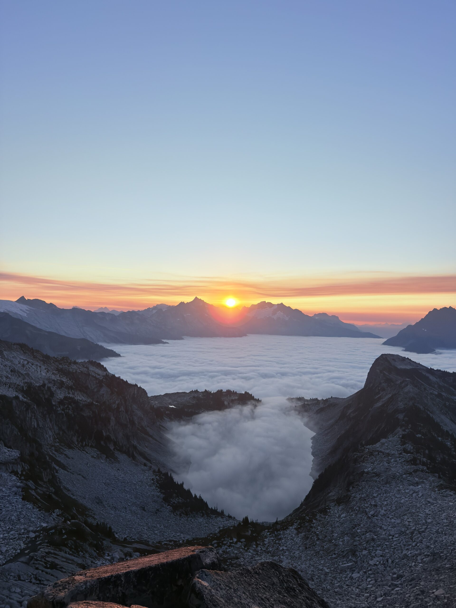
We didn’t waste any time—Red Bull for a quick boost, one last look at the maps, which showed a bit over five hours to the campsite. Arrival after dark, haha. Headlamps on, fast pace. Of course, we only met people heading back to their cars after finishing their hike. Along the way, we kept doing the math in our heads, and if we maintained a solid pace, we might even catch the sunset—the very reason we wanted to sleep up here.
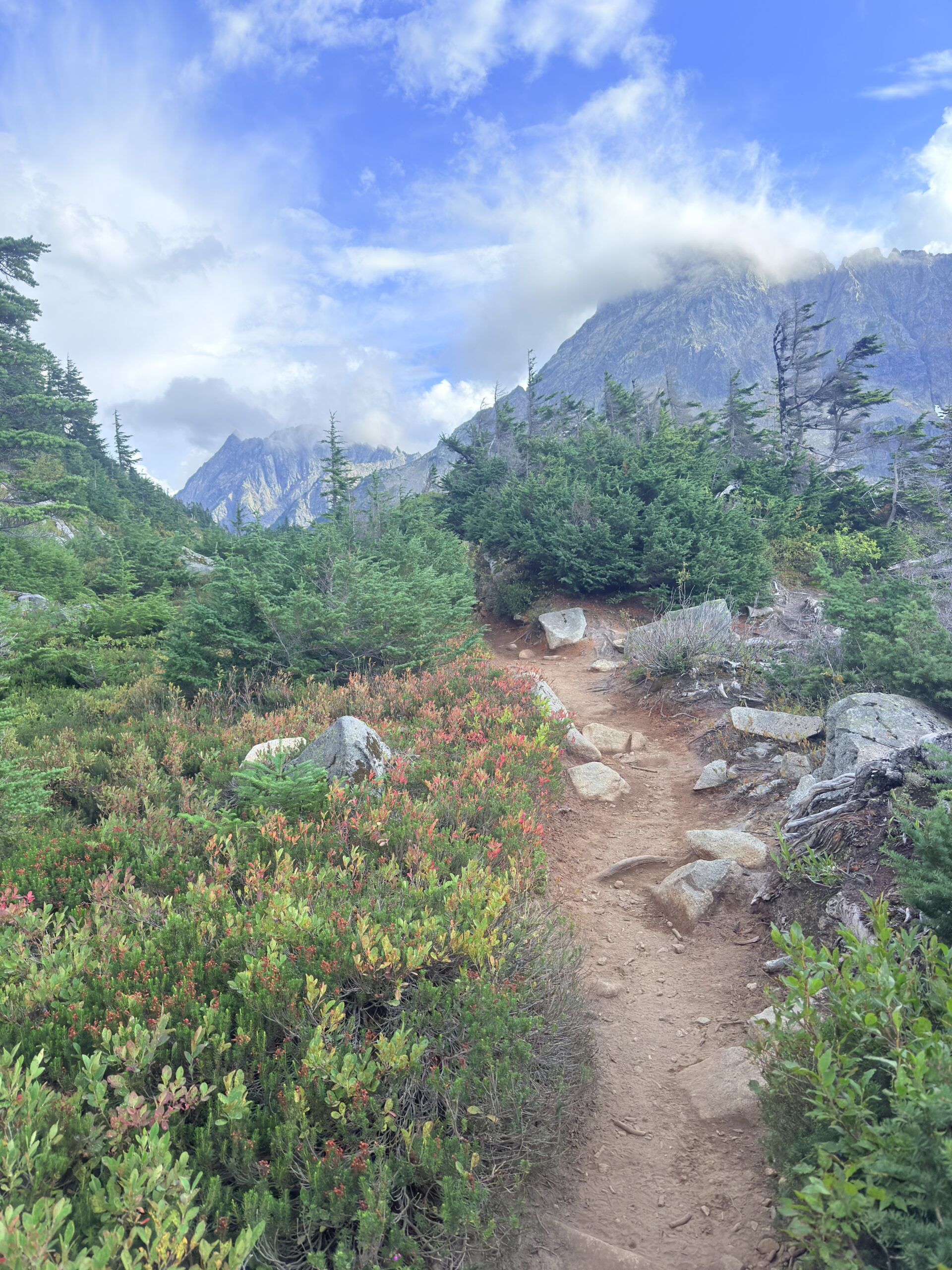
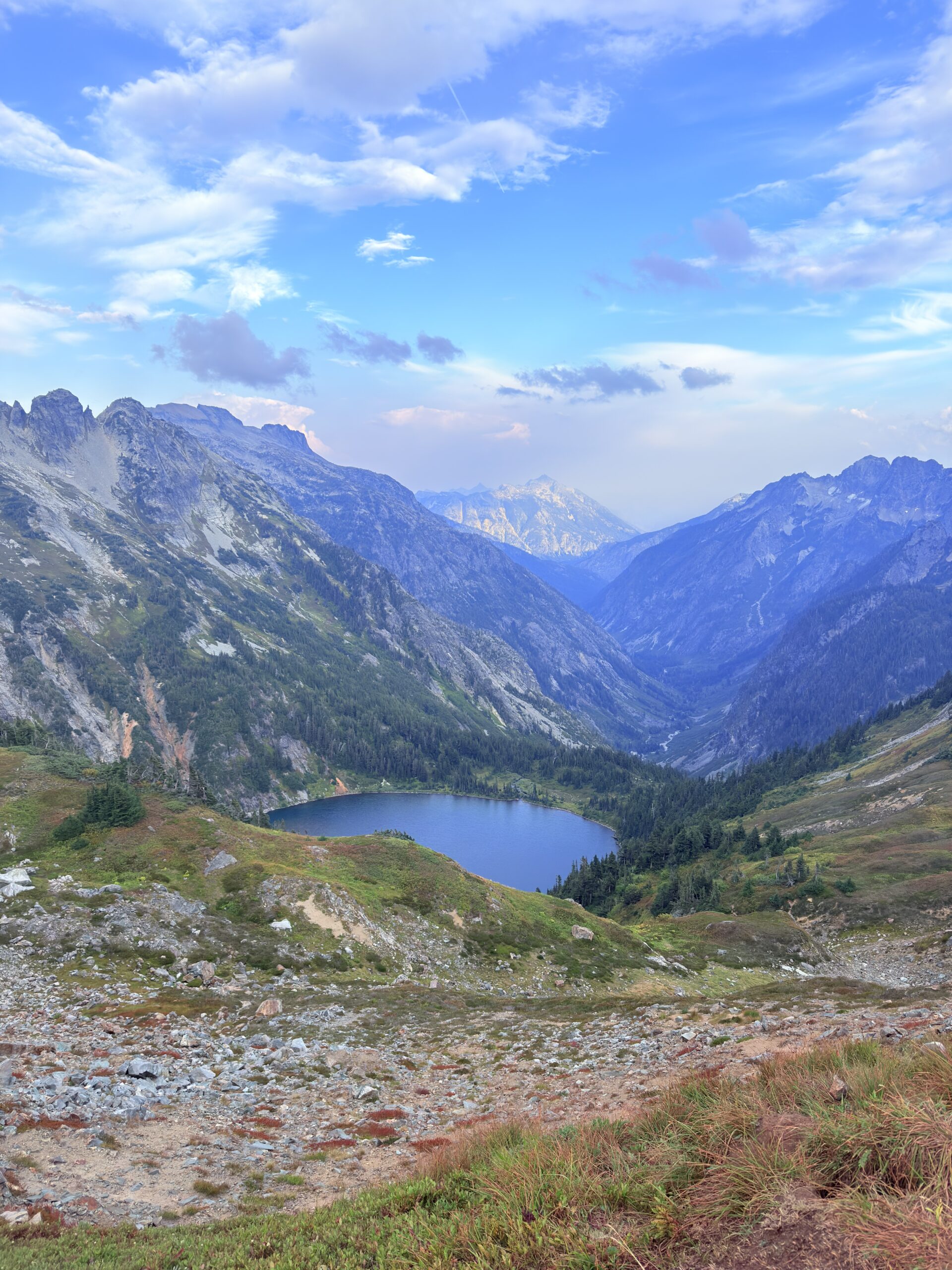
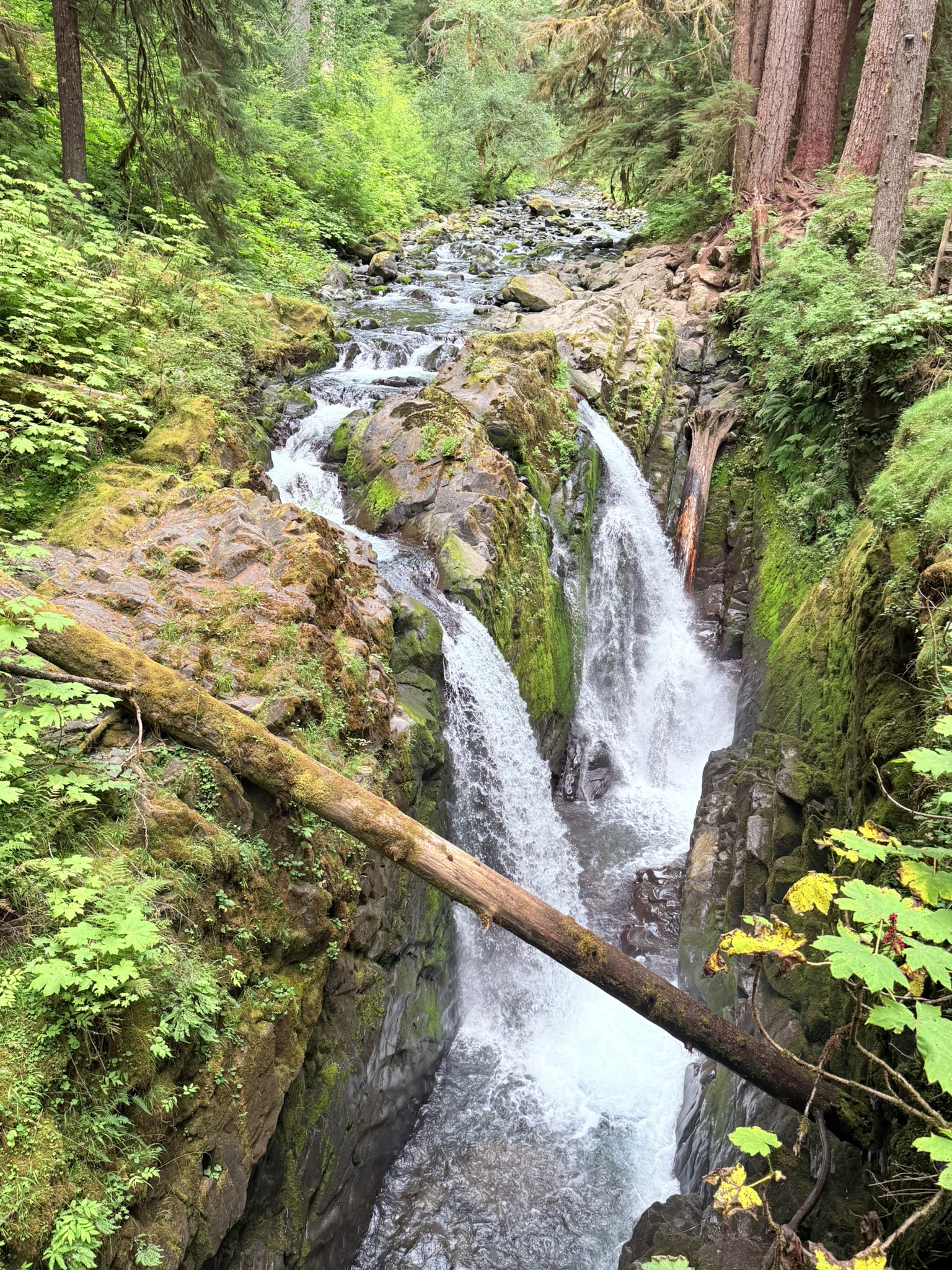
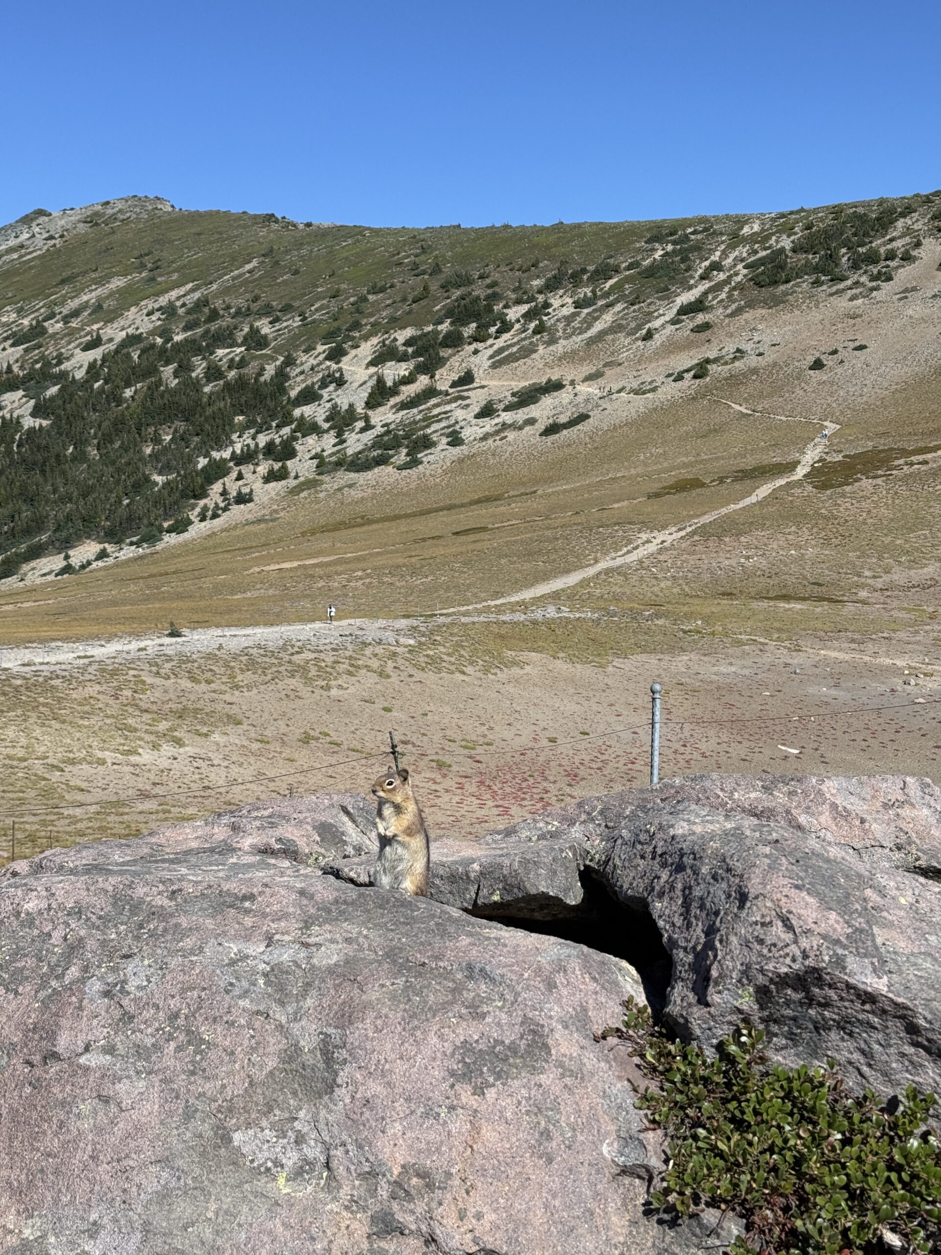
The first half of the trail leads through the forest, so I didn’t stop much for photos or videos and kept moving. But once we passed that section, Lu had to push me forward in places, because I kept stopping to film and take photos. The views opened up to stunning peaks, glaciers, and a rather suspiciously named lake – doubtful lake, yes it’s really called like that.
On the trail, we met a couple originally from Ukraine who told us they definitely wouldn’t sleep on the ridge. They had seen a bear along the way. We asked whether it was a black bear or a grizzly, and they said that grizzlies supposedly don’t live in North Cascades National Park. About half an hour later, we spotted a black bear just below the trail, calmly looking for berries for dinner.
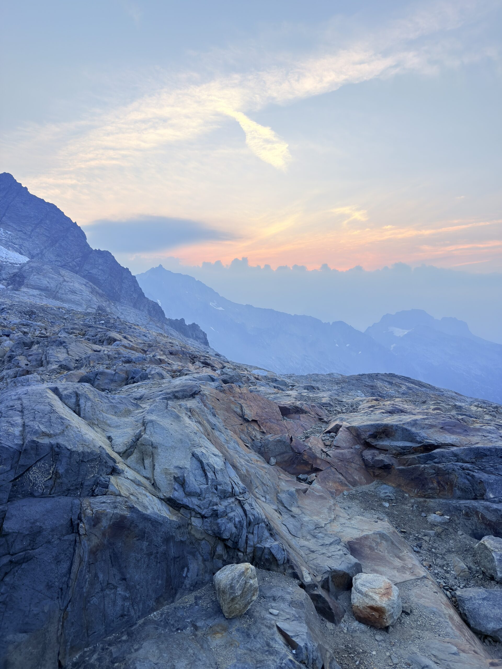
It took us a little over three hours to reach the campsite, which left us about 20 minutes to change into dry clothes and pitch the tent before sunset—perfect timing.
The sunset was absolutely perfect, even more beautiful than we had hoped for. To be honest, by that point we were mostly just hoping we’d make it in time at all. We enjoyed the sunset to the fullest, then crawled into our warm sleeping bags for dinner—it was cold under the glacier, and we were still overheated from the uphill push.
After dinner, we brushed our teeth away from the tent, stored the bear canister, and finally crawled into our sleeping bags. We were already looking forward to the sunrise the next morning.
Day 2 (September 9, 2025)
Descent from Sahale Glacier (9.88 km, 14 m↑ 1,217 m↓)
Hike to Hidden Lake Lookout (13 km, 1,577 m↑ 32 m↓); with a 4WD car, shorter by 7 km and 600 vertical meters
Sunrise is around 6:30 a.m., so we set the alarm for 5:55, planning to pack up the tent before moving to the spot where we wanted to watch the sunrise. We wake up to real cold, and everything is damp, so getting out of the sleeping bags is not very tempting. In the end, we only pack our clothes, sleeping bags, and sleeping pads, leaving the tent for later, once we return from the sunrise — maybe it will dry a bit in the meantime… definitely, haha. Because of the fog, we only see the early morning colors, the sun itself stays hidden, but we are more than happy because we experienced a perfect sunrise anyway.
We pack up the tent as quickly as possible — of course it’s wet — and head back to the car. Near the forest, there’s such a thick layer of clouds that people we meet along the way ask us whether it’s even worth continuing and if they’ll see anything at all. We encourage them, saying it’s absolutely worth it, because the fog stayed mostly in the lowlands, while above a certain elevation there was beautiful visibility. And besides, hiking above the clouds is always worth it. We get back to the car around 10 a.m., and the parking lot is completely full.
We free up the spot for someone else and move on toward the Hidden Lake Trail. We’re hoping to sleep at the old Fire Lookout. The first come, first serve rule applies here, so reservations are not possible.
On the way to the trailhead, we run into a small (or rather big) complication. The access road to the parking area is a service road, and at one point there’s a pothole so deep that we simply can’t get through with our lil Cherry. Unfortunately, we don’t have AWD, so we decide to back up a bit and leave the car parked much lower down — which adds roughly 7 km and 600 vertical meters to our hike. At the car, we cook some food, pack our things for the hike, and spread the tent inside the car so it can dry.
Shortly after we start walking, we meet a car driving down. The passengers ask us why we’re walking, and when we explain what kind of car we have, they’re not surprised at all. Apparently, that one bump is the only real issue, and after that it’s manageable. But when we see them driving down over that bump, we’re very glad we didn’t continue. They have AWD and are still struggling — and they’re going downhill. Thanks to them, we at least learn that there are only two other cars at the parking lot, and one of them has just a single person who plans to sleep up there. That gives us hope that we might be lucky and find space in the lookout.
Overall, it’s very foggy today, so we have no views at all, and we’re basically just praying to make it to the top. At times we hear thunder, and every now and then we feel drops on our skin, not really knowing whether it’s just fog or if it’s starting to rain. About an hour before the summit, we meet two girls from Germany. They told us the trail is quite confusing and that they didn’t see any lookout. They admit, though, that they weren’t really looking for it and didn’t go all the way to the top — they stopped at the lake viewpoint. According to them, we probably won’t see much anyway because the fog has rolled in again. At least they show us a few photos of what we’re supposed to see, just in case the weather doesn’t improve even tomorrow morning.
Their comment about not seeing any lookout scares us a bit, but I try to calm us down by reminding myself that I spoke to a ranger when we were arranging the Sahale Glacier permit, and he confirmed that no reservation is needed for the Hidden Lake Fire Lookout so there has to be a lookout. It starts to rain, and thunder echoes around us.
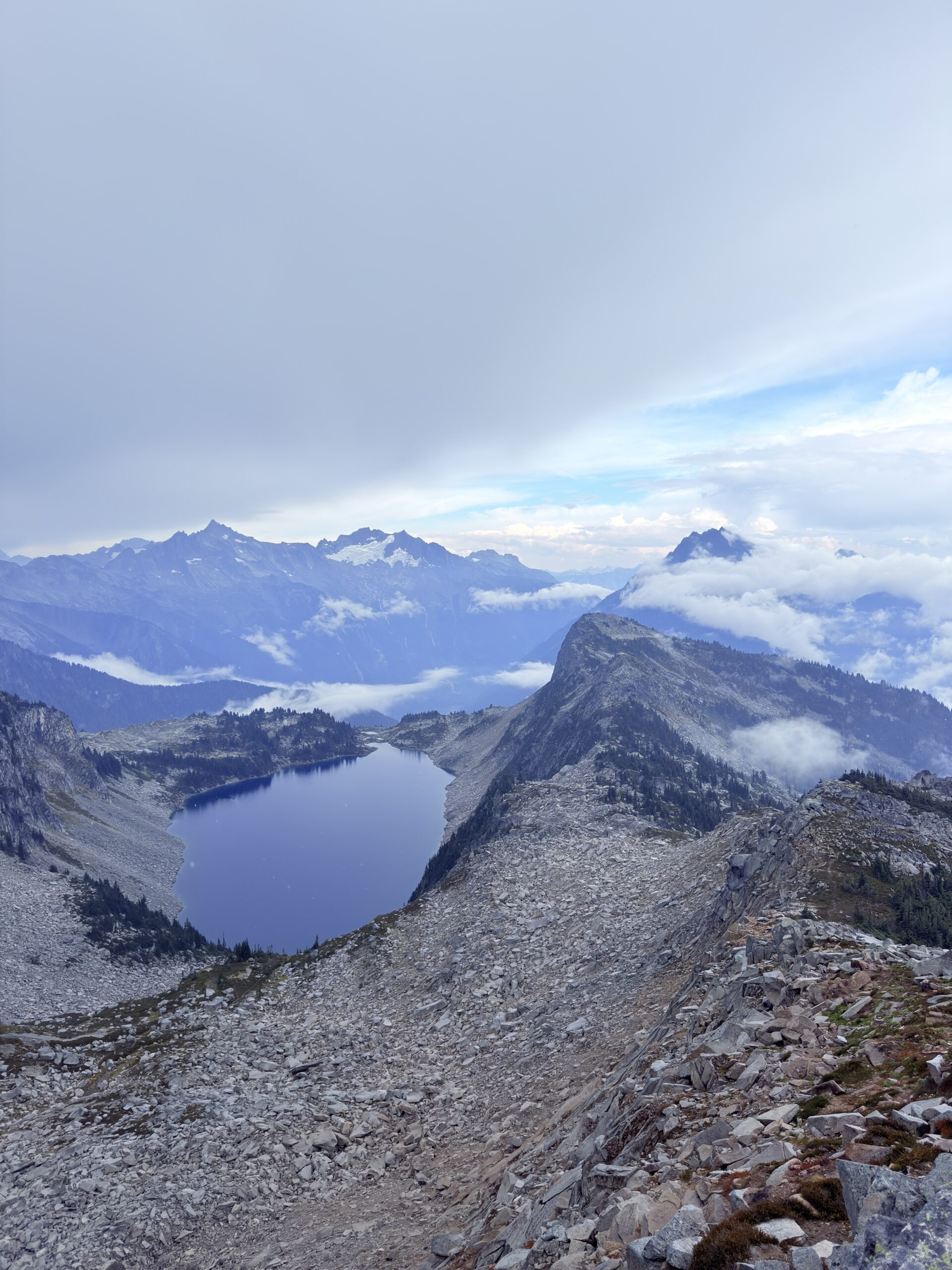
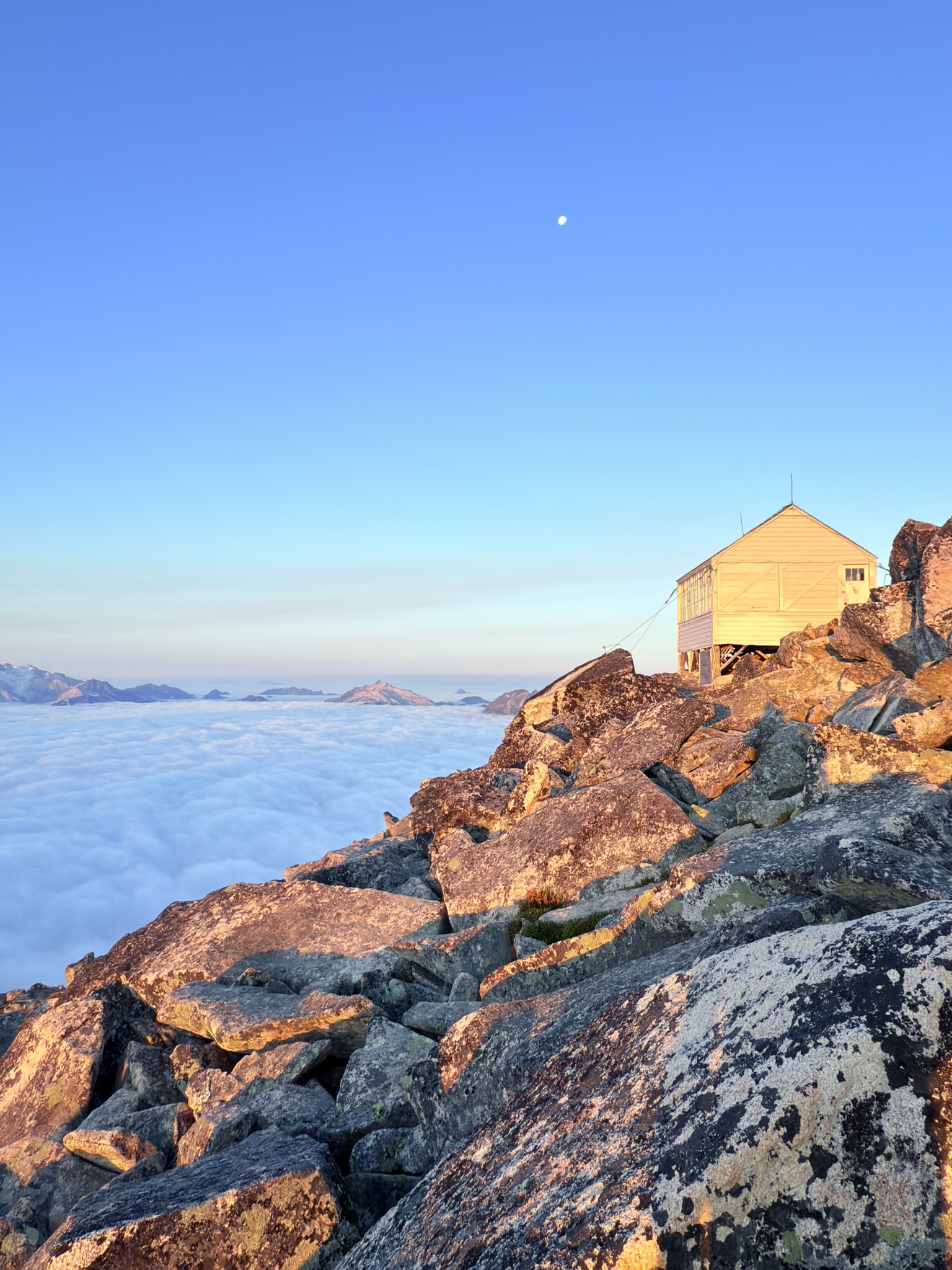
Luckily, within a few minutes, we spot the lookout. Even though I don’t quite understand from its position how we’re supposed to get there, at least we know the little cabin really exists — which is important, since we didn’t bring a tent. About 15 minutes later, the view of the lake opens up as well. The fog keeps swirling around the peaks, so sometimes we get beautiful views, and sometimes we see absolutely nothing.
Fortunately, we also find the path to the Fire Lookout, and thank goodness we don’t have to scramble over rocks in the rain — a well-trodden trail leads all the way up. Step by step, we reach the cabin, and what a relief: it’s unlocked and empty. Tonight’s accommodation is secured.
We settle into our “hotel” for the night. At the entrance, there are papers with rules explaining what is allowed and what is not. One thing that really catches our attention is the instruction on what to do in case of lightning. You shouldn’t stay near windows, and ideally you should take foam pads, place them in the center of the room, put a stool with glass insulators on the legs on top of them, remove all metal objects, and stand on the stool. I truly hope there won’t be any lightning during the night…
We also learn that the lookout was built in 1931 and was in operation for only about 20 years, although unfortunately we don’t find out why such a short time. Inside the cabin, there are card games, chess, a small version of Monopoly, and various books. We decide to have dinner and play cards. Outside, the fog is so thick that we can’t see anything, but the cabin has views in all directions, so if it clears — and we really hope it does — we plan to step outside for sunset.
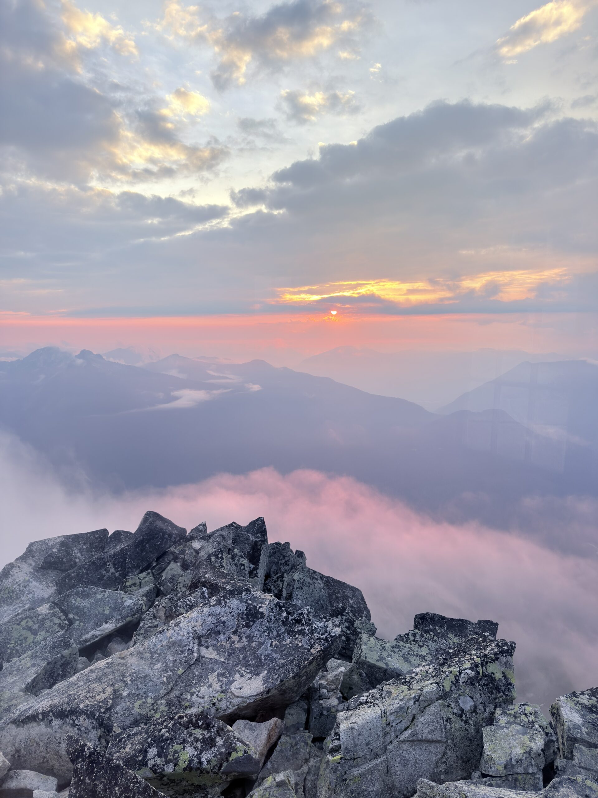
While playing cards, we keep an eye on what’s happening outside, and once again we’re lucky. Just before sunset, the view clears a bit, giving us another beautiful evening. We’re quite exhausted and plan to wake up again for sunrise, so we head to bed fairly early.
Day 3 (September 10, 2025)
Hidden Lake Lookout (only down to the parking lot) (6.52 km, 23 m↑ 1,052 m↓)
Thornton Lakes (16.48 km, 958 m↑ 958 m↓)
We set the alarm for 6:00 a.m., and even from our beds we can see how beautiful it is outside. We spend a moment admiring the view from the warmth of our sleeping bags, but curiosity wins and we head outside to see it properly. The guy who slept down by the lake also runs up to catch the sunrise. We enjoy a relaxed breakfast with the sunrise, take plenty of photos and videos, and then pack up inside the cabin. Thornton Lakes is still ahead of us today, and already yesterday during the ascent we both started to feel our Achilles tendons.
On the way down, we notice two tents we had already seen the previous day and had been wondering about, since there were only two cars in the parking lot. One belonged to the girls from Germany, who didn’t have any tents with them, and the other belonged to the guy from New York, who slept by the lake. So we go over to check the tents — they’re empty. At least that means they don’t belong to someone who got into trouble in the mountains. Either they’re emergency tents from the national park, or they were left behind by some irresponsible idiots who didn’t want to carry them back down.
From the parking lot, the guy from the lake gives us a ride — thank goodness — saving us about 7 boring kilometers. Our first stop is to return the bear canister, and at the same time we ask the ranger about the tents. National parks don’t leave emergency tents anywhere, so he also finds it strange. He plans to hike the trail the next day, so he takes approximate coordinates and says he’ll check it out. We chat with him about both trails, and then the girls from Germany arrive, so we end up talking with them as well — and completely forget to ask why the fire lookout was only used for 20 years…
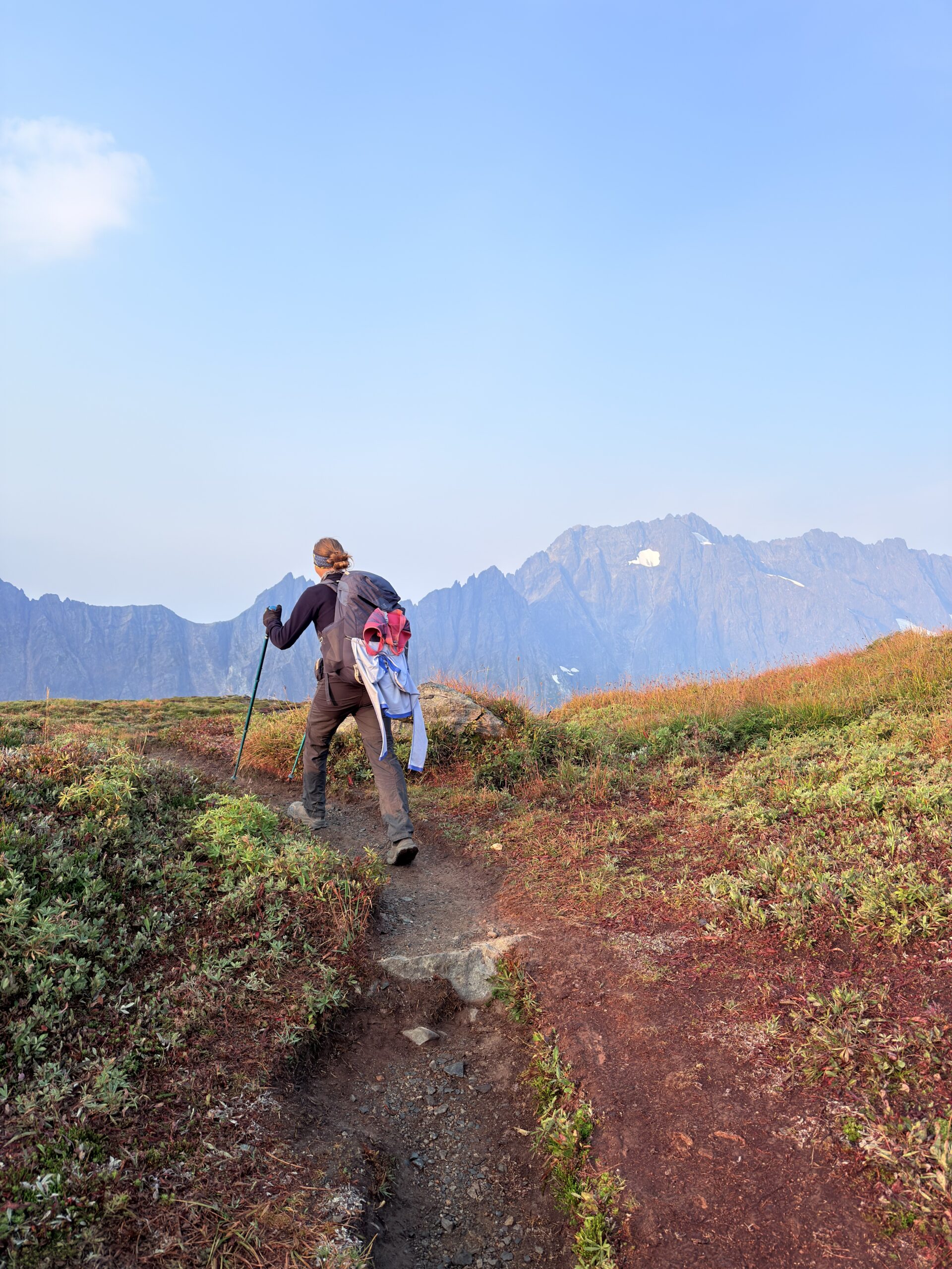
We refill our water and continue toward the trailhead. Once again, we’re facing the service road — steep and rough. We’re just praying not to meet anyone, because stopping on this hill is not an option. The traction control keeps flashing the whole time. Luckily, only about 10% of the road is this steep. We successfully make it to the parking lot, which is completely full, of course. There, we cook a late breakfast and head out. Most people are already walking in the opposite direction. Only one Asian guy is heading the same way as us, sounding quite ambitious when he says he wants to reach Trappers Peak — although his pace suggests otherwise.
Along the trail, we meet a very lovely older couple. Thanks to a half-marathon T-shirt, we get into a conversation and learn that the man is running a marathon in Fairbanks, Alaska, in about ten days, while the woman plans to hike the same distance. Wow — hats off. We’d guess they’re around 70 years old.
At the lake, we stop for a snack — and today I even treat myself to a coffee. We enjoy the nice weather and the absolute calm by the water. Unfortunately, we can’t stay too long, because we still need to move on toward Abbotsford. We have to sort out some banking issues there. I arranged an American Express card from Scotiabank for our time in the U.S., but both of us had suspended our Canadian phone numbers. That meant I couldn’t receive the SMS codes for two-factor authentication, and the phone number can only be changed in person at a branch.
So at the lake, we set a strict time by which we need to be back at the car. There’s one section that simply can’t be sped up, but the part closer to the car definitely can — as we soon find out. To make it on time, we run a good portion of the trail. My Achilles tendon hurts while walking, but not while running — great. Unfortunately, not for long… Eventually, my other knee starts hurting too, and the Achilles really kicks in right at the car, to the point where I can barely walk. Hopefully tomorrow will be better.
For now, we’re trying to get as close as possible to Abbotsford, where we have a bank appointment scheduled for the next day. We spend the night near a casino close to the border, and while having dinner, we watch a family of raccoons running around in front of the car.
Day 4 (September 11, 2025)
We crossed into Canada without any issues at all—now we’re just hoping the way back won’t be a problem. We still had quite a bit of time before our appointment, and unfortunately it couldn’t be moved earlier, so we decided to do some grocery shopping and fill up the tank in the meantime.
Luckily, we managed to sort everything out at the bank. After that, we grabbed a burrito and tried to log into online banking to pay off the debt we’d already racked up on the credit card—and surprise… a problem. Good thing we tried it right away. The banker told us to come back anytime, so I guess we showed up faster than he expected. In the end, everything was successfully resolved, and we could finally head toward Olympic National Park—assuming the border officers wouldn’t mind that we had turned around and gone back to Canada for just one day.
At the border, the officer found it strange that we’d spent only five hours in Canada, and so on and so on. Once we explained the banking issue, he just laughed at our dirty car and let us through.
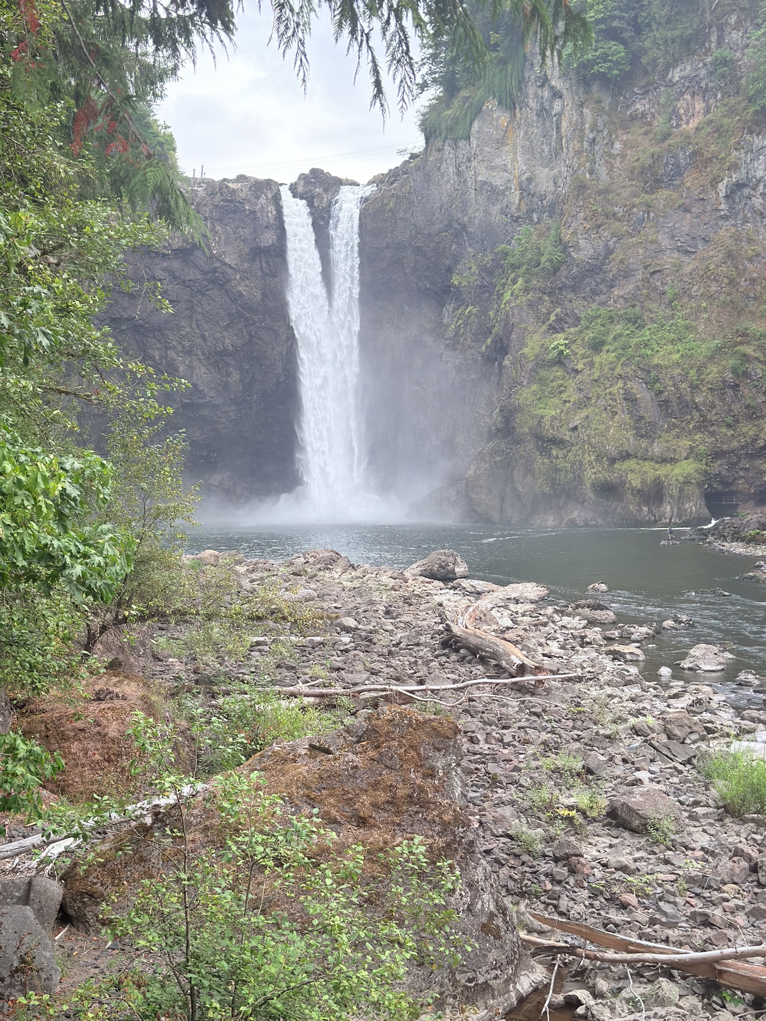
On the way, we also stopped at Snoqualmie Falls, where I realized my Achilles tendon wasn’t okay – most likely inflammation. So we made another stop at Walmart, bought some Voltaren, and hoped it would help as quickly as possible. We had planned to run the High Divide Trail & Seven Lakes Basin Loop the next day (30 km and about 1,500 m of elevation gain), but we’re moving that to one of the following days—and there’s a 99% chance we won’t be running it at all.
We also tried to sort out Planet Fitness now that we finally have a Scotiabank debit card, but unfortunately it still didn’t work. Planet Fitness requires a U.S. debit card; we only have a credit card, which can be used for the initiation fee, but the monthly payments must come from a debit card. After a lot of troubleshooting, we solved it through Wise, and around 9 p.m. we finally made it into the Planet Fitness showers.
After that, we drove closer to Olympic National Park and left about an hour of driving for the next day.
Day 5 (September 12, 2025)
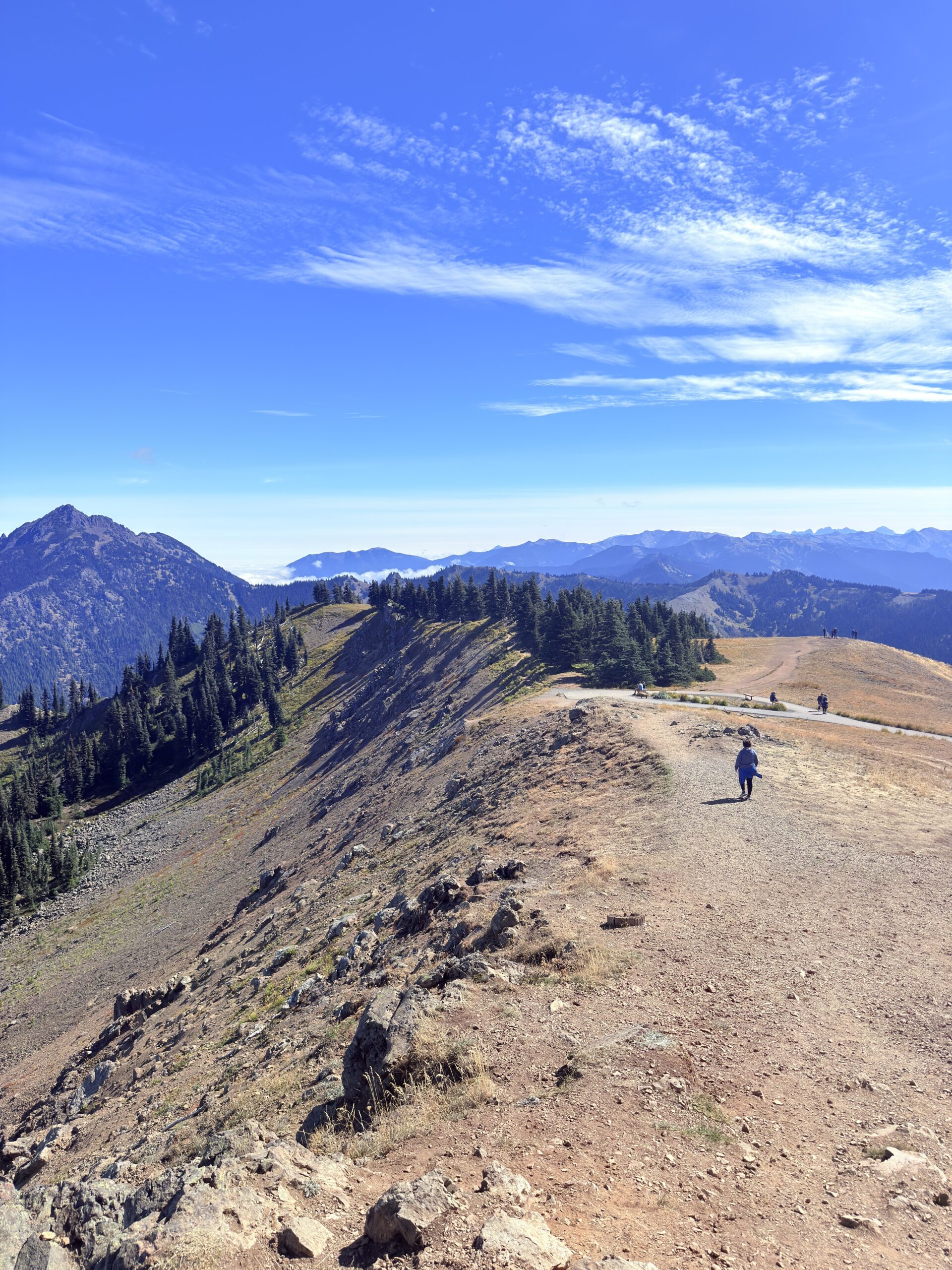
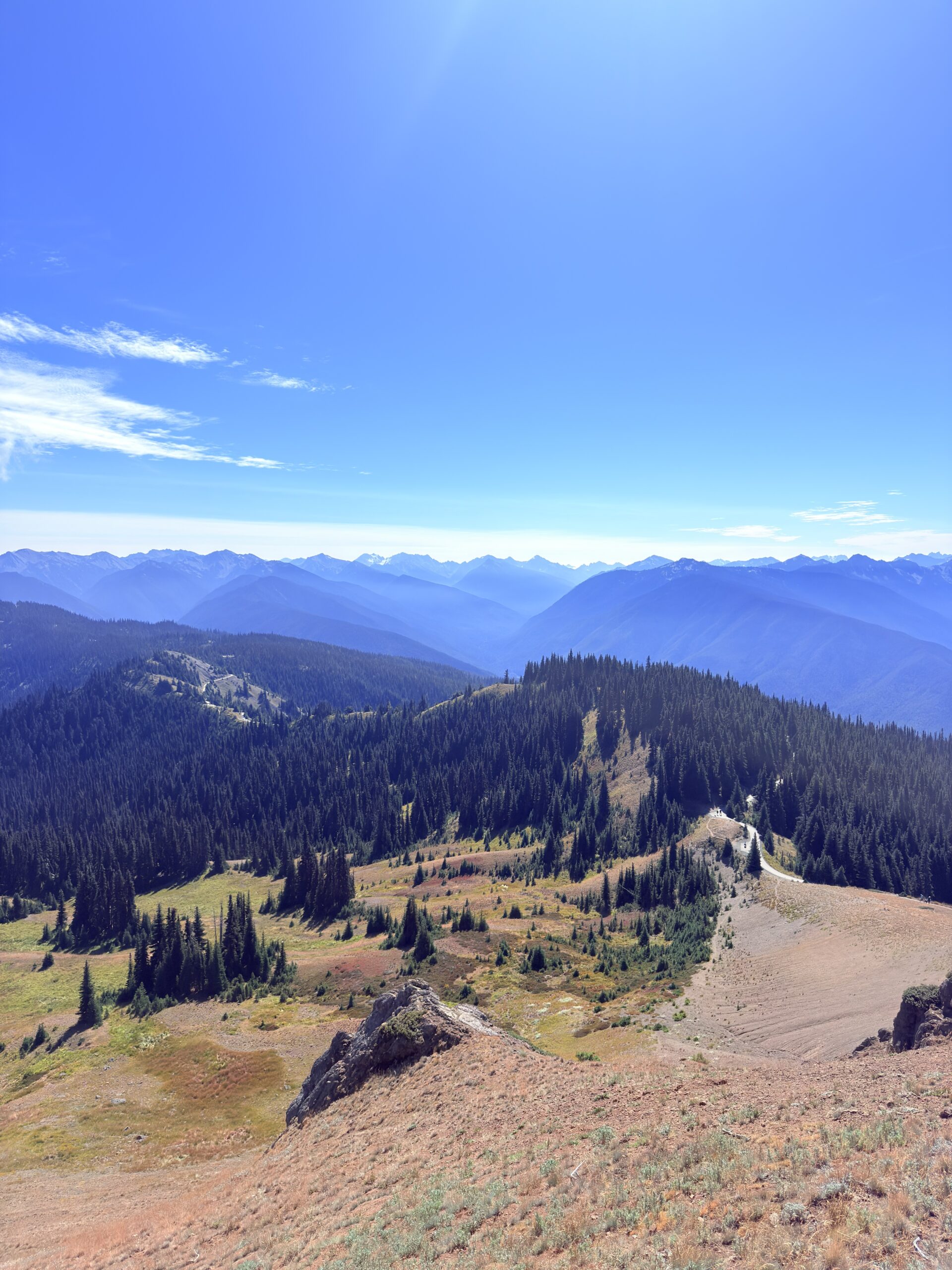
Hurricane Hill via Hurricane Ridge (5.28 km, 220 m ↑ / 220 m ↓)
Marymere Falls (3.46 km, 80 m ↑ / 80 m ↓)
Hole in the Wall
We started the morning slowly, with a calm breakfast and a phone call home. After that, we headed to Hurricane Hill, where an easy walk awaited us. Hurricane Hill is clearly a very popular trail—and it’s easy to see why. The route follows a paved road, making it accessible to absolutely everyone: all age groups, including families with strollers. On top of that, the views are simply perfect. We moved closer to the visitor center so we wouldn’t take up parking space for other visitors and cooked ourselves a simple lunch with beautiful views all around.
At the visitor center, we tried to find out whether it would be possible to reserve a campsite for the High Divide & Seven Lakes Basin Loop, but they sent us to the information center near Port Angeles. Unfortunately, there were no available spots for the next three days. That means we’ll have to do the trail in one day—even with a sore Achilles tendon, which at least seems to be improving significantly.
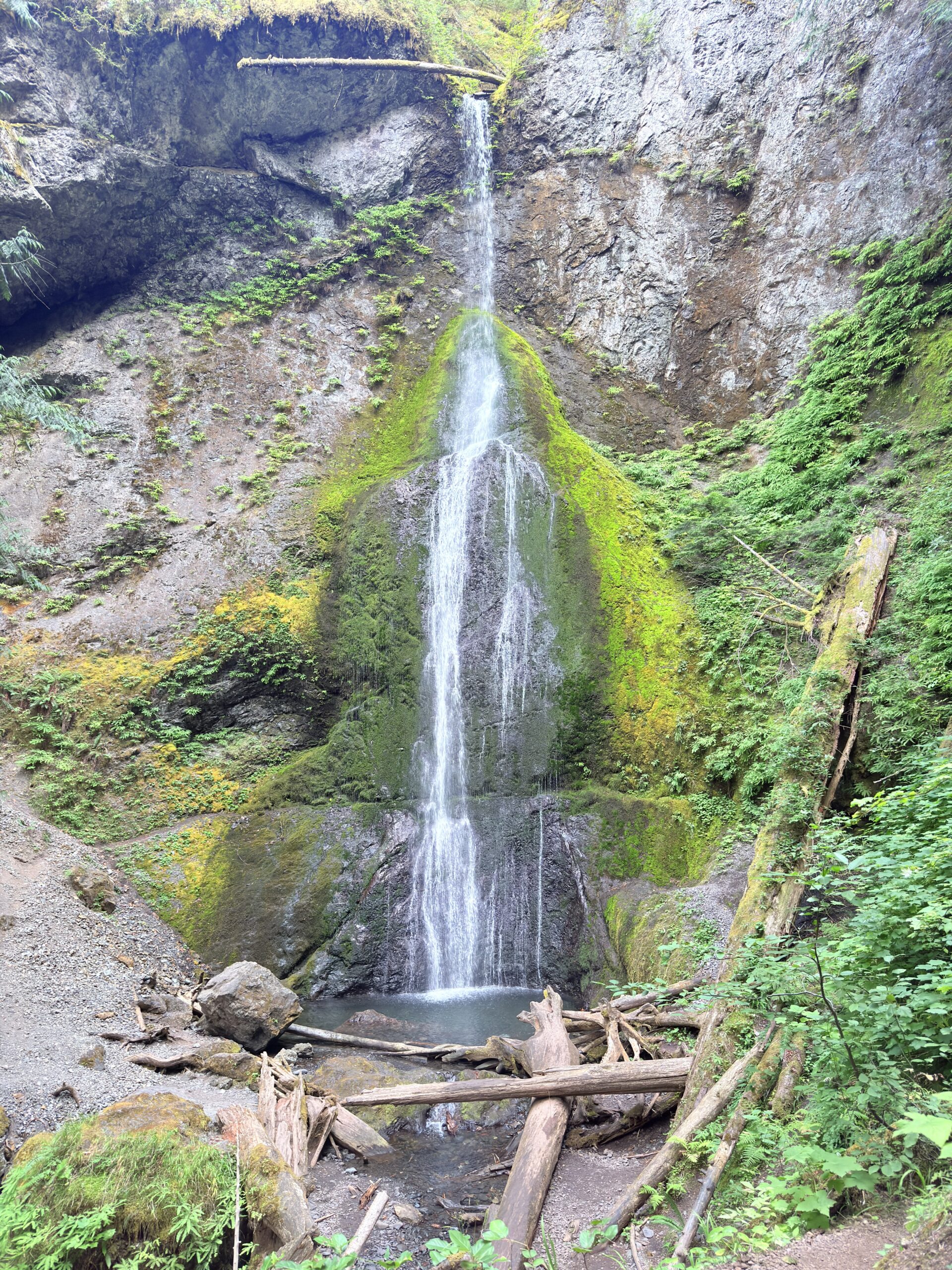
We then continued to Marymere Falls, located near Lake Crescent, which is so massive it almost feels like being at the ocean already. The walk to the waterfalls is another short stroll, which I was especially grateful for today—no long distances. The trail leads through the forest, offering pleasant shade, but because it’s such a short walk, it’s once again quite crowded.
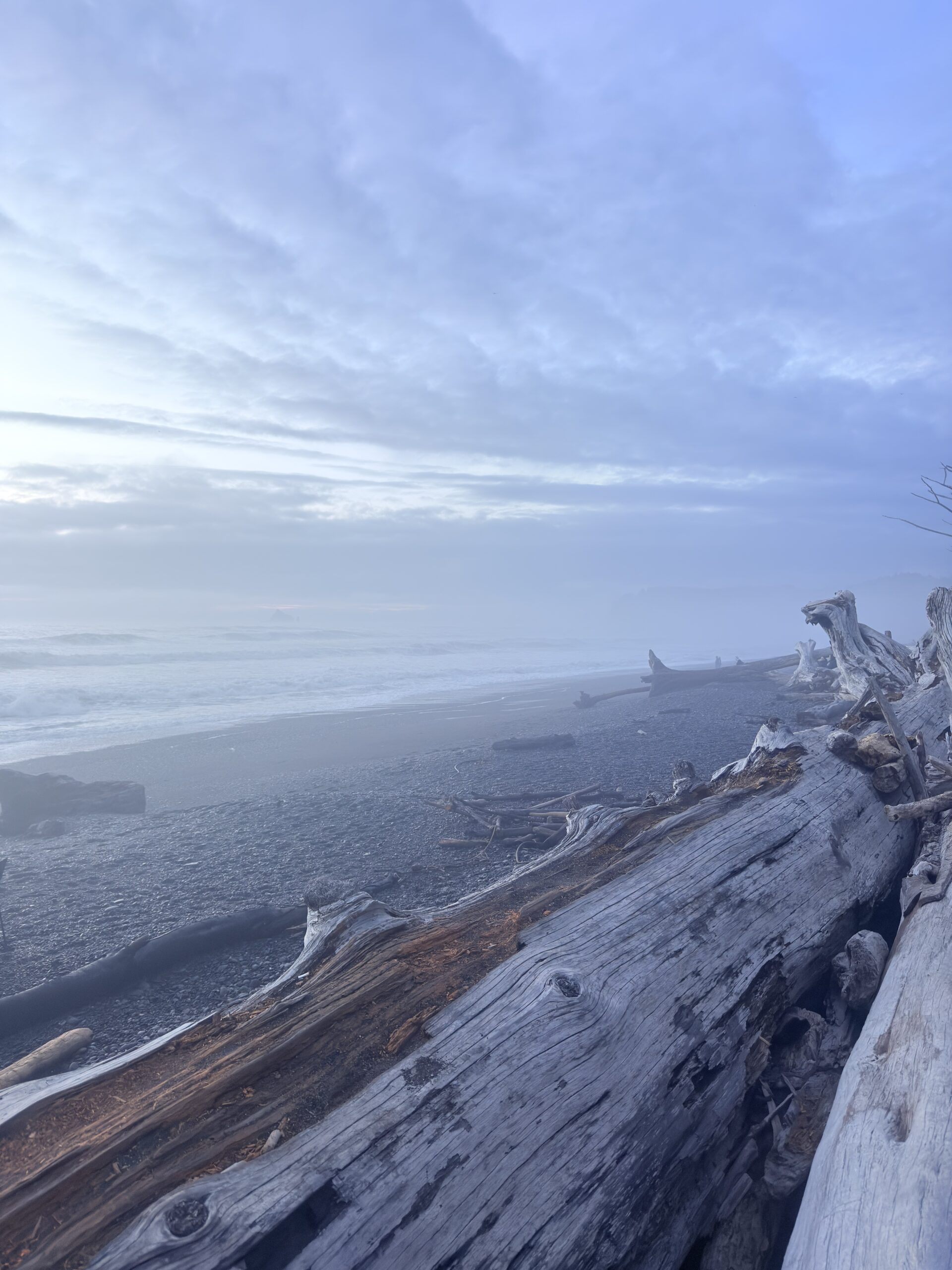
In the evening, we headed to the coast, to Rialto Beach, hoping to catch a nice sunset. We planned to walk all the way to Hole in the Wall, but with the tide coming in and heavy fog limiting visibility—and with the rocky beach being difficult to walk on—I decided it was better to save my Achilles rather than push it. After about a kilometer, we turned around and chose to wait for the sunset near the parking area instead.
We really loved the beach. With all the fog around, it felt incredibly mystical. To top it off, there was a man dressed in a black robe playing some kind of unusual musical instrument—it fit the scenery perfectly. In the end, there was no sunset, but it didn’t bother us at all. The overall experience was peaceful and enjoyable, and we agreed that we needed to slow down a bit—which we definitely managed to do today.
Next, we’ll be heading toward the Sol Duc River, where the High Divide Trail awaits us the following day.
Day 6 (September 13, 2025)
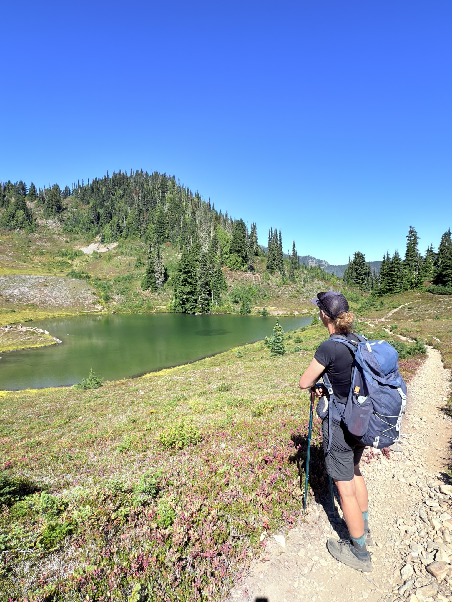
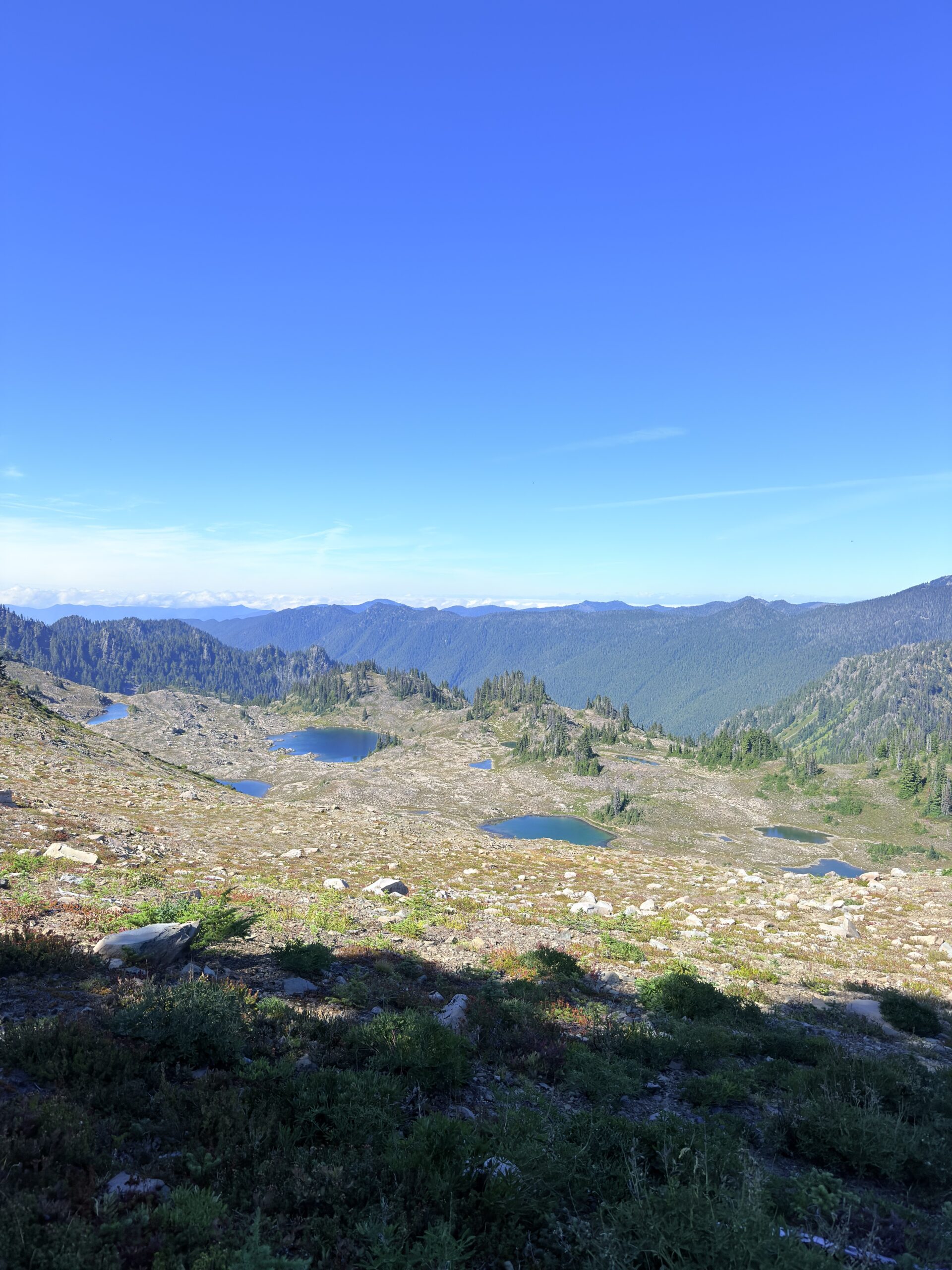
High Divide & Seven Lakes Basin Loop Trail (30.80 km, 1,456 m ↑ / 1,456 m ↓)
For today, Lu officially crowned me a princess, so I’m heading out carrying nothing but my trekking poles and a camera. We agreed on a snail-paced day, just to be safe, so we packed our headlamps as well—hoping, of course, to make it back to the car before dark. We set off around 8:30 a.m. By then, the parking lot was already packed to bursting, and as we gradually passed countless backpackers, it was easy to understand why. Some of them were planning to stay on the trail for up to five days.
After about four kilometers, the campsites began—almost every kilometer, another one appeared. At first, we couldn’t understand how not a single campsite had been available, given how many there are along the trail. But as time went on and we kept meeting more and more hikers, it made perfect sense. Of course, we also passed plenty of people hiking light, just like us, so we assumed they were doing the loop in one day as well. Some of them were going even lighter than me—no water at all, or maybe just a half-liter bottle. I truly don’t understand that, especially since I didn’t see any personal sherpas walking alongside them like I had, haha.
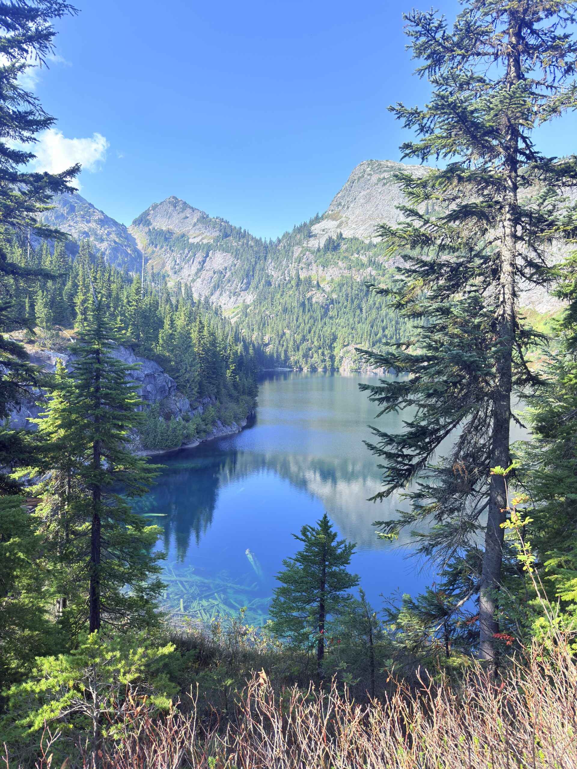
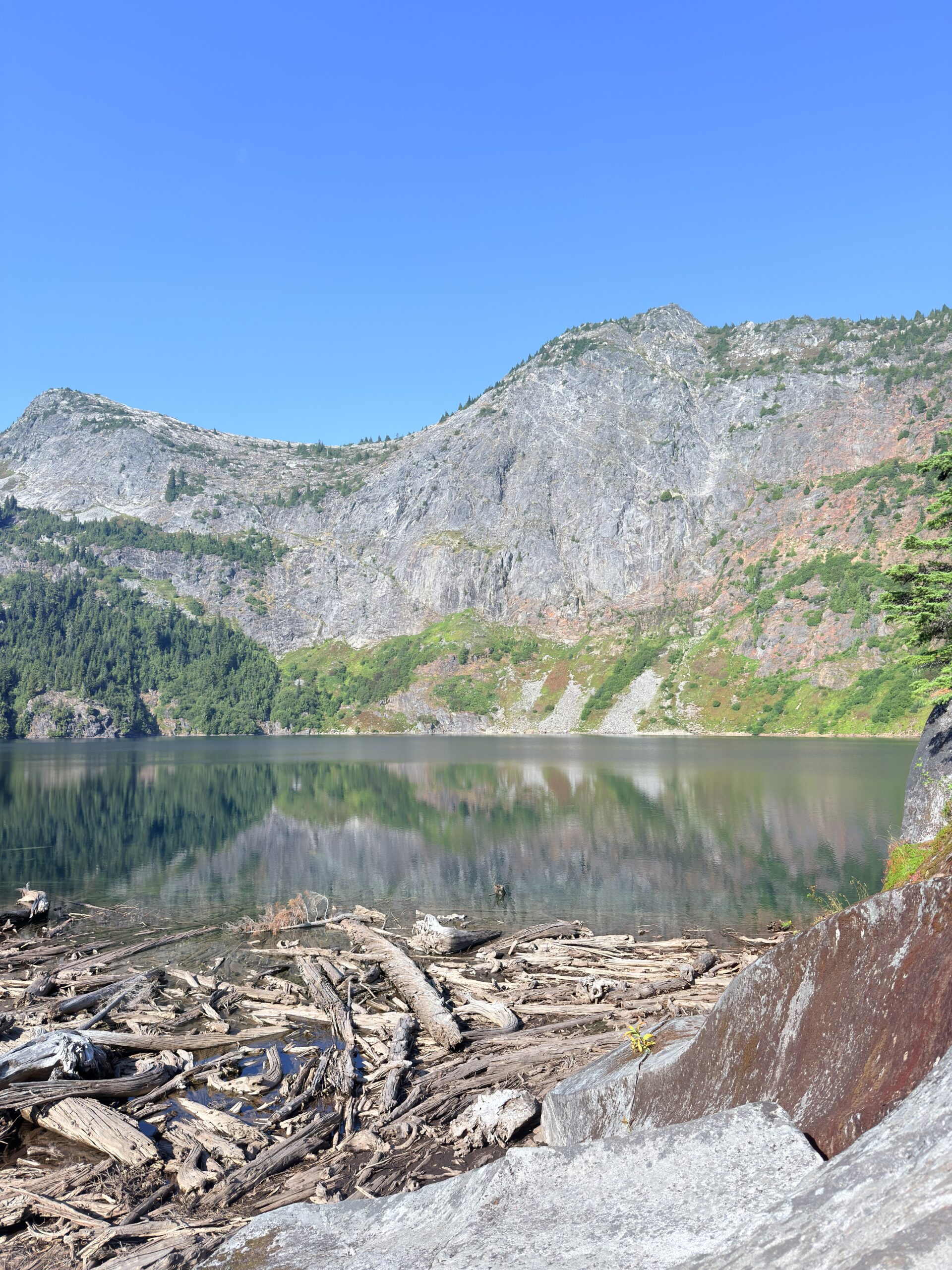
From Heart Lake onward, the trail becomes truly spectacular—lakes stretching out on one side, glaciers rising on the other. It’s no surprise this is one of the most popular trails in Olympic National Park.
Roughly halfway through, we met two couples: one from Seattle, showing the local beauty to the other couple visiting from Colorado. They teased us about who would make it to the finish first. Given my leg, I put my money on them.
The last six kilometers were… a prayer. I was literally hoping with every step that we’d reach the car soon. Lu tried to break the distance into manageable pieces, telling me things like, “In one kilometer, there’s a pond,” or “there’s a lake,” so it wouldn’t feel like endless distance ahead of us. Having those little milestones helped a lot.
At the very end, Sol Duc Falls awaited us—a waterfall so popular that even people who don’t hike come to this part of the park just to see it. From the parking lot, it’s only about 1.5 km. And wow—it’s absolutely beautiful. We stopped for a few photos and videos, and, in my case, mainly for a much-needed rest. For a while, Lu had stopped talking in kilometers altogether and switched to miles—or rather, just distances. Only at the end did she confess she’d been using miles instead of kilometers so it would sound more encouraging.
Back at the parking lot, we ran into the two couples again—or rather, their male halves—whom we’d met halfway through. We weren’t really racing, but apparently the guys beat us by about two minutes, and the women arrived maybe five minutes after us. We started chatting again, and of course, they admired our “lil Cherry.” By now, after traveling through the U.S., they must be at least the twentieth people to compliment – or stop and stare at – our build and our little kitchen setup.
Day 7 (September 14, 2025)
In the morning, neither of us feels like getting out of the car. Everything hurts, and on top of that, it’s raining. Today, Lu is the princess, so I drag myself up and head out into the rain to prepare breakfast. As a thank-you for carrying the backpack yesterday, Lu gets breakfast and hot chocolate served straight to bed.
Using the Too Good To Go app, we found some gluten-free cupcakes in Tacoma, which happens to be on our route. The plan is to stop by Planet Fitness as well—we want to squeeze in a light workout to stretch our core and upper body, then reward ourselves with a hydro massage and a shower. Honestly, a very pleasant way to spend time in a gym, haha.
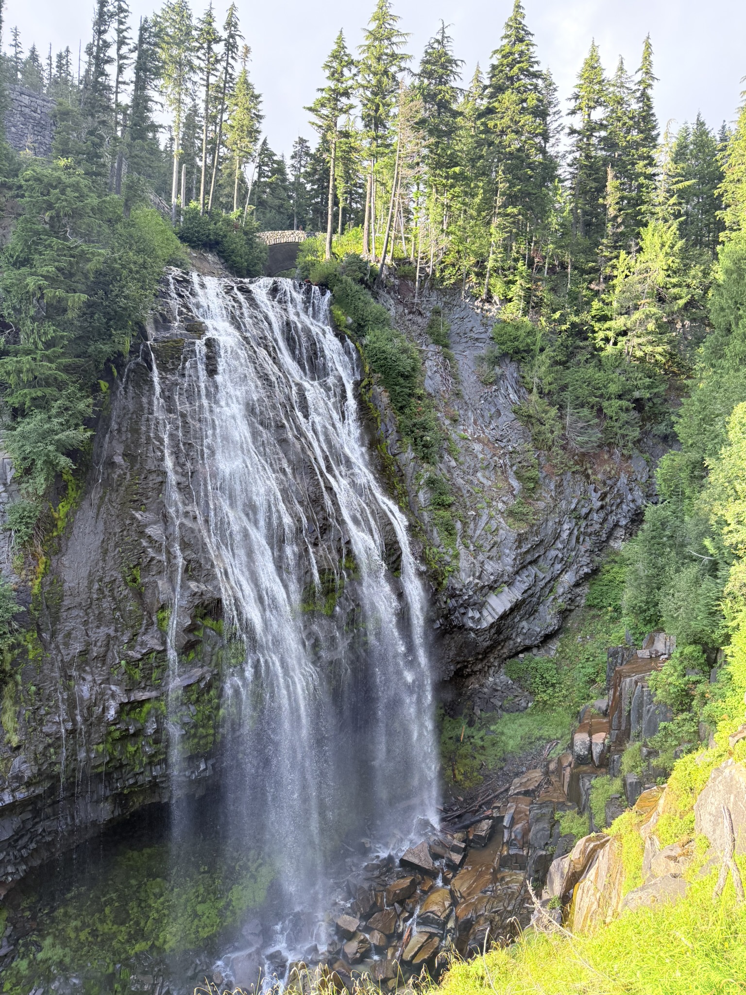
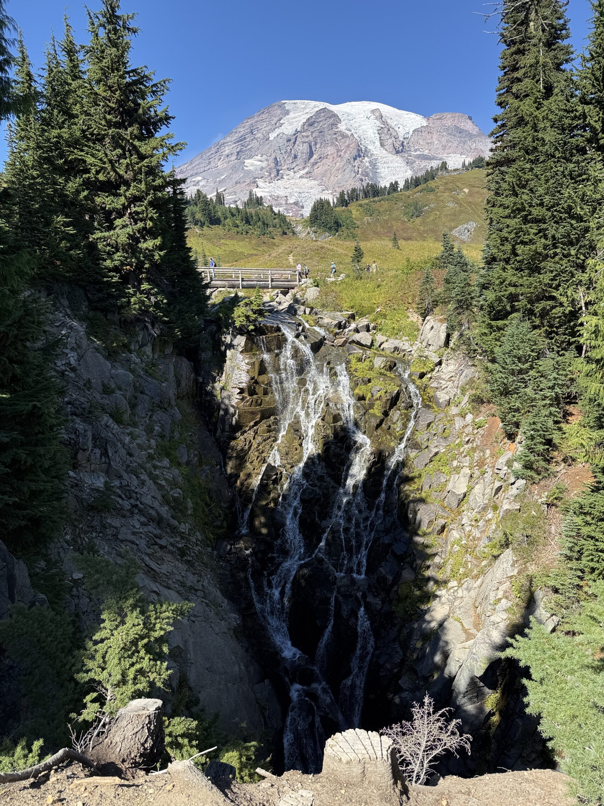
We also need to stop by Walmart for groceries, fill up the tank, and pick up the cupcakes. By the time we’ve done all that, it’s almost 4 p.m., and we still have a drive ahead of us to Mount Rainier National Park, where we’re hoping to hike the Skyline Trail. On the way, we stop at Narada Falls. It’s only about a 300-meter walk to the viewpoint—but I quickly realize that I can barely walk at all. Skyline is officially canceled for today. Narada Falls, however, are absolutely worth even that short detour.
Narada Falls are among the most powerful waterfalls in Mount Rainier National Park. They plunge from a height of about 51 meters and are fed mainly by meltwater from the Paradise Glacier, which is why their flow is strongest in spring and early summer.
Fun fact:
They may look calm in photos, but in reality, Narada Falls are some of the loudest waterfalls in the park—sometimes your own thoughts don’t stand a chance here 😄
We decide to head toward Burroughs Mountain and start that trail the next morning. And then comes another twist… SR-123 is closed. That means a detour—either all the way back toward Tacoma, or around the other side. Slightly shorter, but still long: roughly a three-hour drive. If we go to Burroughs Mountain now, we’d have to repeat that same detour the next day.
We study the maps, thinking ahead about the route toward Trout Lake to visit Denča (a friend we met while doing a snowboard course together), and it starts to look like it makes more sense to do Burroughs Mountain first and Skyline the following day. We briefly consider doing both trails in one day, but that would be unnecessarily intense. So once again… we choose a slower, more relaxed approach.
Today just isn’t going our way, so we officially declare it a maintenance day.
Day 8 (September 15, 2025)
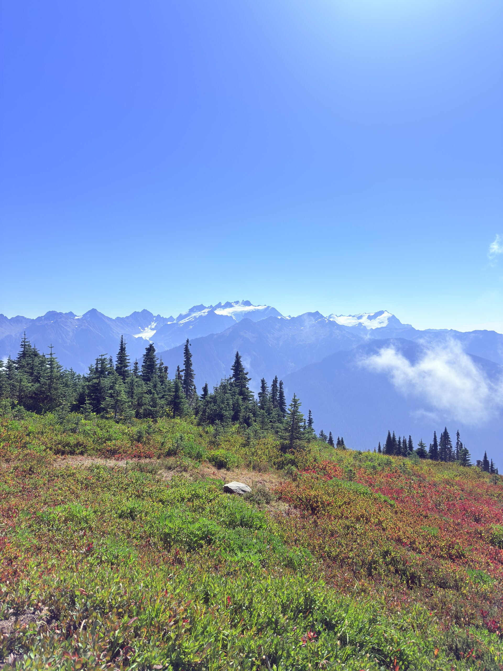
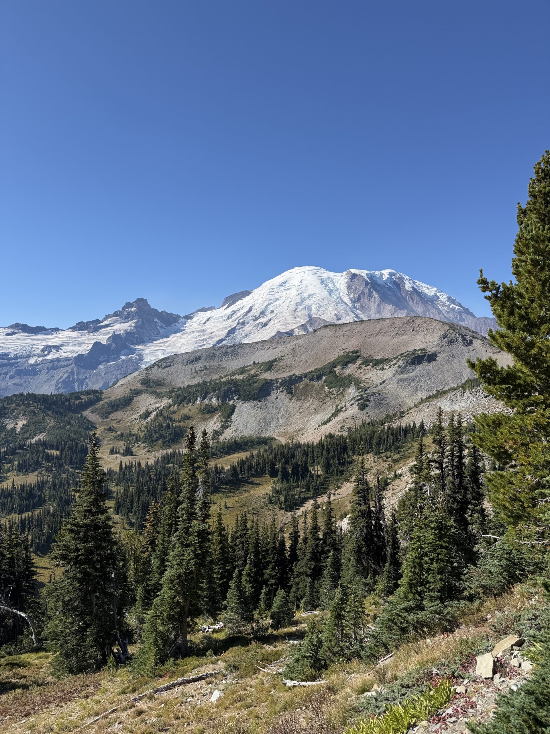
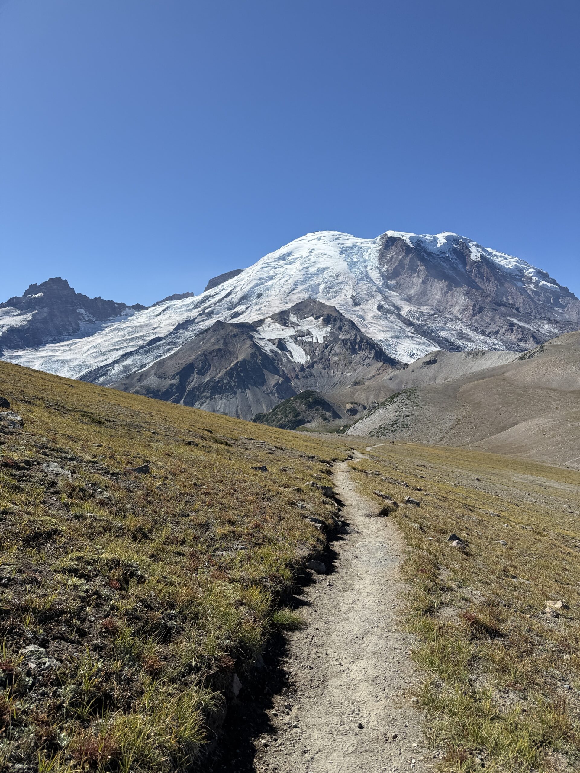
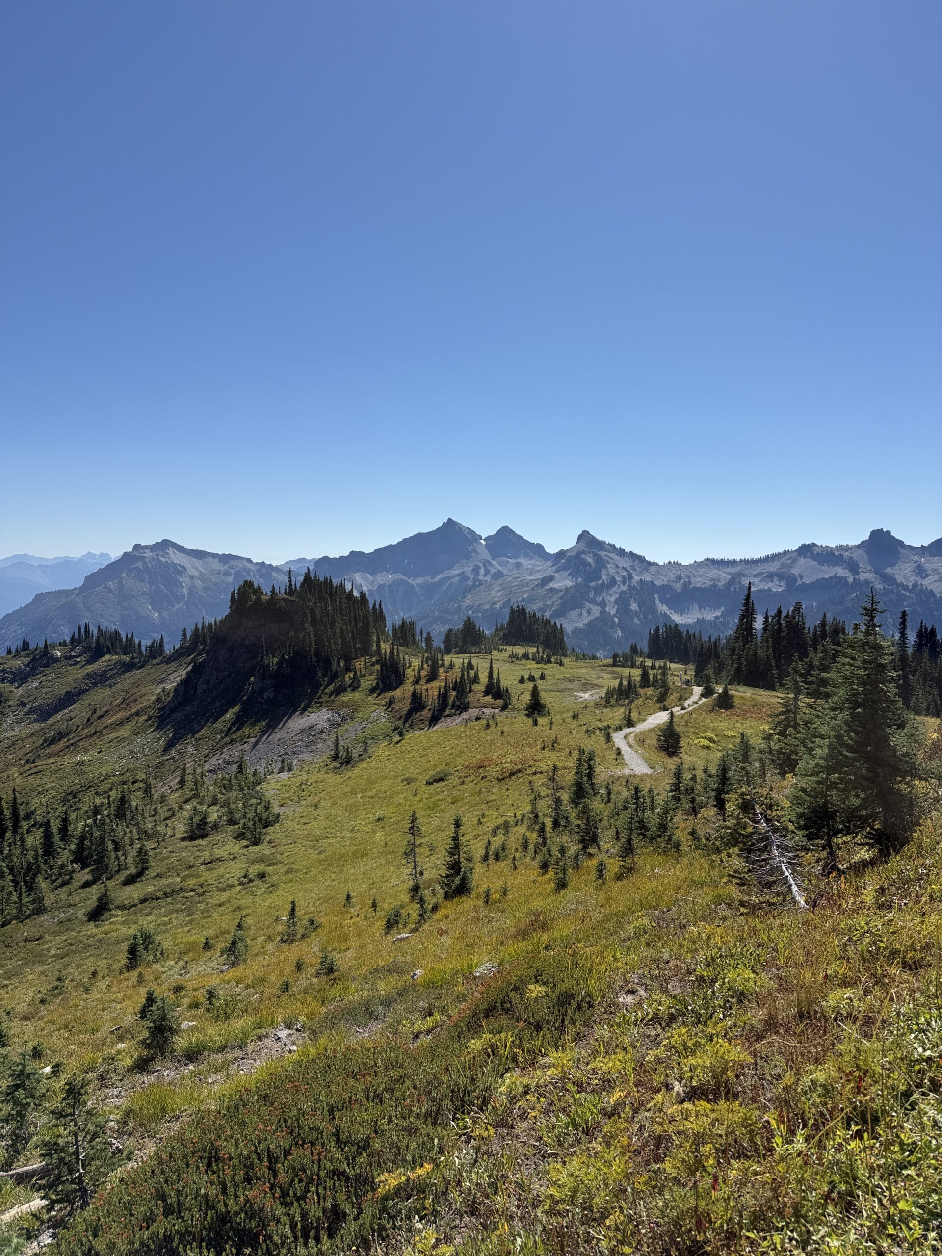
Burroughs Mountain (15.28 km, 808 m ↑ / 808 m ↓)
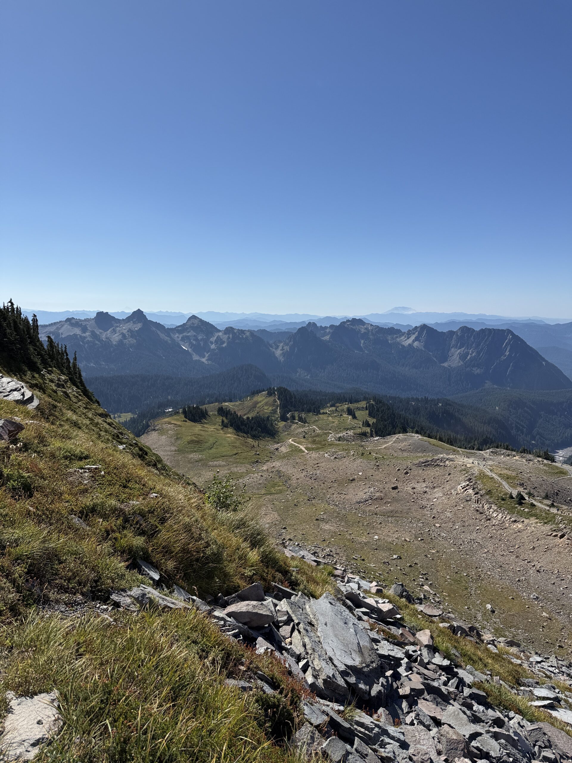
Burroughs Mountain offers access to three summits and can be hiked partly as a loop. Mount Rainier and the Rainier Glacier are already visible from the parking lot, and with each summit you get closer and closer to the glacier itself. This trail is definitely best started early in the morning, as it doesn’t offer many shaded sections. We really appreciated the early start—not only because of the heat, but also because the visibility in the morning and throughout the late morning was excellent. On the way back, as we turned around, the views gradually became hazier, possibly due to mist or smoke—it was hard to tell.
The trail itself is a reward from start to finish, with stunning views along every section. Of course, we couldn’t miss the third summit and the chance to get as close to the glacier as possible. The views are absolutely worth it. Most people likely turn around at the second summit, which already offers completely perfect views after just about 5 kilometers with roughly 300 meters of elevation gain. Pure magic.
We treated this hike as terrain scouting, with the hope of returning in the future to climb Mount Rainier itself.
Mount Rainier is the most heavily glaciated mountain in the contiguous United States. It has more than 25 glaciers that feed surrounding rivers and significantly influence the local climate.
Fun fact:
Mount Rainier is actually an active stratovolcano—the last eruption occurred roughly 1,000 years ago. Because of the massive amount of ice on its slopes, Rainier is considered one of the most dangerous volcanoes in the U.S., even though it looks calm and majestic.
In the end, there’s nothing left to do but relocate back near the Skyline Trail…

Den 9 (September 16, 2025)
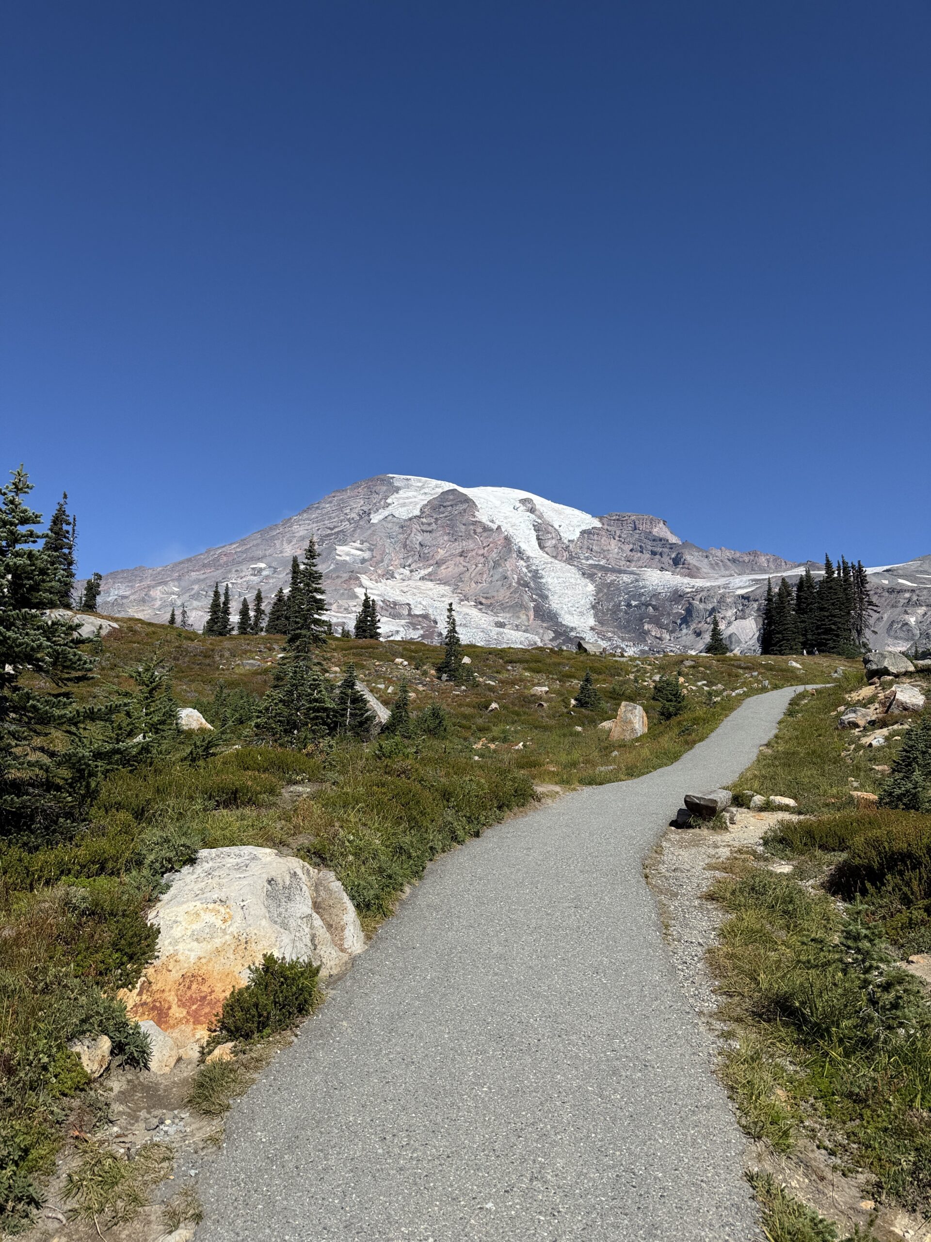
Skyline Trail (9.09km, 582m↑ 582m↓)
In the morning, we try to get to the trail as early as possible because we still have a fairly long drive ahead of us to Trout Lake to see Denča, and we don’t want to arrive too late.
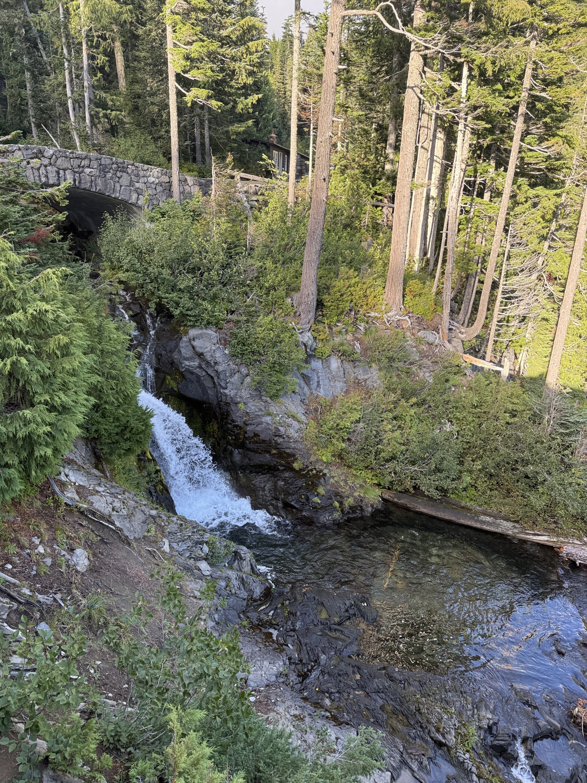
Even though there are several possible trails from this side — not just Skyline — all of the trails are absolutely crowded with people, which we already expected when we were parking. It’s not surprising: you don’t need to walk far, and the views are perfect. The entire 9 kilometers offer something to look at. Since we took the trail clockwise, a beautiful waterfall awaits us at the end.
Fun fact:
The Skyline Trail is considered one of the very few hikes in the U.S. where you can see Mount Rainier’s glaciers, wildflower meadows, waterfalls, and volcanic landscapes all in a single loop. On clear days, hikers often joke that the trail feels like a “greatest hits album” of Mount Rainier National Park — without ever having to stray far from the trailhead.
In Mount Rainier National Park, we also wanted to hike Tolmie Peak, but unfortunately this trail is closed indefinitely due to a bridge that you have to cross to reach the trailhead.
Immediately after the hike, we head toward Trout Lake, but the roads are quite congested, so of course we arrive after dark.
Denča originally wrote that she would wait for us in White Salmon, where her yoga class had just ended. However, the drive takes longer than any of us expected, so she heads out ahead, and we agree to meet directly at her place.
We agree over the phone that we’ll make dinner together, but once we finally arrive, we can’t stop talking because we have so many questions for each other. The last time we saw each other was about three years ago, just before she left to volunteer in Mexico and then moved to the USA, where she stayed — so it’s no surprise. We talk until about midnight and then head to sleep so we don’t sleep through half of the next day.
Day 10 (September 17, 2025)
We wake up around 7 a.m. and have breakfast together. Denča took the day off because of us, but she still has to go to work for a short meeting. The evening before, Denča briefly explained what she does, and we liked it, so she offered that we could go with her and she would show us around. She works at Trout Lake Abbey (a Druid and Buddhist sanctuary). During the meeting, we look around this interesting place, and afterward Denča gives us a guided tour with explanations. In about a week, there is supposed to be a Druid ceremony, and we regret that we don’t have unlimited time, because we believe that taking part in something like this would be a valuable experience.
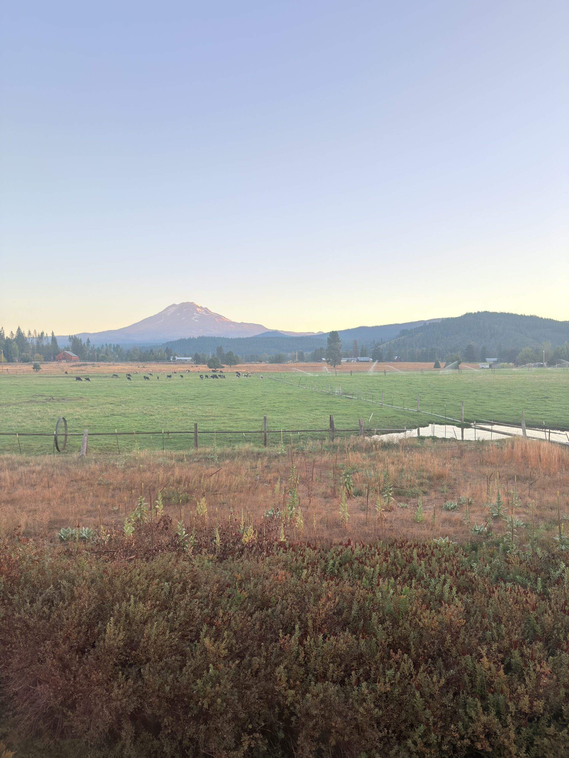
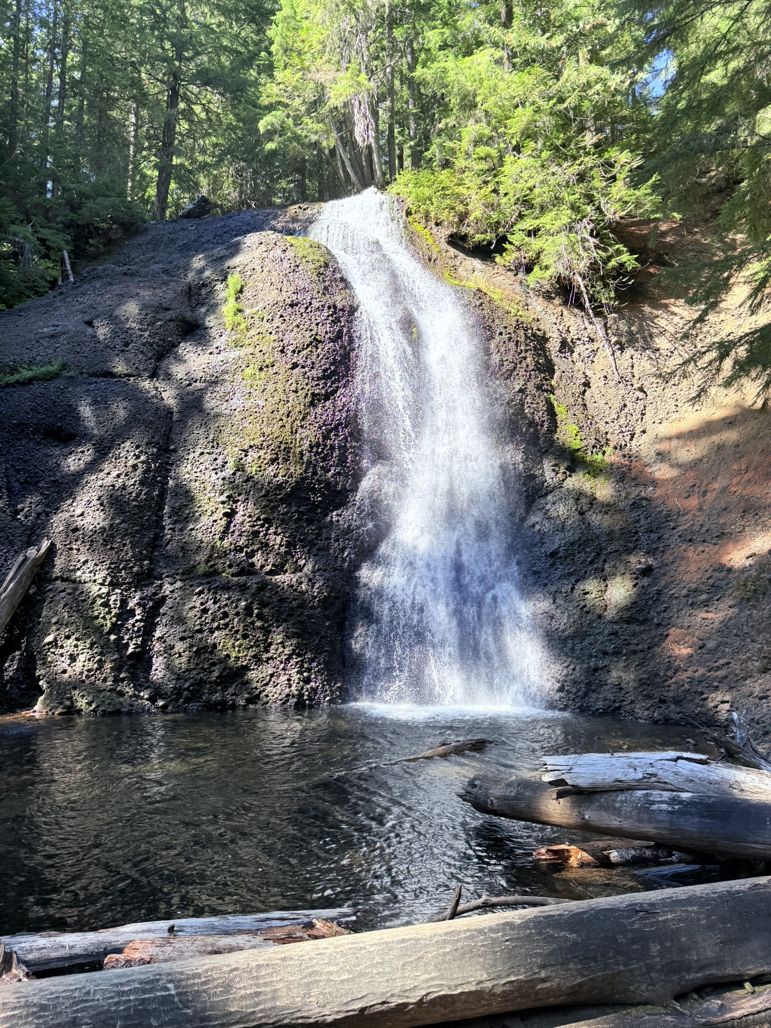
Then we head out for a morning coffee and decide what we’re going to do. We leave the entire program up to Denča, because she knows the area best. We start at Langfield Falls, which lies off the main tourist routes in the Gifford Pinchot National Forest, and thanks to that, there is often a sense of calm you would hardly find at more popular places. The waterfall is fed by water from Mount Adams, which means it has a stable flow even during the dry summer months. Locals consider it a “secret swimming spot,” although the water is more suitable for cold-water enthusiasts than for a long swim. We originally thought we might cool off here too, but it was quite chilly right by the waterfall, so unfortunately we skipped it.
We then continue on to Mosquito Lake, which, despite its name, is not a place where mosquitoes will eat you alive — at least not for most of the year. The lake was formed as a natural depression created by volcanic activity and is a perfect example of a quiet “forest lake,” where time seems to move differently. Thanks to minimal wind, the water surface is often perfectly still and acts like a mirror reflecting the surrounding forest. Locals usually come here early in the morning or in the evening, when the place takes on an almost meditative atmosphere. The lake is also ideal for paddleboarding.
Our last stop is Guler Ice Caves, which Denča told us about and which we were really looking forward to. These caves are one of the most unusual natural phenomena in the entire state of Washington. Even in the middle of a hot summer, you can find ice here — and sometimes even snow. However, this is not a classic ice cave. Cold air accumulates in lava tubes formed during eruptions of Mount Adams and works like a natural refrigerator. In winter, the cold gets “locked in” inside and only slowly escapes during the summer. Thanks to this, it is one of the few places where you can cool off in flip-flops… literally.
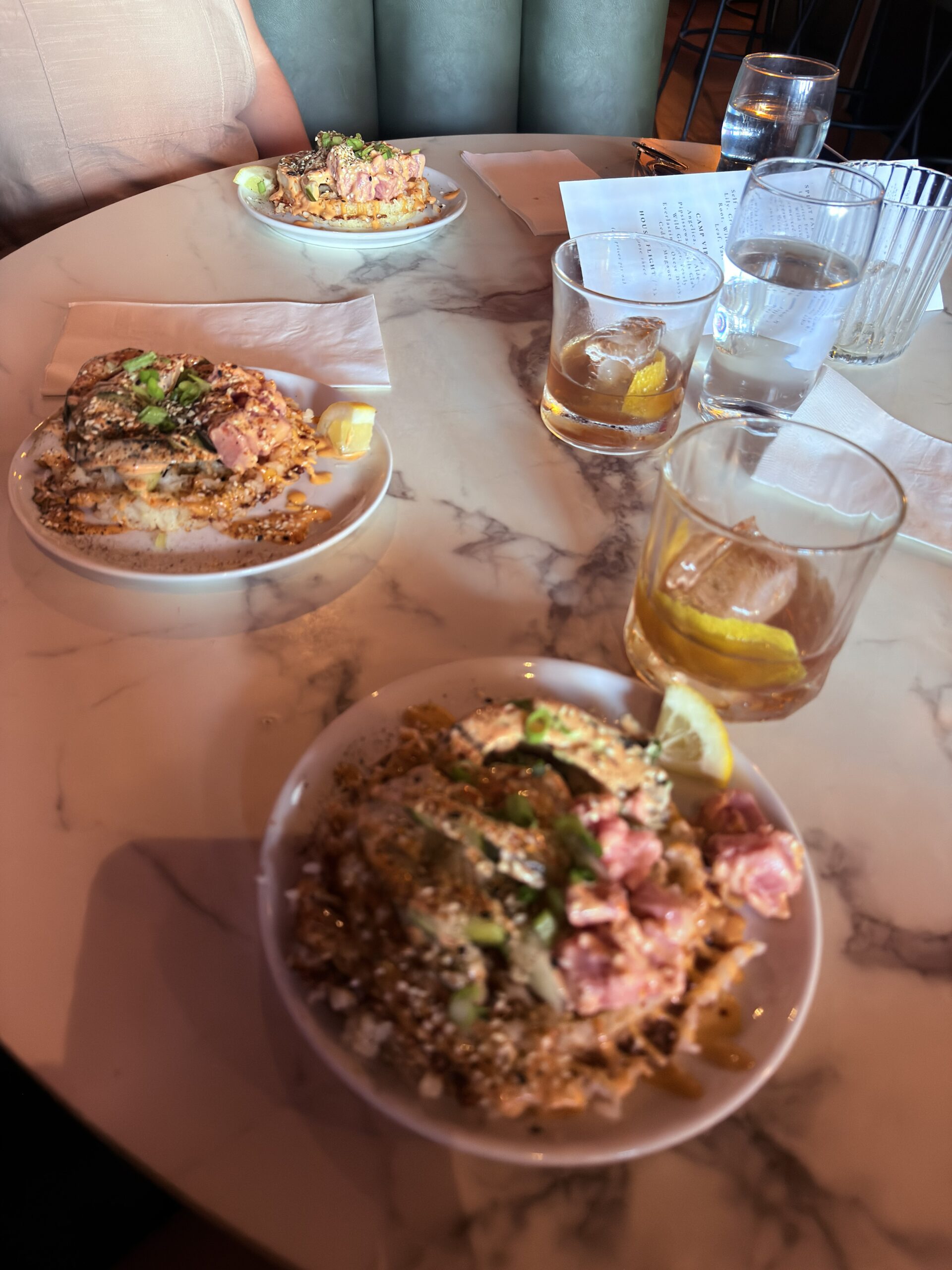
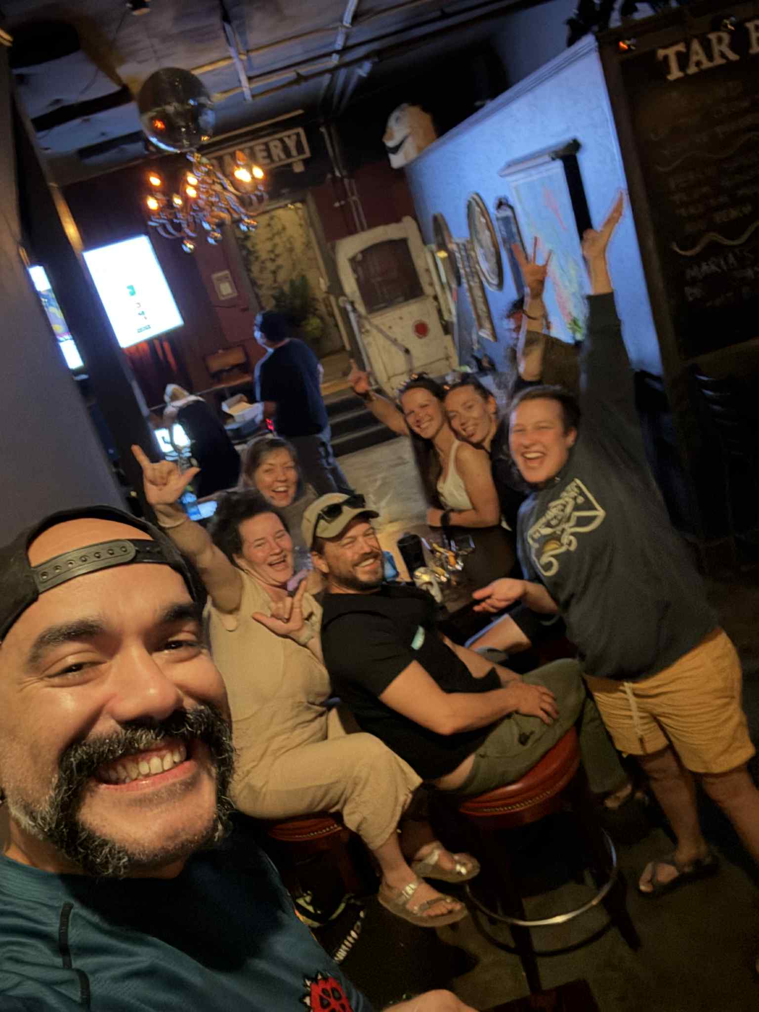
It’s incredibly hot, so we go to cool off in Hood River. The water is, of course, icy cold, so we don’t stay long. Since we start getting hungry, we drive to White Salmon, where Denča has some of her favorite spots. She takes us to Gander and Goose, a cozy bar where they make rice waffles in a poke style — absolutely perfect. We didn’t skip the cocktail either, which was also fantastic, we tried some of the owner’s special herbal spirit as well, and dessert. Eventually, Denča’s friends Brett and KC show up — clearly unexpectedly even for her — so we go for food again at the restaurant across the street. Once again, we leave the choice to the more experienced ones, and the table fills up with lots of plates that we all share. However, when we want to pay, we find out it’s already been taken care of — Brett covered the bill. It’s very kind of him, but we don’t know if we’ll have the chance to return the favor, so we feel a bit awkward. Karaoke starts soon in the bar across the street, so in the end we all continue there, where we wrap up our perfect day together. Except for poor Denča, who has to get up early in the morning.
Day 11 (September 18, 2025)
In the morning, we tried to get up together with Denča so she wouldn’t be alone, and we thought we would prepare breakfast for her, but today she was leaving for work earlier than the previous day — damn it. At least we packed her breakfast into a container, which we planned to bring to her at work once we finished packing. On the way, we also stop for coffee and a dessert at her favorite café as a thank-you for how well she took care of us and showed us everything. We drive to her workplace, say our goodbyes, and hope that we’ll manage to meet again on our way back to Canada.
Approximate expenses for the whole 11 days and 2 people:
· Gas = $317
· Food = $251
· Campsites = $26
· Other = $287
TOTAL: $880 (40USD/person/day)