
01/05/2026
5th– 14th Oct 2025
Colorado Road Trip Itinerary - Travel diary
Low-Cost Travel Tips, Best Hikes & Hidden Gems
If you’re looking for the ultimate Colorado road trip with epic hikes, alpine lakes, and hidden gems — this guide is exactly what you need.
📍 Location: Colorado, USA
⏱️ Duration: 7 – 10 days
💰 Budget: Low-cost possible
🚐 Sleeping: Car camping + campgrounds
🏔️ Best time to visit: autumn beacuse of the nature colours – apen (September), don’t leave it for late autumnt, snow can surprise you.
⚠️ Tip: Check weather
🧭 Table of Content
- Colorado Road Trip Overview
- Day 1 – Colorado National Monument
- Day 2 – Penny Hot Springs, Hanging Lake
- Day 3 – Estes Park
- Day 4 – The Keyhole
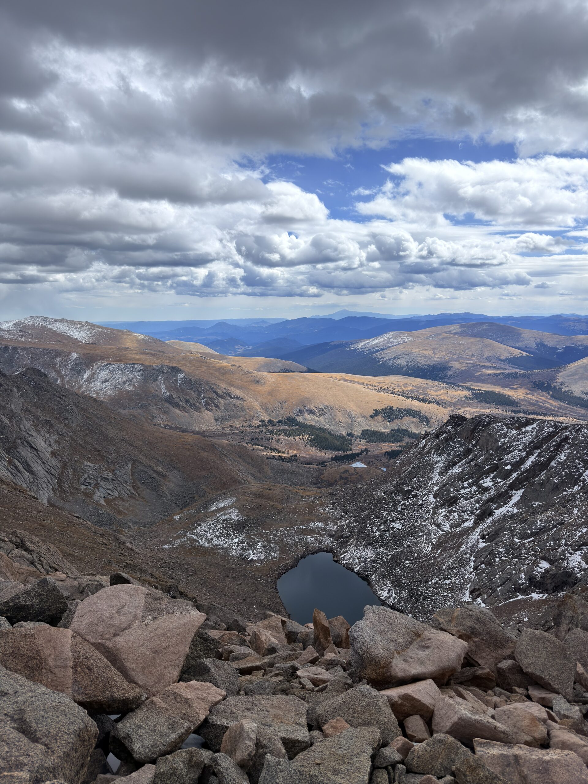
- Day 5 – Mount Bierstadt, Blue Lakes
- Day 6 to 8 – Garden of The Gods + rest days
- Day 9 – Black Canyon, Bridal Veil Falls
- Day 10 – Island Lake
- Budget & Costs
- Social media, Travel itinerary
- Travel Q&A and important recommendations with links
Before your trip, don't forget:
This article contains affiliate links. If you make a purchase through them, I may earn a small commission at no extra cost to you.
Want to save on your trip with and eSIM? 👇
– Click on the link above “eSIM data” and use a code Miska for 10% off,
– or MICHAE90689 for a discount of $5–$10 depending on your order.
Colorado Road Trip – Our Experience (October 2025)
On our way from Wyoming, we made a short stop in Utah. I needed to pick up a laptop from Marketplace, and we also wanted to meet Jess, who we had met earlier in Oregon.
The timing worked out perfectly — it was the weekend, so we went for a short hike to Gobblers Knob. And honestly? We didn’t expect to be freezing in Utah more than we did in Wyoming.
We stayed one more day, warmed up in hot springs, and then continued towards Colorado. (More about Utah in the next article.)
Day 1 (October 5, 2025)
Colorado National Monument
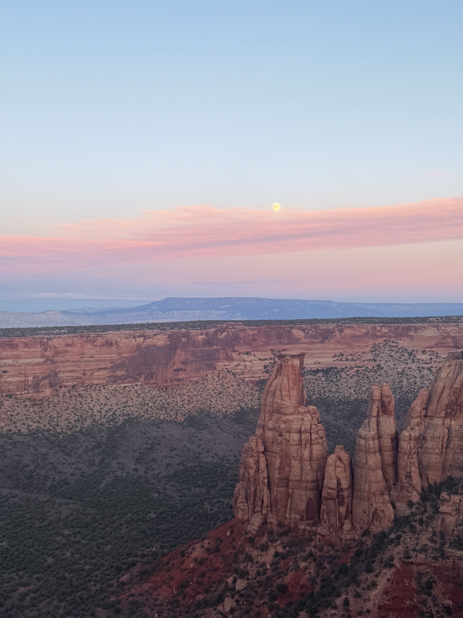
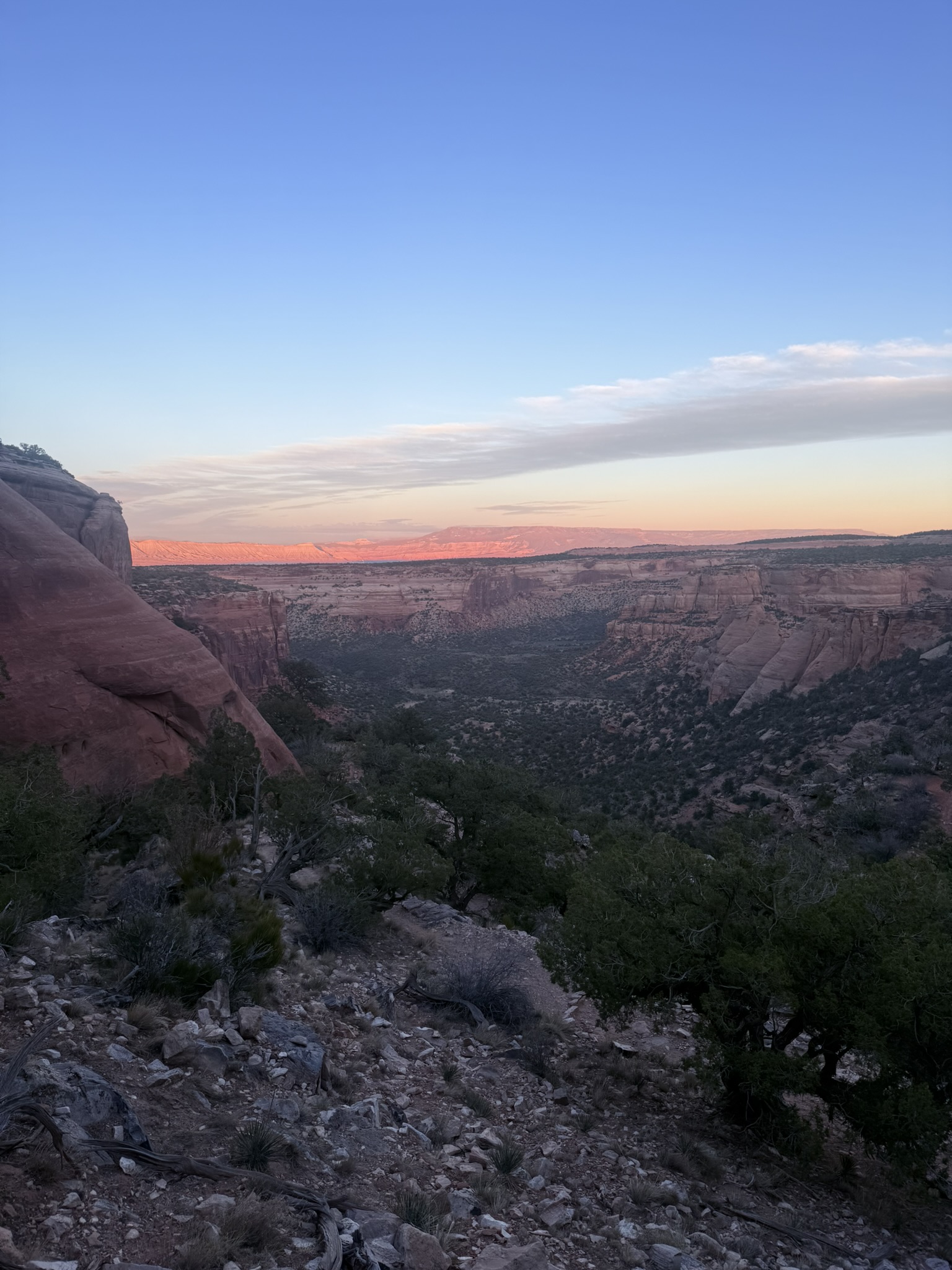
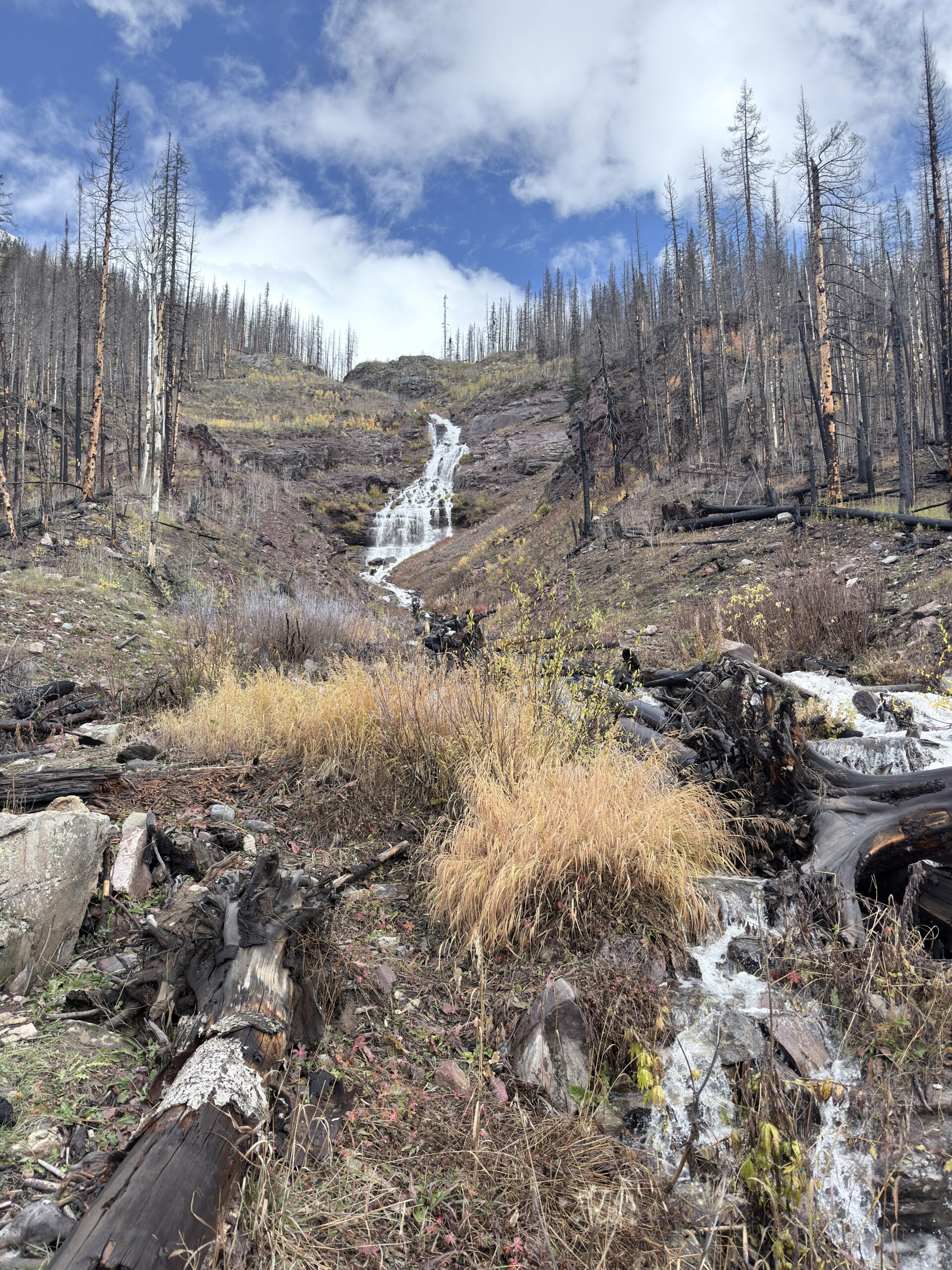
We arrived in Colorado pretty late, so instead of doing anything big, we made a short stop at Colorado National Monument. Sometimes those “quick stops” end up being way more interesting than expected. Colorado National Monument is known for its dramatic red rock canyons, towering formations, and the famous Rim Rock Drive — one of the most scenic drives in Colorado.
But what fascinated me the most wasn’t just the views… it was the story behind the road itself. This 23-mile (37 km) scenic drive was carved directly into the rock in the early 20th century, mostly by hand, with very limited machinery. Much of the work was done with the help of the Civilian Conservation Corps. Just imagine that — people literally hanging on ropes, carving a road into cliffs. Some of the tunnels are even designed to frame the landscape on the other side like a natural window.
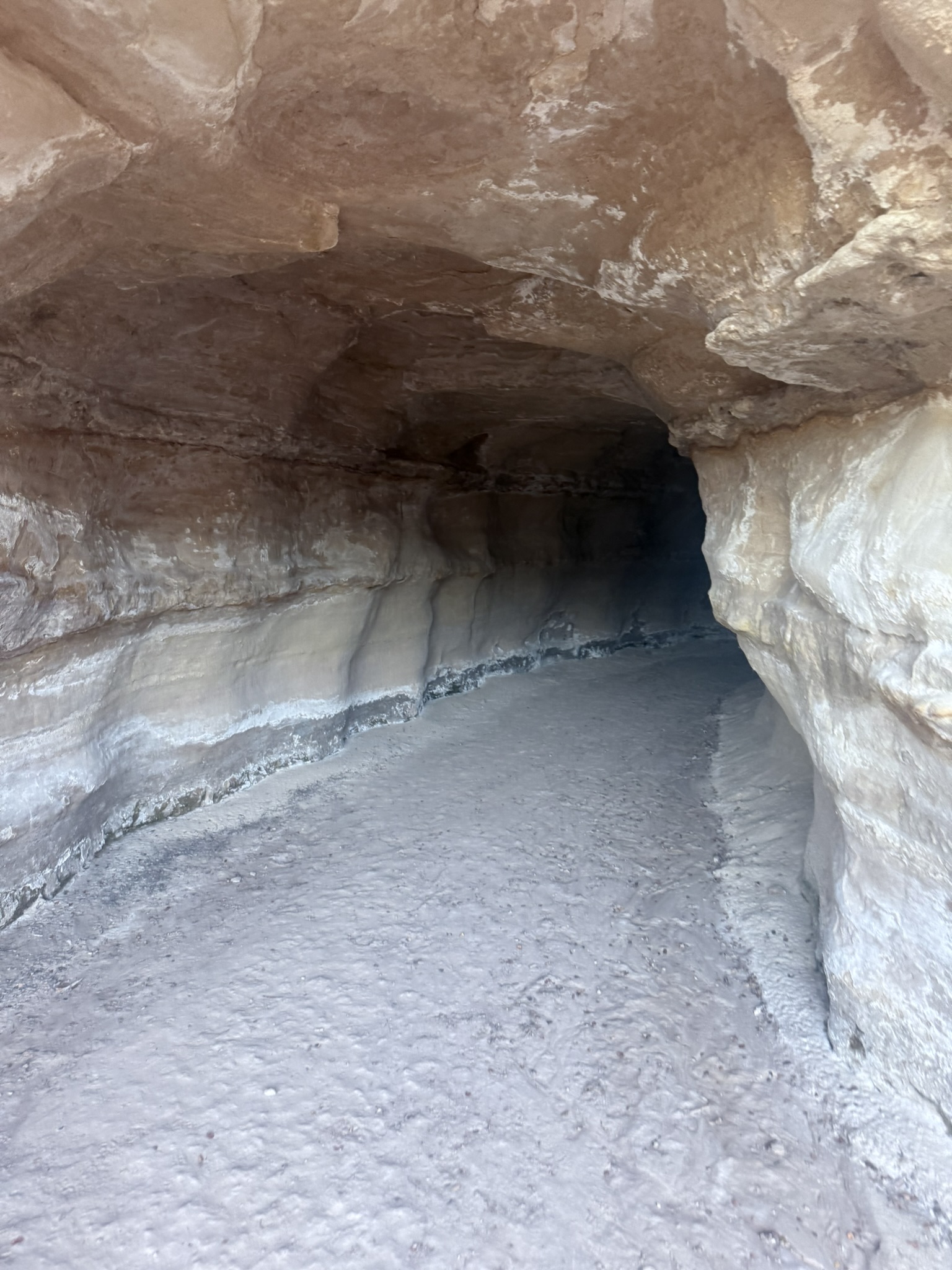
We also did a short walk along the Coke Ovens Trail. On the way, we noticed a small tunnel carved into the rock. It wasn’t anything big or famous, but it made us stop for a moment. It was most likely built for water drainage, helping redirect water during heavy rain or snowmelt.
The Coke Ovens themselves are often misunderstood. Despite the name, they are not man-made. These formations were shaped naturally over millions of years and just happen to look like old coke ovens used in mining. Early visitors thought they looked like beehive-shaped ovens — and the name stuck.
That evening, we found another set of hot springs where it was possible to sleep right at the parking lot. Honestly… waking up knowing you’re about to step straight into hot water? That’s a much better motivation than trying to heat up your car in the morning
Day 2 (October 6, 2025)
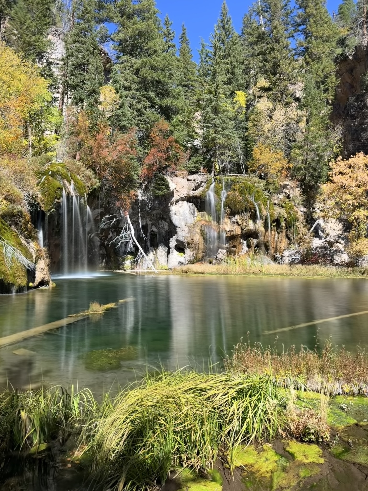
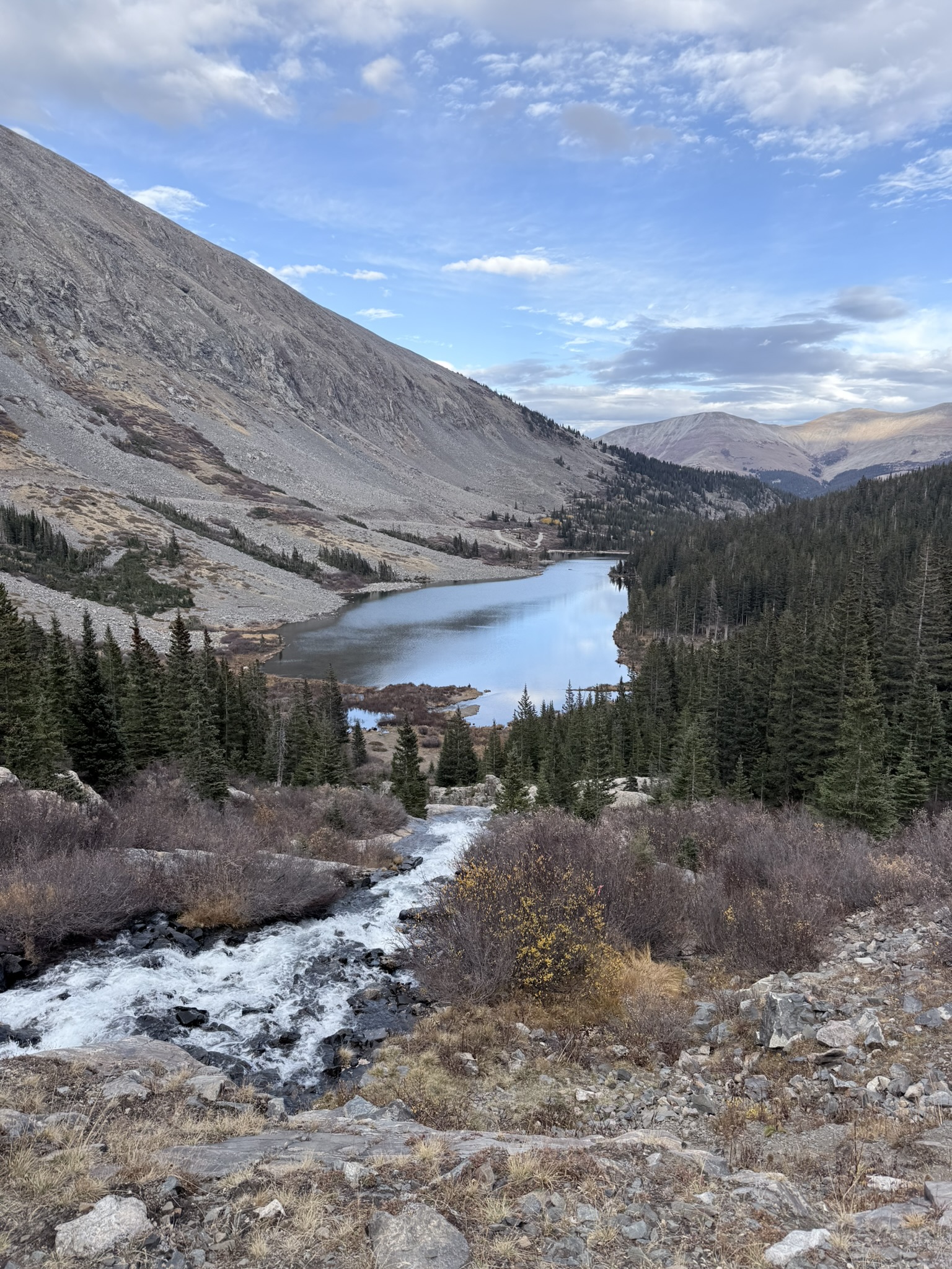
Hanging Lake [5.12km 323m↑ 323m↓]
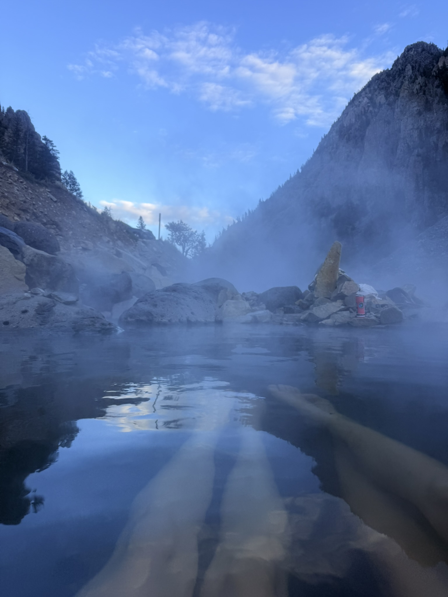
This was probably one of the easiest mornings to get out of the car. We parked right next to Penny Hot Springs, so we knew exactly what was waiting for us. These hot springs are completely natural, free, and right next to the river.
Which means one thing … You can switch between hot water and freezing river in seconds. Not gonna lie — that wakes you up better than coffee. They’re not developed at all, which makes them feel even more real. Just you, the river, and the mountains around.
Later that day, we headed to Hanging Lake. This is one of the most protected and fragile ecosystems in Colorado, which is why you need to book a permit in advance. Use this link. Entrance cost 12USD/person. Permits are available hourly and times vary by season. All reservations are for a 3-hour hiking window. Plan to arrive within 30 minutes of your reservation time.
We actually booked it the day before — and somehow managed to pick the wrong date. But either we got lucky, or the QR code wasn’t working properly… because we got in without any issues.
The trail itself is relatively short but beautiful, mostly shaded by forest. When you finally reach the lake, it almost doesn’t feel real. The turquoise color comes from travertine deposits, and the waterfalls feeding the lake seem to disappear into the rock and reappear somewhere else.
It’s one of those places where you understand why strict rules exist — even a small step off the trail or touching the water can damage the ecosystem. Our time slot started at 11AM and even with limited access, it still felt quite busy. Up to 615 visitors are allowed per day, so don’t expect solitude.
After this, we started heading towards Estes Park, where a much more challenging day was waiting for us. Not necessarily because of distance… but because we were already starting above 2,000 meters, and winter conditions were slowly catching up with us.
Day 3 (October 7, 2025)
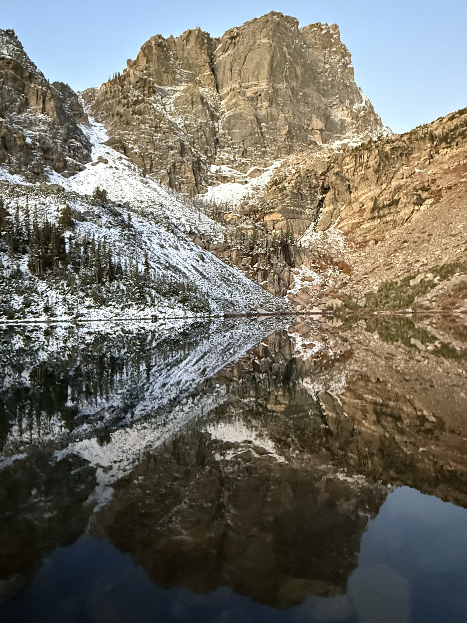
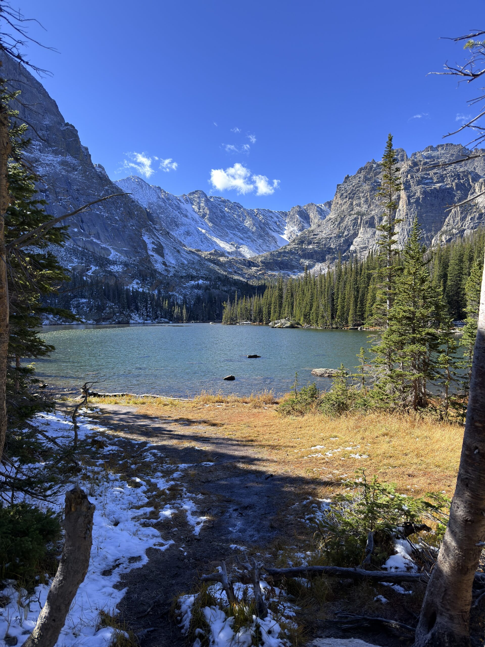
Emerald Lake, Sky Pond, The Loch and Timberline Falls via Glacier Gorge Loop [23.20km 865m↑ 865m↓]
We started very early because we wanted to catch sunrise at Emerald Lake, one of the most beautiful lakes in Rocky Mountain National Park. Unfortunately, the sunrise didn’t turn into the dramatic show we had imagined, but honestly? Hiking in the dark, with almost nobody on the trail and snow crunching under our feet, felt magical in its own way.
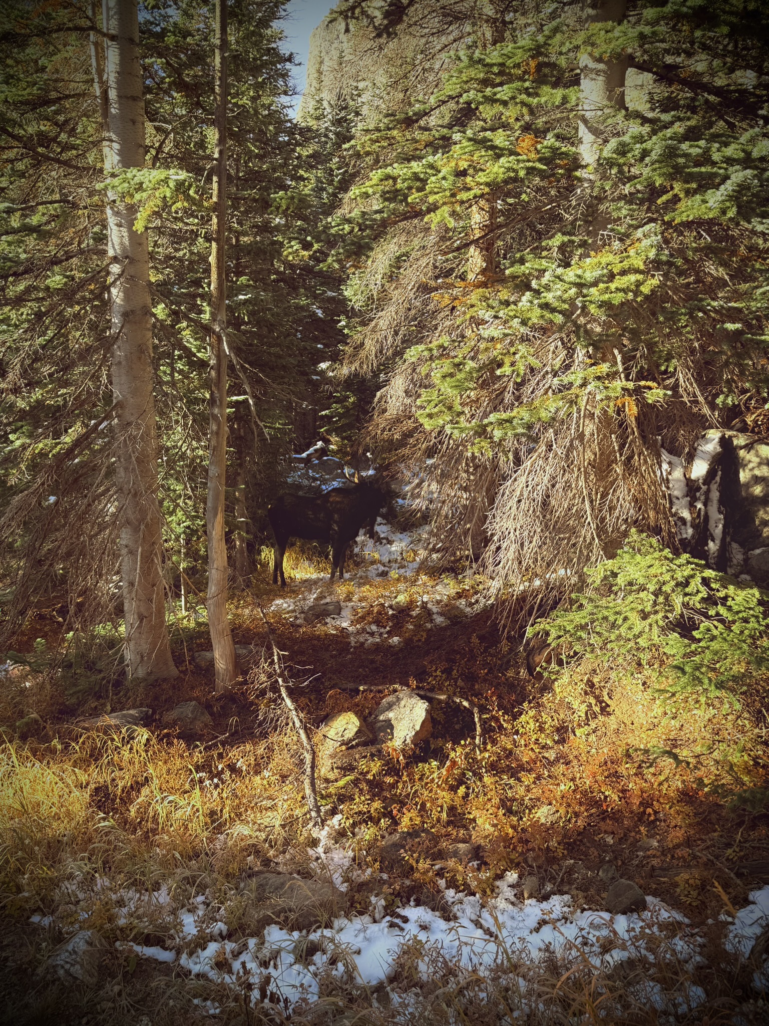
Estes Park is the main gateway to Rocky Mountain National Park, and you immediately feel that you’re in the high mountains. The town sits at over 2,300 meters above sea level, which means even a “normal” walk can feel surprisingly harder. The reward, though, is huge — especially in autumn, when the landscape turns golden and wildlife is everywhere. We were lucky enough to spot elk right on the trail. If they hadn’t moved, we probably wouldn’t have noticed them at all, even though they were only about five meters away.
This area is perfect if you want to visit several iconic alpine lakes in one longer hike: Nymph Lake, Dream Lake, Emerald Lake, Lake Haiyaha, The Loch, Lake of Glass, and Sky Pond. Each lake has a completely different character.
Nymph Lake is smaller and shallow, often covered with lily pads in summer, which makes it feel like a natural mirror. A bit farther, Dream Lake is one of the most photographed lakes in the park, surrounded by dramatic peaks. If you arrive early, the reflections can be absolutely stunning — and the same goes for Emerald Lake, which is definitely worth visiting in the morning.
Emerald Lake is often considered the highlight of the easier part of this route. Its turquoise color comes from glacial flour — tiny rock particles suspended in the water that reflect the light and create that unique shade. If you continue farther, the trail becomes quieter and more adventurous. Lake Haiyaha means “big rocks,” and once you get there, the name makes perfect sense. Huge boulders are scattered everywhere, and the lake can have a milky turquoise color depending on the sediment in the water.
From there, you can continue toward The Loch, Lake of Glass, and finally Sky Pond — one of the most epic alpine destinations in Rocky Mountain National Park.
The trail to Lake of Glass was a little more adventurous than expected. There was already quite a bit of snow, and at one point the trail seemed to lead across a small waterfall. Since it was freezing, getting wet wasn’t exactly part of the plan. The other option was climbing over icy sections, which didn’t feel much better.
Classic me — I started panicking on the way up, already imagining how I would get back down. In the end, it wasn’t as dramatic as it looked at first… as usual. But of course, the little stress moment had to be there.
After this mentally intense but beautiful day, we stopped by the gift shop and then moved closer to the trailhead for the next day. Unfortunately, we couldn’t sleep right at the trailhead, so we drove back a little and spent the night by the road.
Day 4 (October 8, 2025)
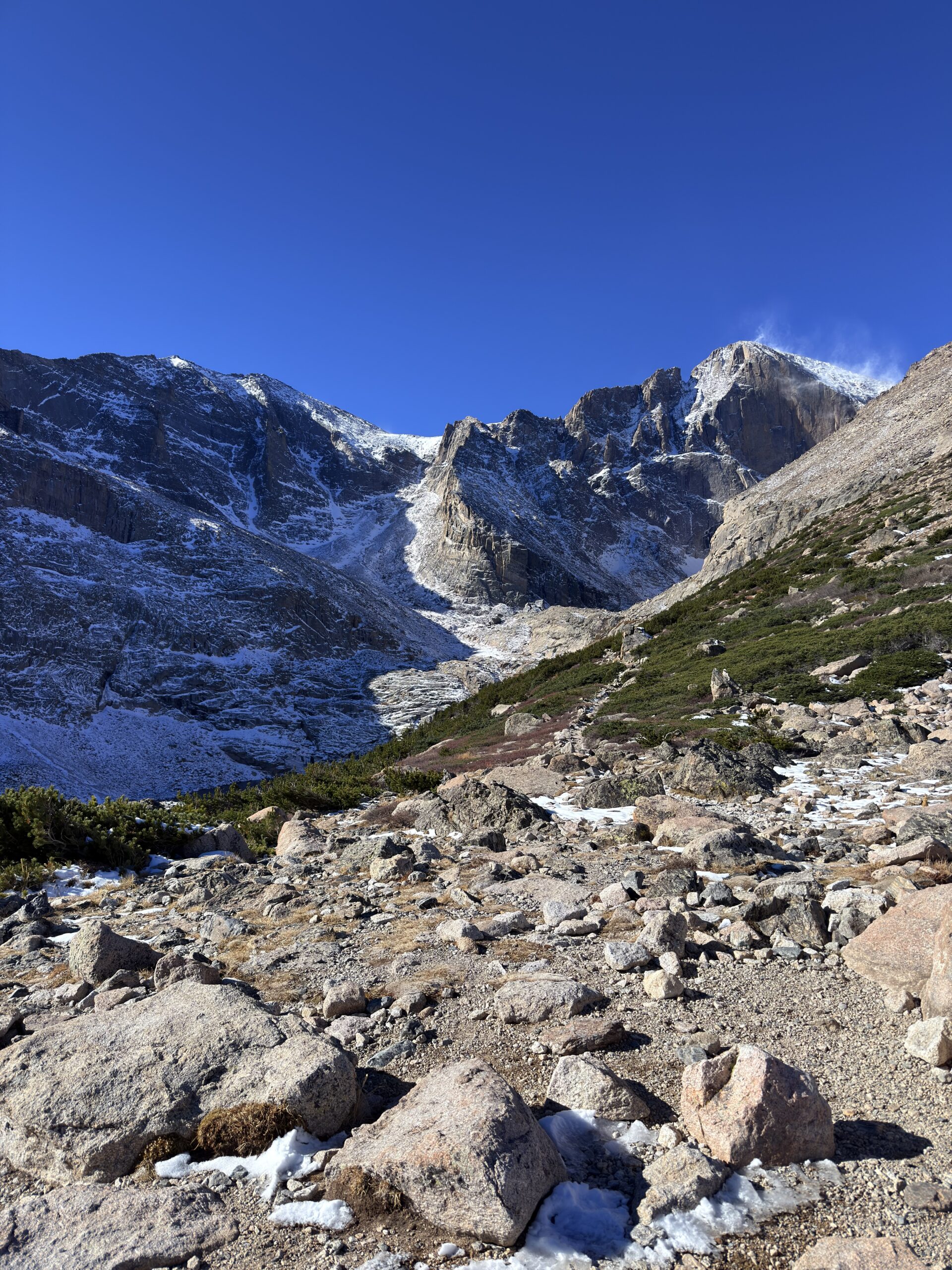
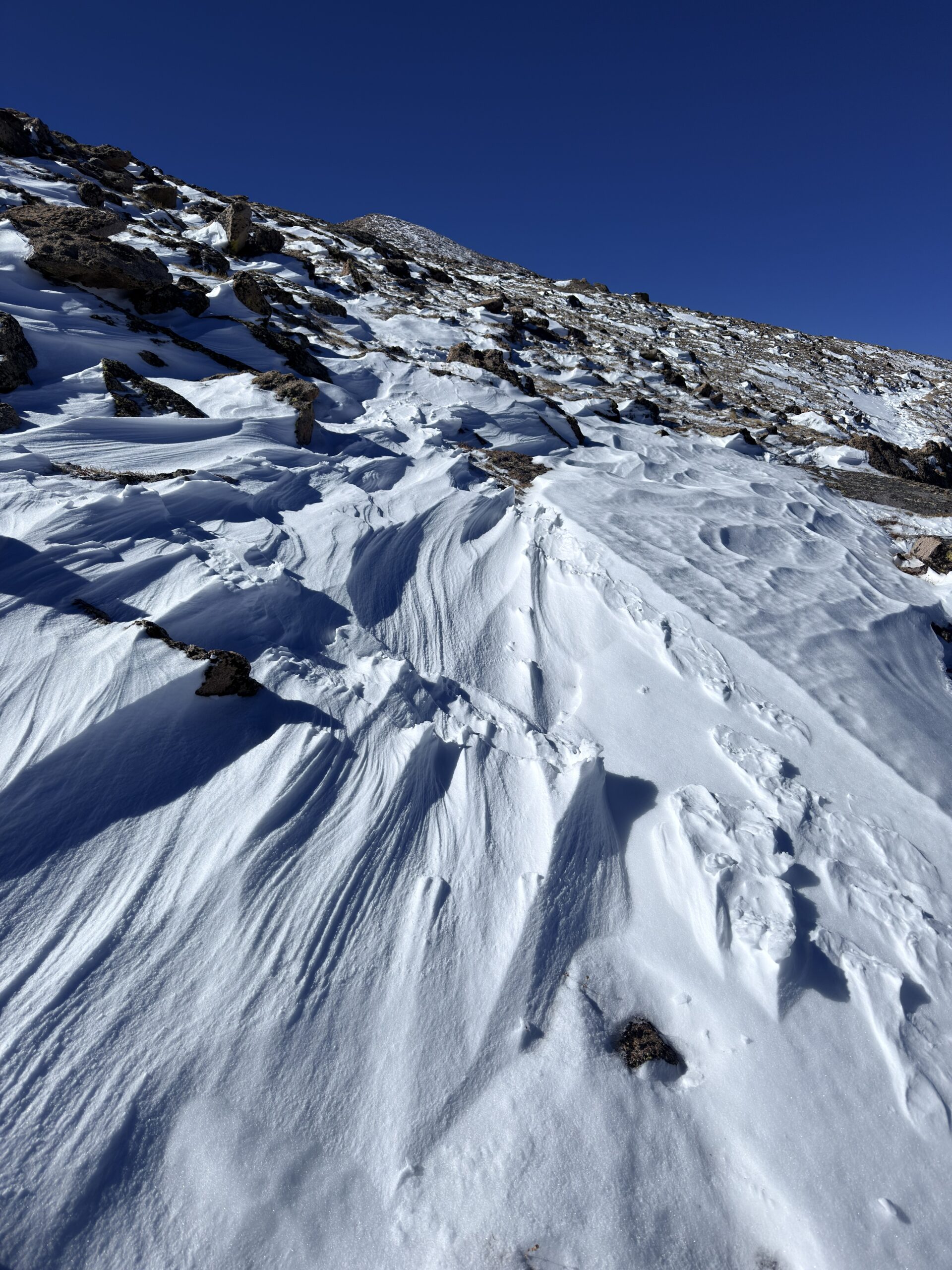
The Keyhole [21.07km 1.310m↑ 1.310m↓]
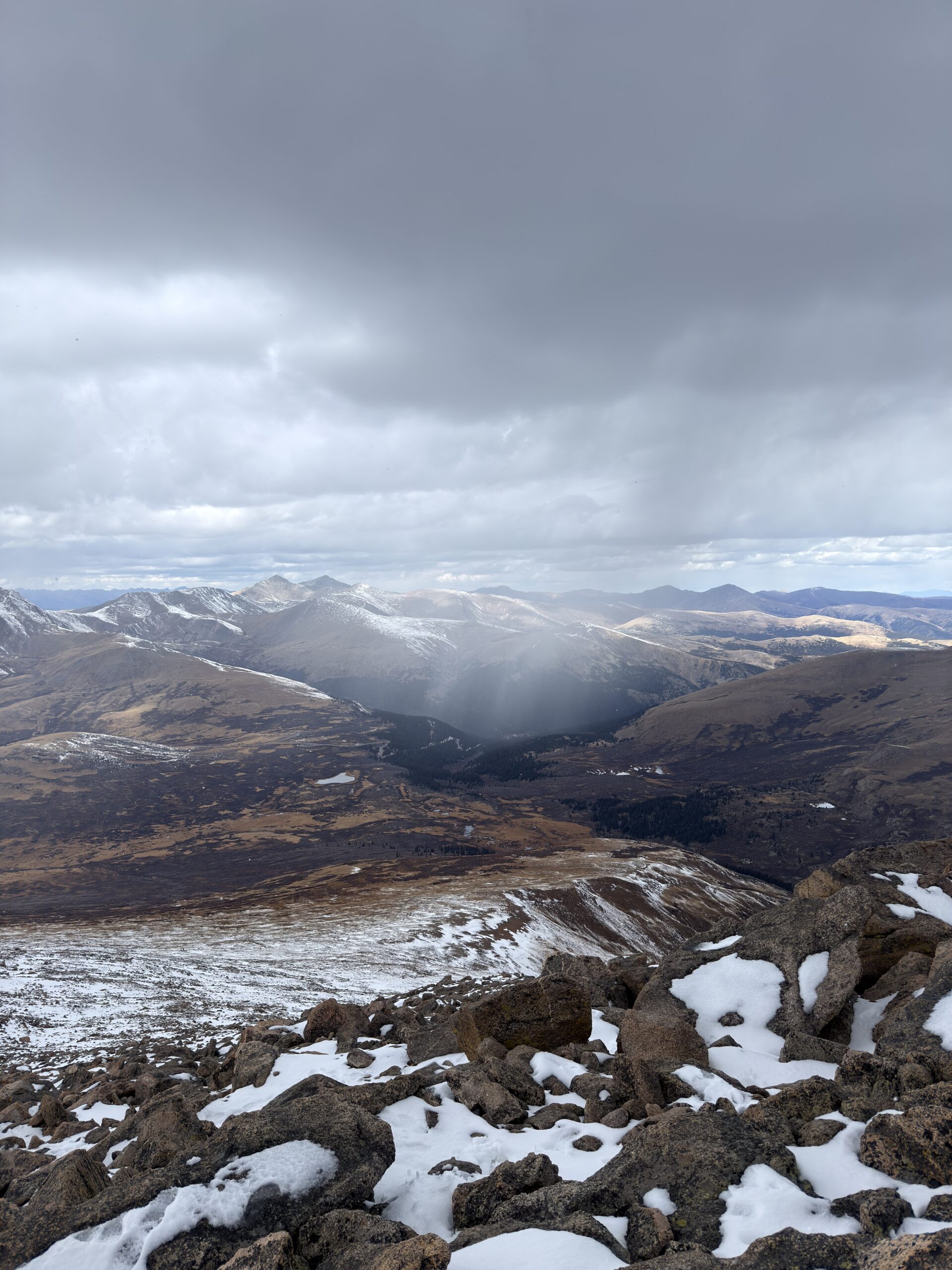
This was supposed to be our first Colorado fourteener — Longs Peak. I had been nervous about this hike for days, and honestly, it showed. We didn’t make it to the summit. Not only because the elevation really didn’t agree with me that day, but also because the conditions were far from ideal.
There were strong wind gusts, a solid layer of snow on the trail, and in some places, the snow was frozen. We met only about four other people on the trail, and all of them told us they had also decided not to summit because it simply didn’t feel safe.
Longs Peak is one of the most famous and challenging hikes in Rocky Mountain National Park. At 4,346 meters, it is the highest peak in this part of the park and the only fourteener located inside its boundaries.
The most popular route is the Keyhole Route. Many hikers start around 2–3 AM because weather at this altitude can change extremely fast, and afternoon storms are common in Colorado.
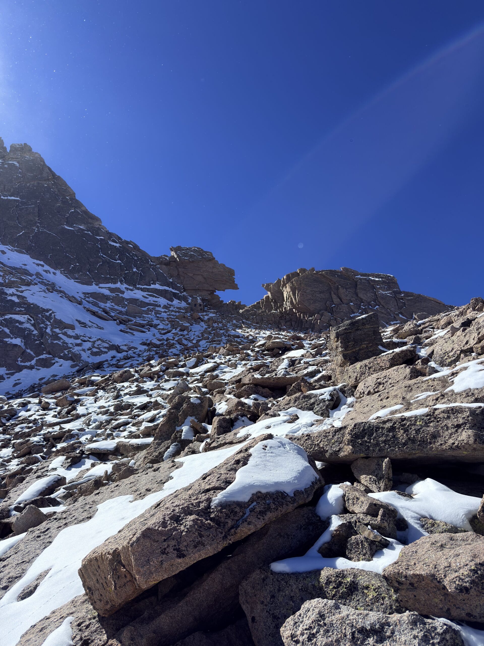
The trail begins in the forest, but eventually climbs above the tree line into a harsh alpine environment. One of the most important points on the route is The Keyhole — a rock opening in the ridge that marks the transition into the much more exposed part of the climb.
After The Keyhole, this is no longer just a normal hike. The route continues through sections like The Ledges, The Trough, and The Narrows, where you need to scramble, stay on route, and be extremely careful.
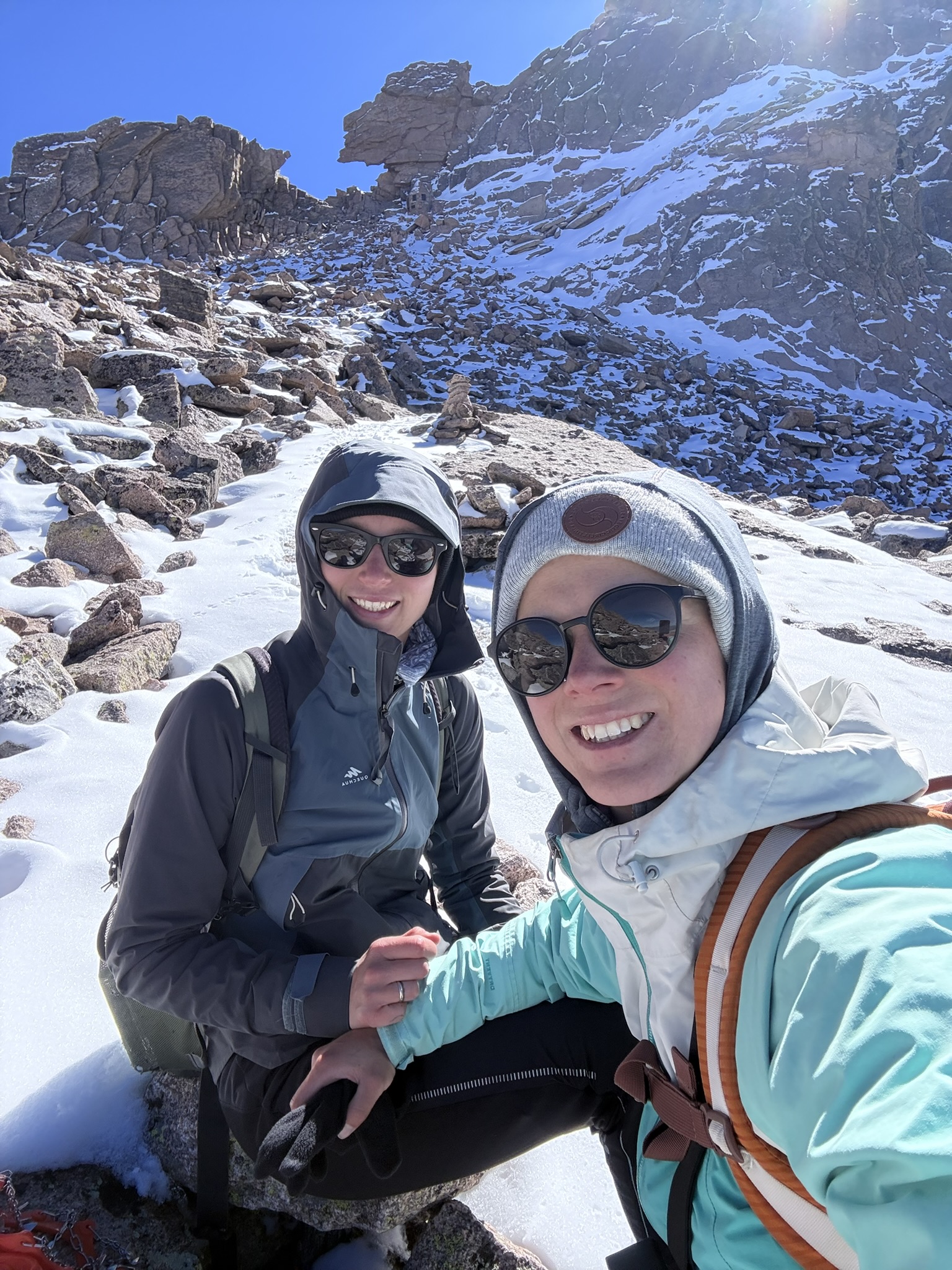
The Keyhole is not only a landmark — it’s also a mental checkpoint. Many people turn around here, and that is completely okay. For us, this was the right decision too.
I started feeling seriously unwell about 300 meters before The Keyhole, most likely because of the cold, altitude, and elevation gain. I had symptoms of altitude sickness and, honestly, for a moment I didn’t know what to do with myself. The freezing wind definitely didn’t help.
There is an emergency shelter at The Keyhole, so we hid there for a short moment, tried to rest, eat something, and drink. This hike reminded me of one very important mountain rule: If you can’t eat, it’s time to go down. And that day, going down was the smartest thing we could do.
Day 5 (October 9, 2025)
Mount Bierstadt [11.17km 791m↑ 791m↓]
Blue Lakes [3.00km 121m↑ 121m↓]
After our unsuccessful attempt on Longs Peak, another fourteener was waiting for us — Mount Bierstadt.
This time, I prepared much better. We made extra tea for the hike because when it’s freezing, cold water is not exactly ideal. I also gave myself a rule: every 100 meters of elevation gain, I had to eat something. Nothing big, just small bites, but I knew that if I kept eating regularly, I wouldn’t get into the same state as the day before, when I was struggling to eat at all.
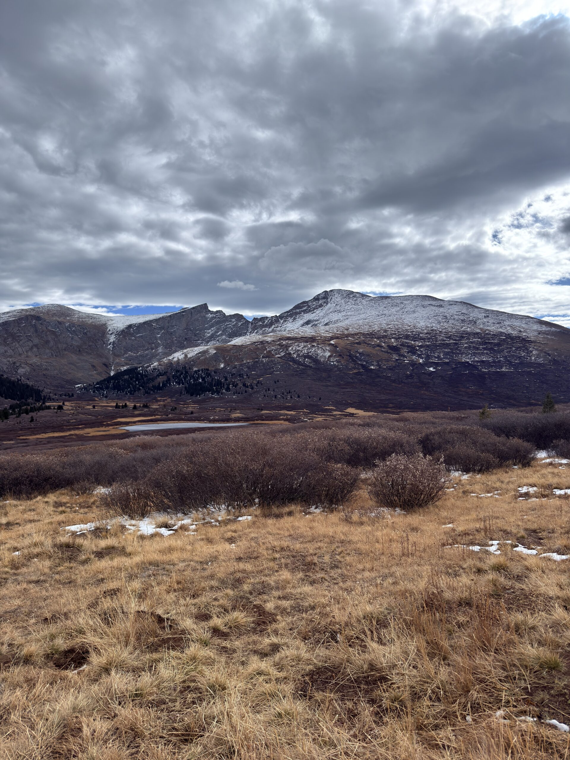
Mount Bierstadt is one of the most accessible fourteeners in Colorado and is often recommended as a good first fourteener. But that definitely doesn’t mean it’s easy.
The trail starts at Guanella Pass and first crosses wide wetlands and wooden boardwalks. That contrast is beautiful — within a few hours, you go from a marshy valley to a rocky summit at 4,288 meters.
The climb itself is not technically difficult, but altitude, wind, and fast-changing weather can make even a “simple” fourteener feel challenging.
Thanks to what we learned the day before, we made it to the summit with much more confidence — even though the weather still wasn’t perfect. Clouds were constantly moving around us, and at times it even snowed a little, but thankfully no storm came.
Later that day, we visited Blue Lakes, which are much less crowded. The trail to Lower Blue Lake is short and easy to follow, but if you continue toward Upper Blue Lake, learn from our mistake: stay on the right side of the lower lake.
We couldn’t see the trail clearly on the map, but it looked like it kept going… until suddenly we were in a place where turning back felt annoying, so we continued even though there was no visible trail.
That evening, we met part of our family — and what was supposed to be a short visit turned into three unplanned rest days.
Day 6 to 8 (October 10 to 12, 2025)
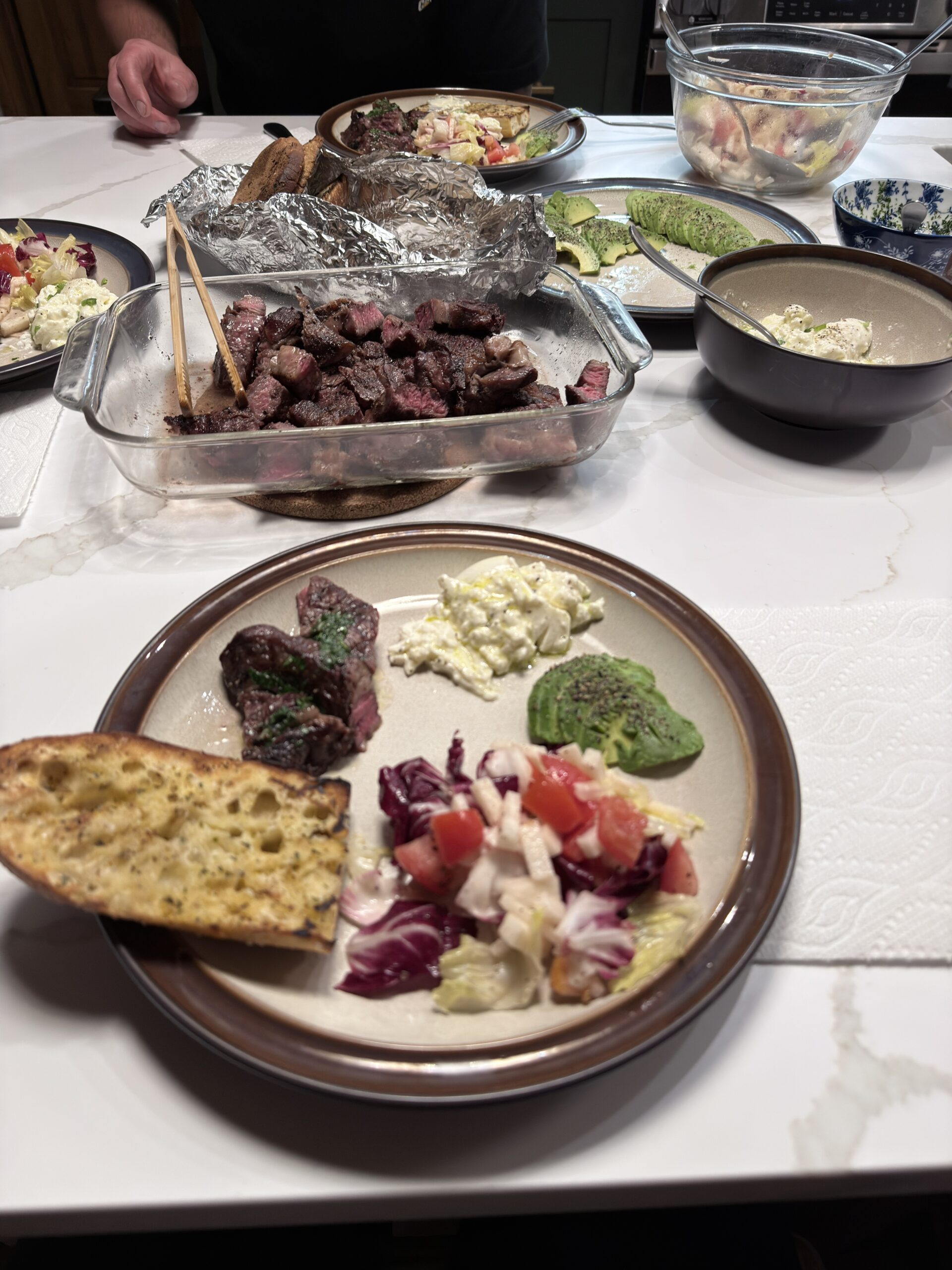
After several intense days in the mountains, it was finally time to slow down. We had three “rest days,” although they weren’t exactly lazy. We visited family, did laundry, planned the next parts of the road trip, organized our things, and even changed the oil in the car with Kuba’s help.
Those ordinary tasks may not sound exciting, but on a long road trip, they make a huge difference. We didn’t stop exploring completely — we just slowed the pace down.
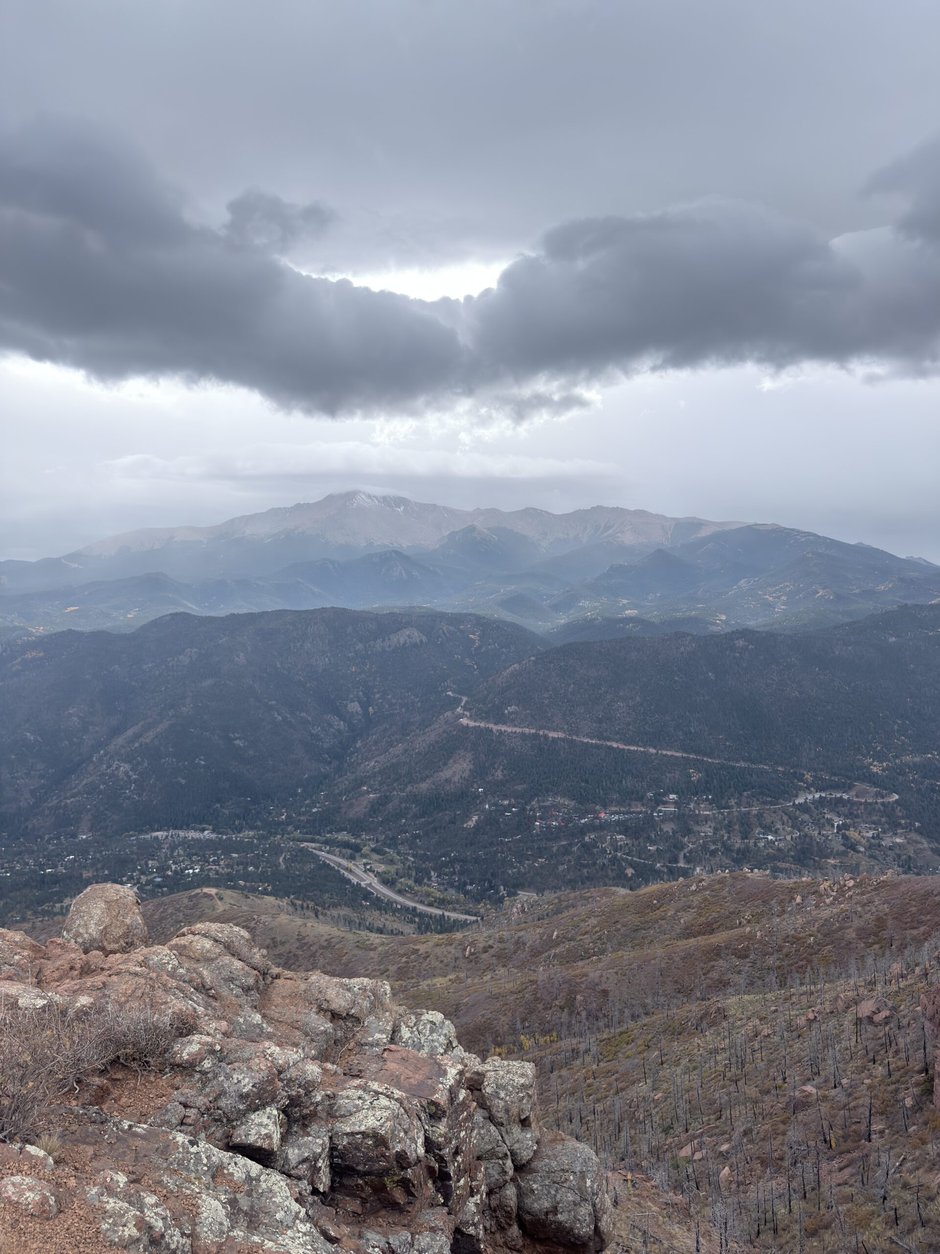
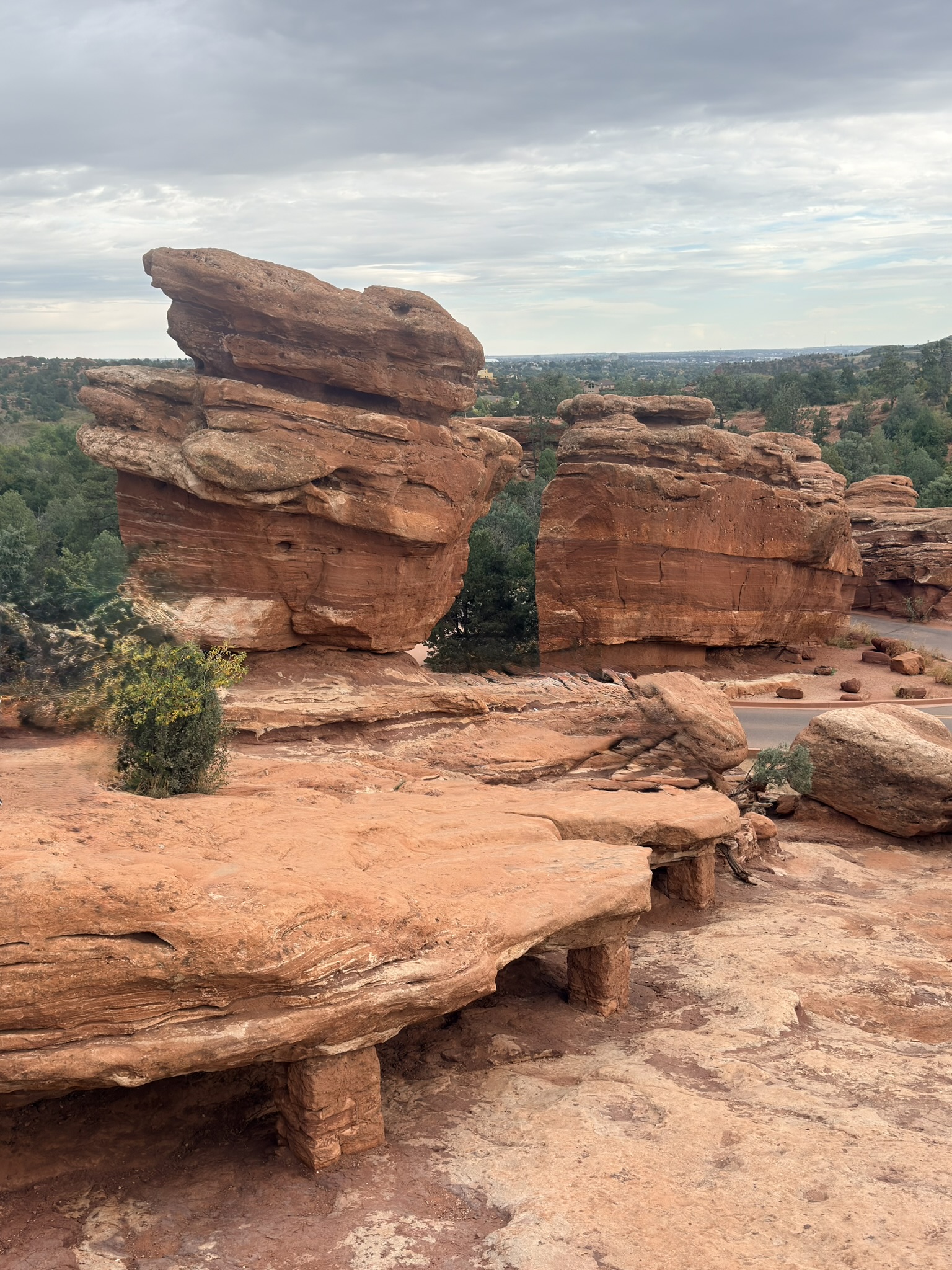
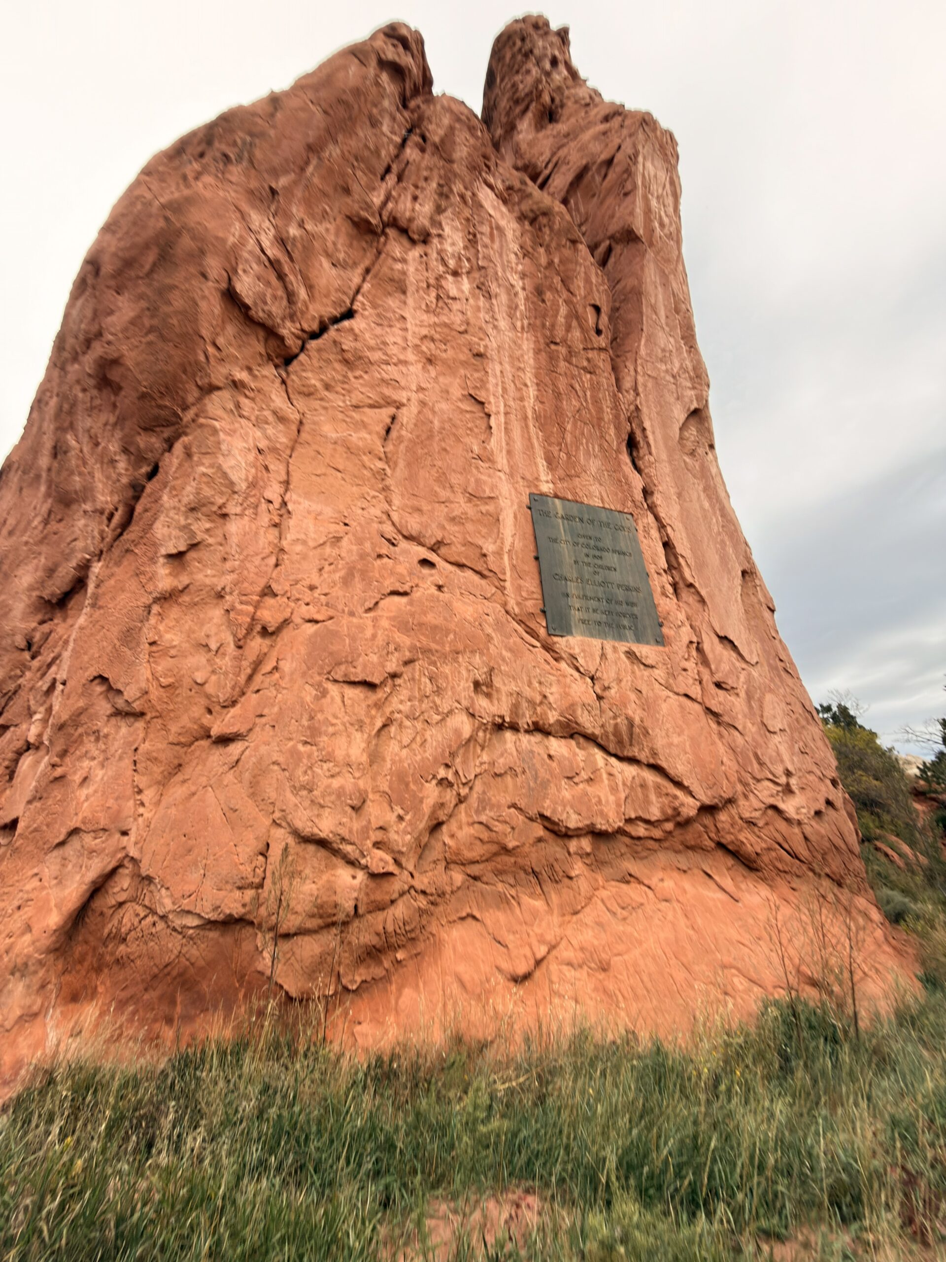
One of the places we visited was Garden of the Gods in Colorado Springs. It felt completely different from the rest of Colorado. Instead of high alpine lakes and snowy peaks, massive red rock formations rise dramatically from the landscape, with mountains in the background.
It was a perfect change of scenery: fewer kilometers, less elevation gain, but still plenty of beautiful views. And honestly, these “normal” days between big adventures are often the ones that help you actually enjoy the whole trip.
Day 9 (October 13, 2025)
Black Canyon [2.38km 115m↑ 115m↓]
Bridal Veil Falls [4.44km 265m↑ 265m↓]
We left early in the morning and were immediately welcomed by an unpleasant surprise. It was around -5°C and snowing, which wouldn’t have been such a problem if we could just keep driving and heat the car. But after changing the oil, we apparently hadn’t tightened the oil filter properly, and the car started leaking oil. Then it showed an error… and eventually didn’t want to continue.
In the US, we understood that the phrase “to protect and serve” written on police cars can actually be true. Just a few minutes after we pulled over, a police officer stopped to check what had happened and how he could help. Luckily, by that point, we already knew what the problem was and were dealing with it — but we still really appreciated the concern.
We continued to Cotopaxi, where Kačka and Jakub had recommended a gluten-free burger at a gas station. So we grabbed a quick snack and kept going.
About half an hour later, we drove into a heavy snowstorm. It became pretty intense around Monarch Pass — the windshield wipers were going at maximum speed, but visibility was still terrible. Luckily, all cars were moving slowly in a line, around 20 km/h, and everyone made it through safely.
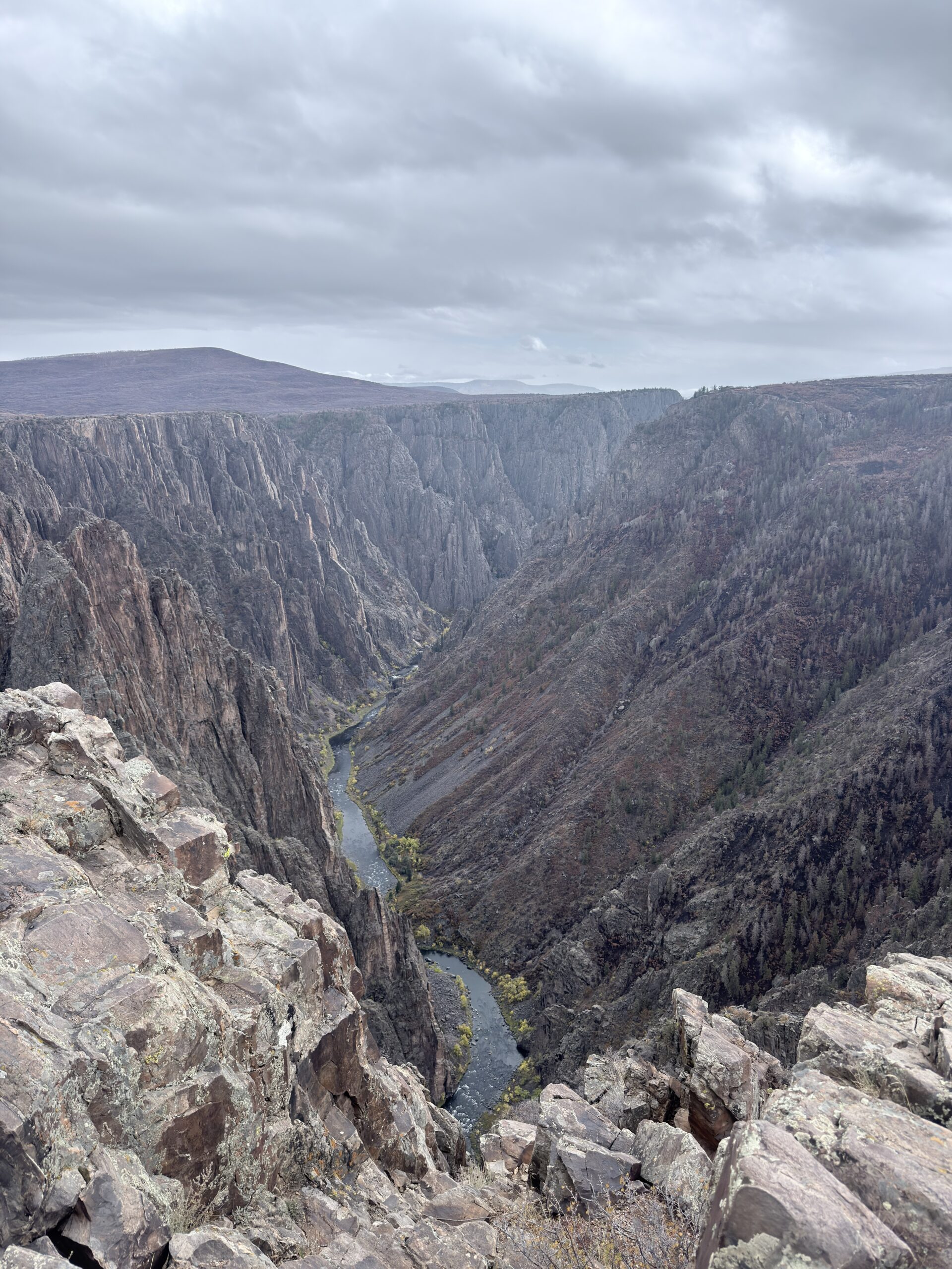
One of the places that surprised us more than expected was Black Canyon of the Gunnison National Park. At first glance, it doesn’t look as famous or dramatic as some other national parks. But once you reach the overlooks, the canyon suddenly opens below you — incredibly deep, narrow, and steep. What makes Black Canyon so unique is not only its depth, but also how little sunlight reaches the bottom. In some sections, the canyon is so narrow that the sun touches the river below for only a few minutes a day.
The result is a dark, dramatic landscape that feels completely different from most other national parks. And the best part? You don’t need long hikes to enjoy the views. Several viewpoints are located right along the road, and each one shows a completely different angle of the canyon.
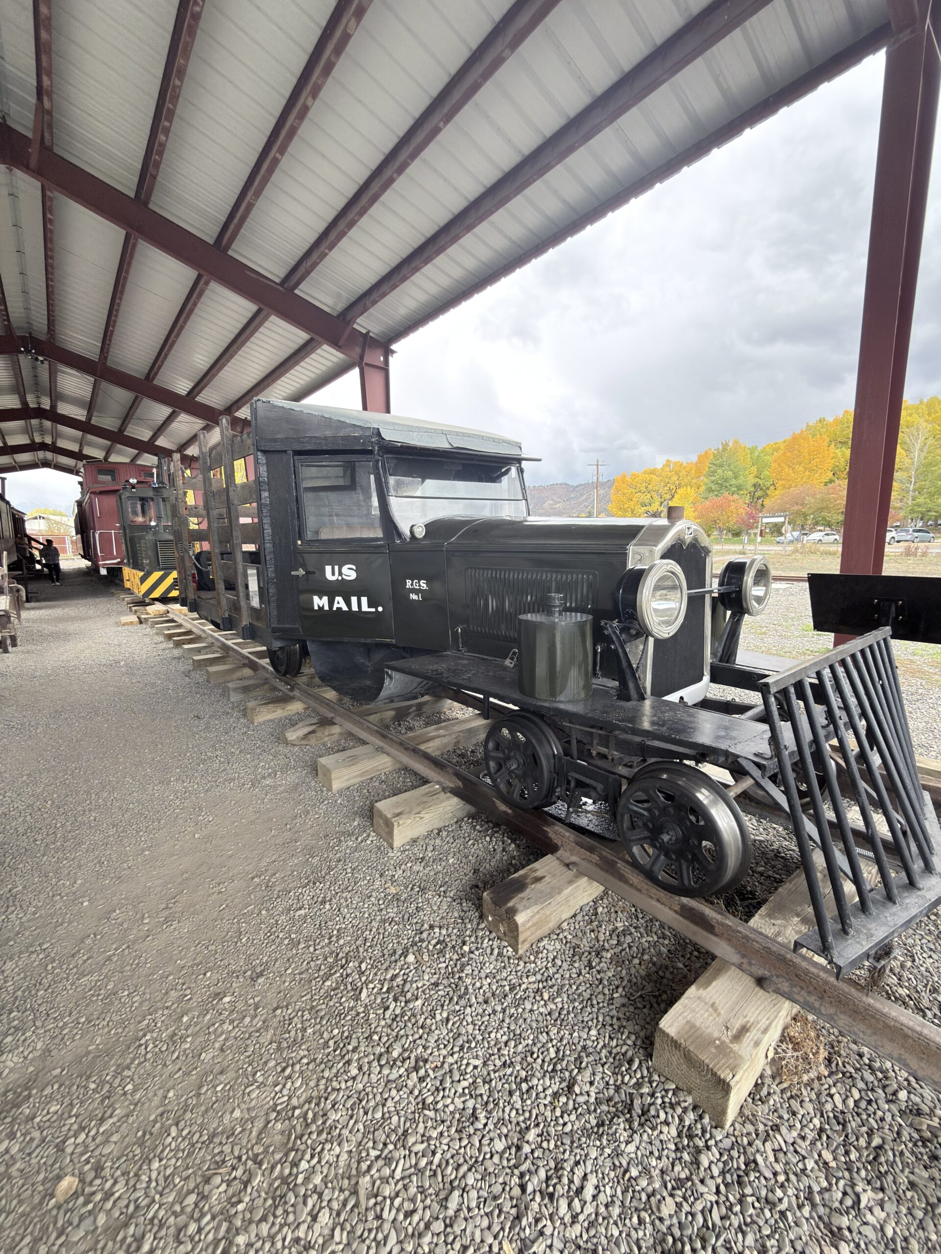
On the way, we needed to refill water, so we stopped in Ridgway, where we also noticed an outdoor railway museum across the street. We visited the outside section and saw old trains that were once used for mail service.
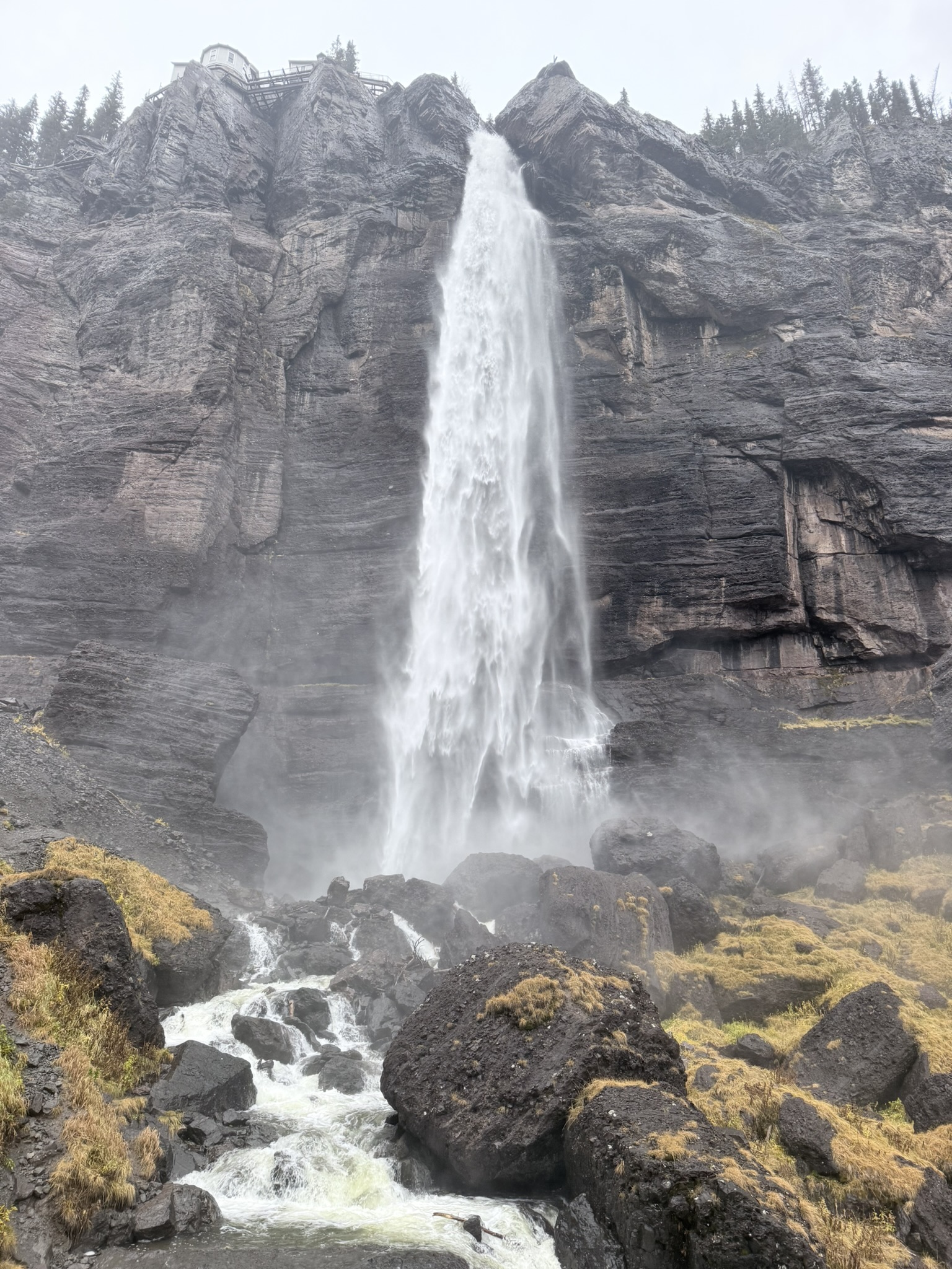
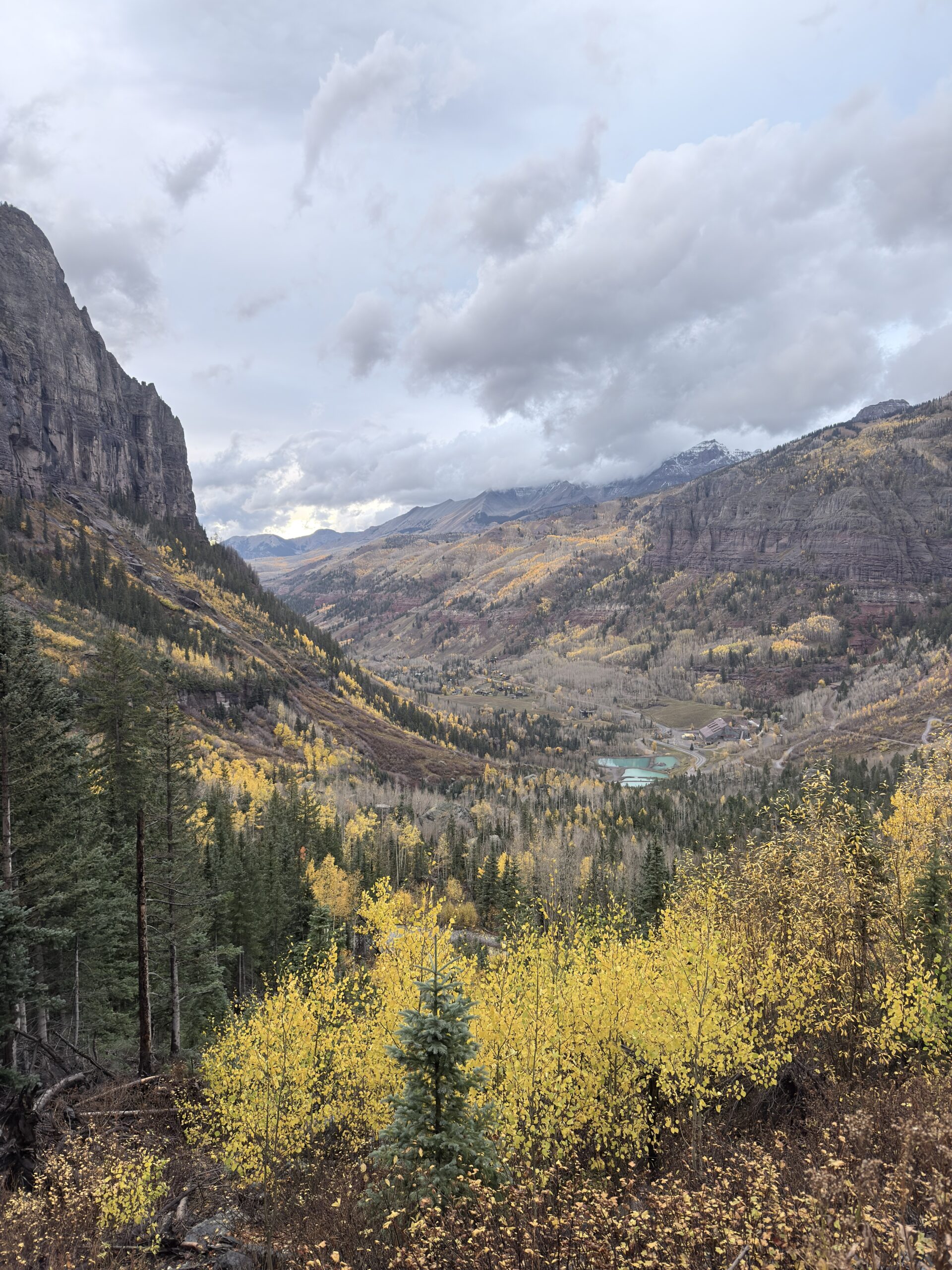
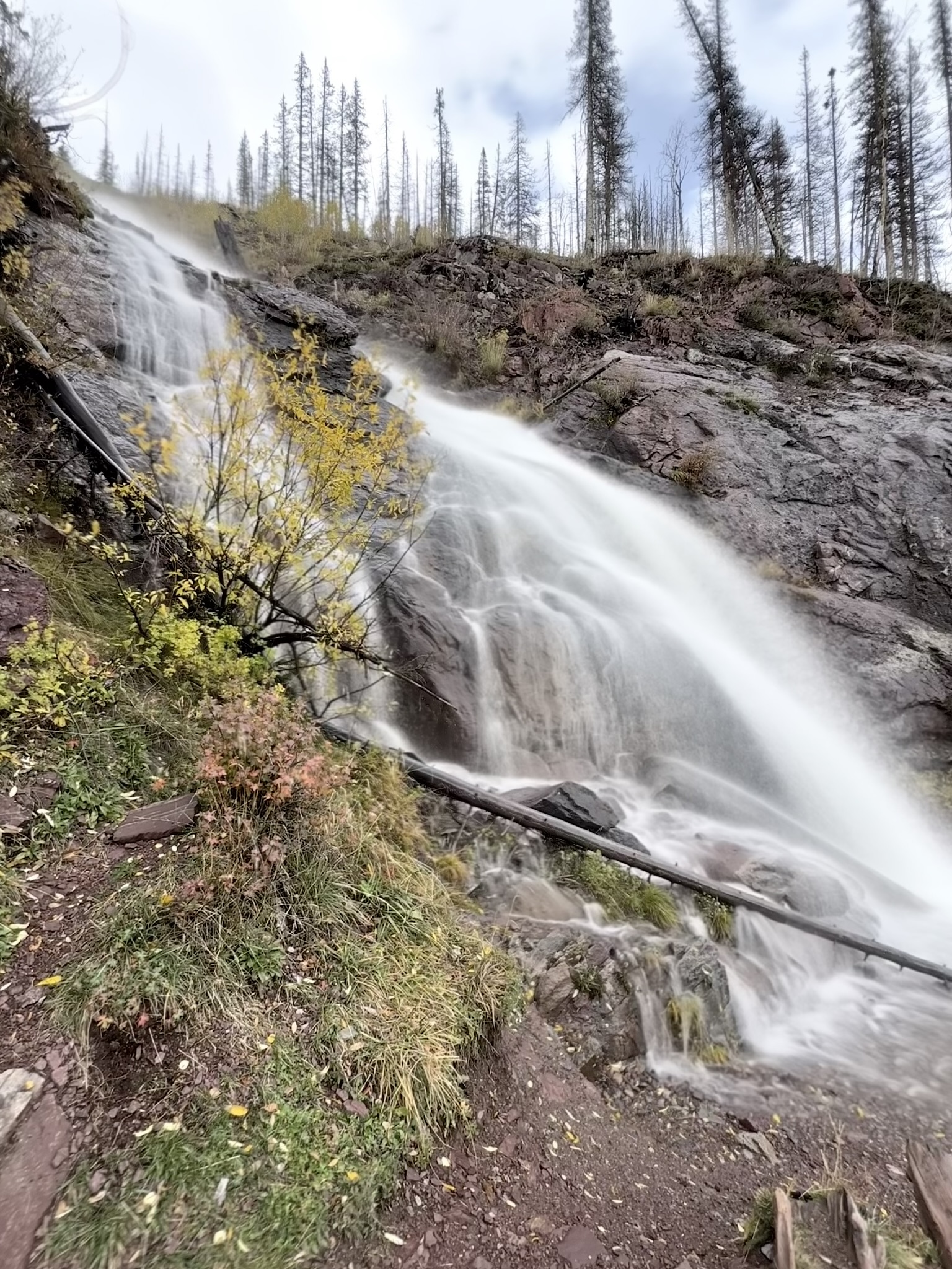
To end the day, we visited Telluride, a mountain town known for skiing in winter and hiking in summer. You can also take the free gondola to Mountain Village, which makes it easy to enjoy the area without much effort.
Before that, we hiked to Bridal Veil Falls, one of the tallest waterfalls in Colorado. The road itself is an adventure — you can either hike or drive up a steep, rocky road. If you drive, I would definitely recommend a high-clearance 4×4. But if you only want to visit the waterfall, walking is the better and more relaxed option. The waterfall drops almost 110 meters, and at the top stands a historic power plant, which gives the whole place a unique atmosphere.
On the way back, we watched a beautiful sunset and then took the gondola ride through Telluride and Mountain Village. That night, we found a pullout somewhere between Telluride and Ridgway. We parked in the dark, so we had no idea where we were sleeping.
But in the morning…
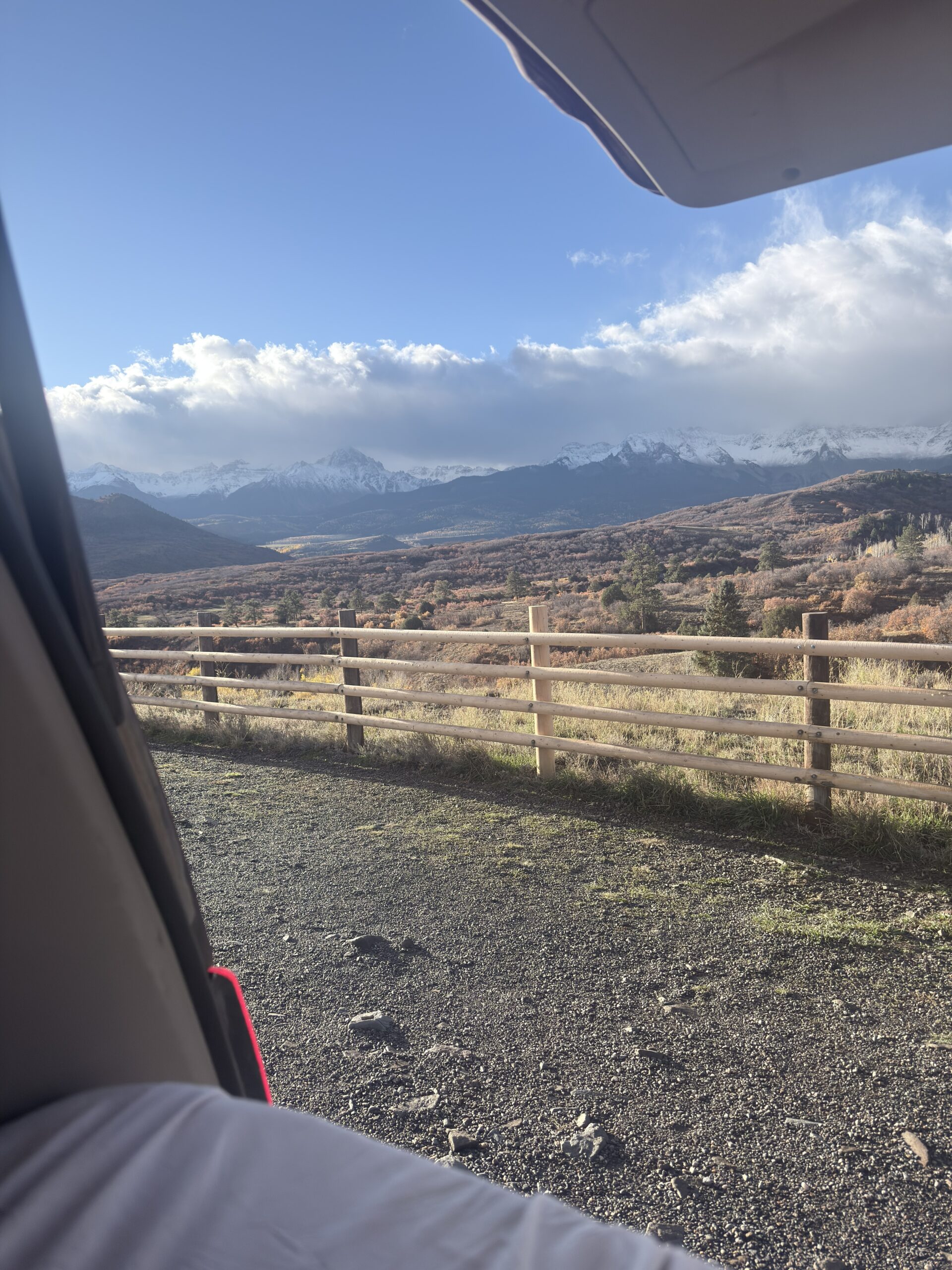
Day 10 (October 14, 2025)
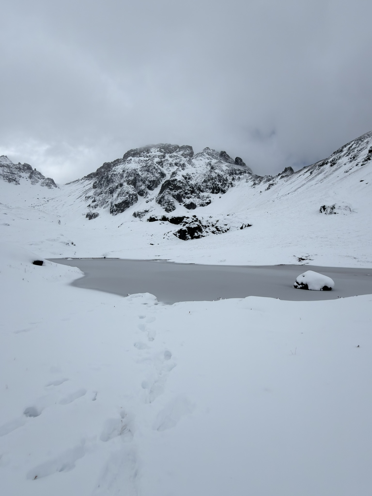
Island Lake [10.74km 814m↑ 814m↓]
I could wake up to those views every single morning.
This day, we were excited to drive the Million Dollar Highway, and I can honestly say — I highly recommend it. We almost twisted our necks trying to decide which side to look at first.
One of the places that completely stole our hearts in Colorado was Island Lake near Silverton. Even the drive toward the trailhead is an experience, whether you hike from lower down or drive a high-clearance vehicle along one of the iconic mountain roads in the Silverton area. Once you reach the lake, the scenery feels almost unreal: turquoise water, sharp mountain peaks, grassy slopes, and snowy patches all around.
It’s one of those places where every few steps reveal a new angle that somehow looks even better than the previous one. Island Lake is relatively accessible compared to other places with similar alpine views. You don’t need to hike an extreme distance to reach a high-mountain landscape that usually requires much more effort.
Our original plan was to do a loop and continue from Island Lake to Ice Lake. As we all know… not everything goes according to plan. We started toward Island Lake and planned to continue to Ice Lake afterward, but because of the snow conditions, we had no idea where the trail actually went. Our shoes were completely soaked from walking through deep snow, and the weather wasn’t exactly friendly either. So we decided that Island Lake was enough for the day.
Based on our experience, I would recommend visiting earlier in the season than we did. On the other hand, during peak season, the trail will definitely be busier. If you want a quieter experience, start early in the morning or go later in the afternoon.
And with that, our Colorado adventure came to an end. The next article will be about Utah — where about a week of new adventures was waiting for us.
This trip was completely planned from day 1 but everything kept changing and I’m definitely not complaining
Approximate expenses for the whole 10 days and 2 people:
- Gas = $233.30
- Food = $288.14
- Permits = $24
- Others = $248.12
TOTAL: $793.56 (39.70USD/person/day)
 Low-cost tip:
Cook your own meals + sleep in car
Travel Q&A
Practical tips from our road trip that can save you time, money, and stress.
🚐 Where can you sleep in your car?
Sleeping in your car is one of the easiest ways to travel low-cost — but knowing where it's legal and safe is key.
Read full guide⚠️ Travel Smarter: Save Money, Stay Safe & Know Bear Country
Want to spend less and avoid common mistakes while traveling? Check out my practical tips on saving money on food and accommodation, plus essential advice for staying safe in places like bear country.
See my pro tips🎟️ How to find the best activities & experiences?
If we wanted to book a tours or unique experiences we use GetYourGuide to discover more — it can make planning much easier on the road.
🗺️ Want even more practical travel tips & itineraries?
I create itineraries based on real experiences from the road, including low-cost travel advice, sleeping spots, and practical planning tips. I've also added hotels for those who prefer more comfort.
Explore travel itineraries